Georgetown - Cheddi Jagan Intl
Airport details
| Country | Guyana |
| State | Demerara-Mahaica |
| Region | SY |
| Airspace | Georgetown Ctr |
| Municipality | Soesdyke - Linden Highway - Timehri |
| Elevation | 95ft (29m) |
| Timezone | GMT -4 |
| Coordinates | 6.49893, -58.25435 |
| Magnetic var | |
| Type | land |
| Available since | X-Plane v10.40 |
| ICAO code | SYCJ |
| IATA code | GEO |
| FAA code | n/a |
Communication
| Cheddi Jagan Intl ATIS | 118.000 |
| Cheddi Jagan Intl Ground Control | 121.700 |
| Cheddi Jagan Intl TIMEHRI Tower | 118.300 |
| Cheddi Jagan Intl TIMEHRI Approach | 119.400 |
| Cheddi Jagan Intl TIMEHRI Dep | 119.400 |
Approach frequencies
| ILS-cat-I | RW06 | 109.3 | 18.00mi |
| 3° GS | RW06 | 109.3 | 18.00mi |
Nearby Points of Interest:
Georgetown City Hall
-Fort Zeelandia
Runway info
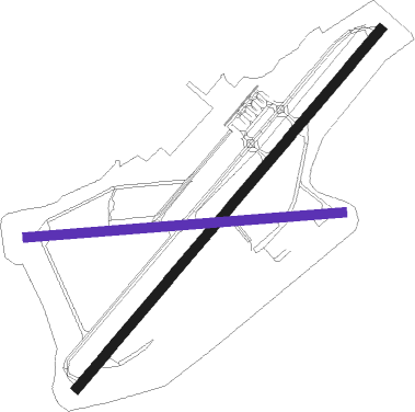
Runway 06 / 24  | ||
| length | 2272m (7454ft) | |
| bearing | 45° / 225° | |
| width | 46m (151ft) | |
| surface | asphalt | |
| blast zone | 58m (190ft) / 62m (203ft) | |
| Runway 11 / 29 | ||
| length | 1526m (5007ft) | |
| bearing | 90° / 270° | |
| width | 46m (151ft) | |
| surface | asphalt | |
Nearby beacons
| code | identifier | dist | bearing | frequency |
|---|---|---|---|---|
| TIM | TIMEHRI (GEORGETOWN) VOR/DME | 0.3 | 246° | 113.50 |
Instrument approach procedures
| runway | airway (heading) | route (dist, bearing) |
|---|---|---|
| RW06 | EDMEK (141°) | EDMEK 4000ft GATUX (28mi, 167°) 4000ft AKSIN (6mi, 135°) 3000ft |
| RW06 | KALUP (169°) | KALUP 4000ft GATUX (34mi, 192°) 4000ft AKSIN (6mi, 135°) 3000ft |
| RW06 | LIKEV (123°) | LIKEV 4000ft GATUX (24mi, 149°) 4000ft AKSIN (6mi, 135°) 3000ft |
| RW06 | MEXEN (161°) | MEXEN 4000ft GATUX (32mi, 185°) 4000ft AKSIN (6mi, 135°) 3000ft |
| RW06 | SISEX (289°) | SISEX 4000ft LITOL (32mi, 265°) 4000ft AKSIN (6mi, 315°) 3000ft |
| RW06 | VUDOK (34°) | VUDOK 3000ft AKSIN (19mi, 27°) 3000ft |
| RNAV | AKSIN 3000ft OGRUM (6mi, 45°) 1800ft SYCJ (6mi, 45°) 142ft (3512mi, 96°) 2000ft AKSIN (3520mi, 276°) 3000ft AKSIN (turn) 10000ft | |
| RW24 | EDMEK (141°) | EDMEK 4000ft IREDA (25mi, 115°) 4000ft BOLAP (6mi, 135°) 3000ft |
| RW24 | KALUP (169°) | KALUP 4000ft IREDA (19mi, 149°) 4000ft BOLAP (6mi, 135°) 3000ft |
| RW24 | LIKEV (123°) | LIKEV 4000ft IREDA (29mi, 97°) 4000ft BOLAP (6mi, 135°) 3000ft |
| RW24 | MEXEN (161°) | MEXEN 4000ft IREDA (21mi, 138°) 4000ft BOLAP (6mi, 135°) 3000ft |
| RW24 | SISEX (289°) | SISEX 4000ft DABUM (21mi, 312°) 4000ft BOLAP (6mi, 315°) 3000ft |
| RW24 | VUDOK (34°) | VUDOK 4000ft LITOL (18mi, 45°) 4000ft DABUM (24mi, 45°) 4000ft BOLAP (6mi, 315°) 3000ft |
| RNAV | BOLAP 3000ft SIRAG (6mi, 225°) 1800ft SYCJ (6mi, 225°) 115ft (3512mi, 96°) 2000ft BOLAP (3504mi, 277°) 3000ft BOLAP (turn) 10000ft |
Disclaimer
The information on this website is not for real aviation. Use this data with the X-Plane flight simulator only! Data taken with kind consent from X-Plane 12 source code and data files. Content is subject to change without notice.