Anahuac - Chambers County
Airport details
| Country | United States of America |
| State | Texas |
| Region | K4 |
| Airspace | Houston Oceanic Ctr |
| Municipality | Chambers County |
| Elevation | 20ft (6m) |
| Timezone | GMT -6 |
| Coordinates | 29.76981, -94.66348 |
| Magnetic var | |
| Type | land |
| Available since | X-Plane v10.40 |
| ICAO code | T00 |
| IATA code | n/a |
| FAA code | n/a |
Communication
| Chambers County CTAF | 122.900 |
| Chambers County HOUSTON Approach/Departure | 134.450 |
Nearby Points of Interest:
San Jacinto Battleground State Historic Site
-Lunar and Planetary Institute
-Christopher C. Kraft Jr. Mission Control Center
-Ashbel Smith Building
-George Washington Grover House
-Elissa
-Mathilda Wehmeyer House and German-American Kindergarten School
-East End Historic District
-Strand Historic District
-Galveston Seawall
-Grand 1894 Opera House
-United States Customs House and Court House
-Scottish Rite Cathedral
-Washburn Tunnel
-Rosenberg Library
-Ashton Villa
-Galveston Orphans Home
-Michel B. Menard House
-Samuel May Williams House
-Galveston Causeway
-Spindletop
-Idle Hours
-Saint Anthony Cathedral Basilica
-Woman's Club of Beaumont Clubhouse
-Jack Brooks Federal Building
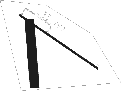
Runway info
Runway 12 / 30  | ||
| length | 916m (3005ft) | |
| bearing | 125° / 305° | |
| width | 18m (60ft) | |
| surface | asphalt | |
| Runway 17 / 35 | ||
| length | 581m (1906ft) | |
| bearing | 180° / 0° | |
| width | 91m (300ft) | |
| surface | grass | |
Nearby beacons
| code | identifier | dist | bearing | frequency |
|---|---|---|---|---|
| MHF | TRINITY (SMITH POINT) VOR/DME | 14.1 | 201° | 113.60 |
| DAS | DAISETTA VORTAC | 25.2 | 3° | 116.90 |
| EFD | ELLINGTON (HOUSTON) TACAN | 27.6 | 252° | 109.40 |
| GDE | GOODHUE (BEAUMONT) NDB | 29.6 | 56° | 368 |
| BVP | NIXIN (HOUSTON) NDB | 31.7 | 292° | 326 |
| VUH | SCHOLES (GALVESTON) VOR/DME | 31.8 | 202° | 113 |
| SBI | SABINE PASS VOR/DME | 33 | 98° | 115.40 |
| BPT | BEAUMONT VOR/DME | 35.3 | 75° | 114.50 |
| IAH | HUMBLE (HOUSTON) VORTAC | 37.2 | 285° | 116.60 |
| CX | ALIBI (HOUSTON) NDB | 58 | 309° | 281 |
Departure and arrival routes
| Transition altitude | 18000ft |
| Transition level | 18000ft |
| SID end points | distance | outbound heading | |
|---|---|---|---|
| ALL | |||
| PSX2 | 198mi | 268° | |
| RW12 | |||
| INDIE8 | 204mi | 21° | |
| LURIC8 | 194mi | 35° | |
| STRYA8 | 197mi | 65° | |
| MMALT5 | 120mi | 93° | |
| HOODO7 | 70mi | 128° | |
| WATFO5 | 100mi | 162° | |
| KARRR6 | 169mi | 234° | |
| BORRN4 | 99mi | 271° | |
| STYCK8 | 166mi | 327° | |
| BLTWY7 | 108mi | 328° | |
| WYLSN8 | 115mi | 333° | |
| RW30 | |||
| INDIE8 | 204mi | 21° | |
| LURIC8 | 194mi | 35° | |
| STRYA8 | 197mi | 65° | |
| MMALT5 | 120mi | 93° | |
| HOODO7 | 70mi | 128° | |
| WATFO5 | 100mi | 162° | |
| KARRR6 | 169mi | 234° | |
| BORRN4 | 99mi | 271° | |
| STYCK8 | 166mi | 327° | |
| BLTWY7 | 108mi | 328° | |
| WYLSN8 | 115mi | 333° | |
| STAR starting points | distance | inbound heading | |
|---|---|---|---|
| ALL | |||
| TSHRT1 | 79.1 | 73° | |
| BLUBL4 | 91.0 | 108° | |
| OHIIO4 | 31.1 | 131° | |
| HUDZY4 | 21.4 | 156° | |
| CESAN4 | 52.0 | 211° | |
| WAPPL6 | 32.7 | 216° | |
| TKNIQ3 | 33.4 | 340° | |
Holding patterns
| STAR name | hold at | type | turn | heading* | altitude | leg | speed limit |
|---|---|---|---|---|---|---|---|
| BLUBL4 | ELLVR | VHF | right | 351 (171)° | 18000ft - 45000ft | 1.5min timed | ICAO rules |
| HUDZY4 | BRWCK | VHF | left | 55 (235)° | DME 20.0mi | ICAO rules | |
| HUDZY4 | WAPPL | VHF | left | 55 (235)° | DME 10.0mi | ICAO rules | |
| OHIIO4 | LYMBO | VHF | right | 71 (251)° | DME 20.0mi | ICAO rules | |
| OHIIO4 | ZEEKK | VHF | right | 46 (226)° | DME 10.0mi | ICAO rules | |
| TKNIQ3 | TKNIQ | VHF | left | 91 (271)° | DME 10.0mi | ICAO rules | |
| TSHRT1 | ALIEF | VHF | right | 209 (29)° | DME 10.0mi | ICAO rules | |
| TSHRT1 | HYDRL | VHF | right | 209 (29)° | DME 10.0mi | ICAO rules | |
| WAPPL6 | BRWCK | VHF | left | 55 (235)° | DME 20.0mi | ICAO rules | |
| WAPPL6 | WAPPL | VHF | left | 55 (235)° | DME 10.0mi | ICAO rules | |
| *) magnetic outbound (inbound) holding course | |||||||
Disclaimer
The information on this website is not for real aviation. Use this data with the X-Plane flight simulator only! Data taken with kind consent from X-Plane 12 source code and data files. Content is subject to change without notice.