Freer - Duval-freer
Airport details
| Country | United States of America |
| State | Texas |
| Region | K4 |
| Airspace | Houston Oceanic Ctr |
| Municipality | Duval County |
| Elevation | 562ft (171m) |
| Timezone | GMT -6 |
| Coordinates | 27.88363, -98.60029 |
| Magnetic var | |
| Type | land |
| Available since | X-Plane v10.40 |
| ICAO code | T19 |
| IATA code | n/a |
| FAA code | n/a |
Communication
| Duval-Freer CTAF | 122.900 |
Nearby Points of Interest:
Herff-Rozelle Farm
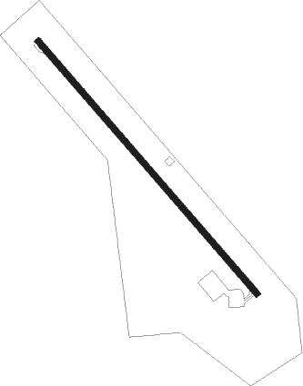
Runway info
| Runway 14 / 32 | ||
| length | 976m (3202ft) | |
| bearing | 140° / 320° | |
| width | 18m (60ft) | |
| surface | asphalt | |
Nearby beacons
| code | identifier | dist | bearing | frequency |
|---|---|---|---|---|
| NOG | ORANGE GROVE TACAN | 29.6 | 89° | 133.60 |
| ALI | ALICE VOR | 31.9 | 104° | 114.50 |
| COT | COTULLA VORTAC | 44.2 | 318° | 115.80 |
| THX | THREE RIVERS VORTAC | 44.2 | 36° | 111.40 |
| NQI | KINGSVILLE TACAN | 48.1 | 116° | 117.80 |
| LRD | LAREDO VORTAC | 49.8 | 244° | 117.40 |
| NLD | NEWLA (NUEVO LAREDO) VOR/DME | 57.8 | 245° | 112.60 |
Disclaimer
The information on this website is not for real aviation. Use this data with the X-Plane flight simulator only! Data taken with kind consent from X-Plane 12 source code and data files. Content is subject to change without notice.