Archer City - Archer City Muni
Airport details
| Country | United States of America |
| State | Texas |
| Region | K4 |
| Airspace | Ft Worth Ctr |
| Municipality | Archer City |
| Elevation | 1063ft (324m) |
| Timezone | GMT -6 |
| Coordinates | 33.58232, -98.61867 |
| Magnetic var | |
| Type | land |
| Available since | X-Plane v10.32 |
| ICAO code | T39 |
| IATA code | n/a |
| FAA code | T39 |
Communication
| Archer City Muni CTAF | 122.900 |
Nearby Points of Interest:
Archer County Courthouse and Jail
-Jack County Courthouse
-Fort Richardson
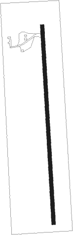
Runway info
| Runway 17 / 35 | ||
| length | 978m (3209ft) | |
| bearing | 181° / 1° | |
| width | 18m (60ft) | |
| surface | asphalt | |
Nearby beacons
| code | identifier | dist | bearing | frequency |
|---|---|---|---|---|
| SKB | SCOTLAND (WICHITA FALLS) NDB | 13.6 | 33° | 344 |
| SPS | WICHITA FALLS VORTAC | 24.3 | 4° | 112.70 |
| SHP | SHEPPARD (WICHITA FALLS) TACAN | 24.9 | 18° | 110.80 |
| GHX | GRAHAM NDB | 25.7 | 164° | 371 |
| UKW | BOWIE VORTAC | 40 | 93° | 117.15 |
| LAW | LAWTON VOR/DME | 55.8 | 13° | 109.40 |
| DUC | DME | 59.5 | 41° | 111 |
| MQP | MILLSAP (MINERAL WELLS) VORTAC | 60.1 | 144° | 117.70 |
Disclaimer
The information on this website is not for real aviation. Use this data with the X-Plane flight simulator only! Data taken with kind consent from X-Plane 12 source code and data files. Content is subject to change without notice.