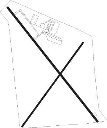
Sinton - San Patricio Co
Airport details
| Country | United States of America |
| State | Texas |
| Region | K4 |
| Airspace | Houston Oceanic Ctr |
| Municipality | San Patricio County |
| Elevation | 45ft (14m) |
| Timezone | GMT -6 |
| Coordinates | 28.03857, -97.54250 |
| Magnetic var | |
| Type | land |
| Available since | X-Plane v10.40 |
| ICAO code | T69 |
| IATA code | n/a |
| FAA code | n/a |
Communication
| San Patricio Co CTAF/UNICOM | 122.800 |
| San Patricio Co CORPUS Approach/Departure | 120.900 |
Nearby beacons
| code | identifier | dist | bearing | frequency |
|---|---|---|---|---|
| CRP | CORPUS CHRISTI VORTAC | 9.6 | 144° | 115.50 |
| NGP | TRUAX (CORPUS CHRISTI) TACAN | 24.9 | 145° | 114 |
| NOG | ORANGE GROVE TACAN | 27.8 | 254° | 133.60 |
| ALI | ALICE VOR | 31.1 | 238° | 114.50 |
| NQI | KINGSVILLE TACAN | 35.2 | 206° | 117.80 |
| THX | THREE RIVERS VORTAC | 42.6 | 307° | 111.40 |
| VCT | VICTORIA VOR/DME | 59.6 | 33° | 109 |
Instrument approach procedures
| runway | airway (heading) | route (dist, bearing) |
|---|---|---|
| RW14 | AUSTS (244°) | AUSTS HUGUE (19mi, 278°) 2100ft ENFUD (10mi, 239°) 2100ft |
| RW14 | CRP (324°) | CRP HUGUE (22mi, 352°) 2100ft ENFUD (10mi, 239°) 2100ft |
| RW14 | THX (127°) | THX FIGNU (31mi, 131°) 2100ft ENFUD (5mi, 59°) 2100ft |
| RNAV | ENFUD 2100ft ELFIY (5mi, 143°) 1700ft BOMSE (3mi, 143°) 1040ft T69 (3mi, 143°) 87ft (5805mi, 106°) 448ft HUGUE (5801mi, 286°) 2100ft HUGUE (turn) | |
| RW32 | CRP (324°) | CRP 2000ft |
| RNAV | CRP 2000ft NEEHO (5mi, 326°) 1400ft T69 (4mi, 322°) 87ft (5805mi, 106°) 1000ft CRP (5800mi, 286°) 2000ft CRP (turn) |
Disclaimer
The information on this website is not for real aviation. Use this data with the X-Plane flight simulator only! Data taken with kind consent from X-Plane 12 source code and data files. Content is subject to change without notice.

