Fort Clark Springs - Laughlin Afb Aux Nr 1
Airport details
| Country | United States of America |
| State | Texas |
| Region | K4 |
| Airspace | Houston Oceanic Ctr |
| Municipality | Kinney County |
| Elevation | 976ft (297m) |
| Timezone | GMT -6 |
| Coordinates | 29.11843, -100.47224 |
| Magnetic var | |
| Type | land |
| Available since | X-Plane v10.40 |
| ICAO code | T70 |
| IATA code | n/a |
| FAA code | T70 |
Communication
| Laughlin AFB Aux Nr 1 AWOS | 119.175 |
| Laughlin AFB Aux Nr 1 CTAF | 123.075 |
Nearby Points of Interest:
Fort Clark, Texas
-Fort Duncan
-State Highway 3 Bridge at the Nueces River
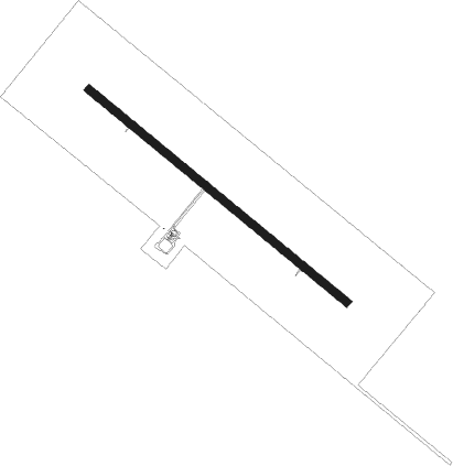
Runway info
| Runway 13 / 31 | ||
| length | 1808m (5932ft) | |
| bearing | 130° / 310° | |
| width | 46m (150ft) | |
| surface | asphalt | |
| blast zone | 255m (837ft) / 255m (837ft) | |
Nearby beacons
| code | identifier | dist | bearing | frequency |
|---|---|---|---|---|
| PFO | SPOFFORD NDB | 2.8 | 59° | 356 |
| BRX | LA FONDA RANCH (BRACKETVILLE) NDB | 9.6 | 301° | 269 |
| DLF | LAUGHLIN (DEL RIO) VORTAC | 21.4 | 309° | 114.40 |
| CPZ | CHAPARROSA RANCH NDB | 28.9 | 117° | 385 |
| PNG | PIEDRAS VOR/DME | 29.4 | 188° | 113.60 |
| DR | KOTTI (DEL RIO) NDB | 33.4 | 302° | 335 |
| RSG | ROCKSPRINGS VORTAC | 54.5 | 11° | 114.55 |
Disclaimer
The information on this website is not for real aviation. Use this data with the X-Plane flight simulator only! Data taken with kind consent from X-Plane 12 source code and data files. Content is subject to change without notice.