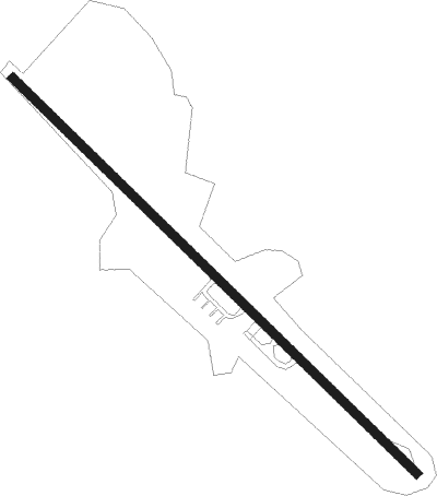
Lancaster - Kirk Air Base
Airport details
| Country | United States of America |
| State | South Carolina |
| Region | |
| Airspace | Atlanta Ctr |
| Municipality | Lancaster County |
| Elevation | 578ft (176m) |
| Timezone | GMT -5 |
| Coordinates | 34.67823, -80.68659 |
| Magnetic var | |
| Type | land |
| Available since | X-Plane v10.40 |
| ICAO code | T73 |
| IATA code | n/a |
| FAA code | T73 |
Communication
Nearby Points of Interest:
Leroy Springs House
-Robert Barnwell Allison House
-Perry-McIlwain-McDow House
-Lancaster Cotton Oil Company
-Buford's Massacre Site
-Lancaster County Jail
-Lancaster Presbyterian Church
-Lancaster County Courthouse
-Craig House
-Mount Carmel A.M.E. Zion Campground
-Wade-Beckham House
-William Harrison Sapp House
-Dr. William Columbus Cauthen House
-Thomas Walker Huey House
-Russell-Heath House
-North Carolina-South Carolina Cornerstone
-Waxhaw Presbyterian Church Cemetery
-Landsford Canal
-Cureton House
-Great Falls Downtown Historic District
-Republic Theatre
-Great Falls Depot
-Landsford Plantation House
-Massey-Doby-Nisbet House
-Catawba Rosenwald School
Runway info
Nearby beacons
| code | identifier | dist | bearing | frequency |
|---|---|---|---|---|
| LKR | LANCASTER NDB | 8.9 | 284° | 400 |
| CTF | CHESTERFIELD VOR/DME | 20.4 | 94° | 108.20 |
| UZ | RALLY (ROCK HILL) NDB | 23.2 | 298° | 227 |
| DCM | CHESTER NDB | 26.1 | 282° | 220 |
| HVS | HARTSVILLE NDB | 32.4 | 116° | 341 |
| CLT | CHARLOTTE VOR/DME | 33.4 | 333° | 115 |
| GHJ | STONIA (GASTONIA) NDB | 38.5 | 317° | 260 |
| UDG | DARLINGTON NDB | 41.9 | 106° | 245 |
| SSC | SHAW (SUMTER) TACAN | 43.4 | 163° | 110.10 |
| SMS | SUMTER NDB | 44.3 | 155° | 252 |
| MMT | MC ENTIRE (COLUMBIA) VORTAC | 45.6 | 189° | 113.20 |
| BES | BENNETTSVILLE NDB | 47.2 | 93° | 230 |
| UOT | UNION COUNTY NDB | 47.2 | 270° | 326 |
| CA | MURRY (COLUMBIA) NDB | 50.8 | 218° | 362 |
| FL | ALCOT (FLORENCE) NDB | 51.2 | 121° | 335 |
| EOE | ENOREE (NEWBERRY) NDB | 51.9 | 249° | 278 |
| CAE | COLUMBIA VORTAC | 52.5 | 204° | 114.70 |
| SLP | FIRST RIVER (SHELBY) NDB | 56.6 | 302° | 417 |
| VU | ALLER (ALBEMARLE) NDB | 57 | 37° | 346 |
| CFY | EVANS (LAKE CITY) NDB | 67.2 | 132° | 420 |
Disclaimer
The information on this website is not for real aviation. Use this data with the X-Plane flight simulator only! Data taken with kind consent from X-Plane 12 source code and data files. Content is subject to change without notice.

