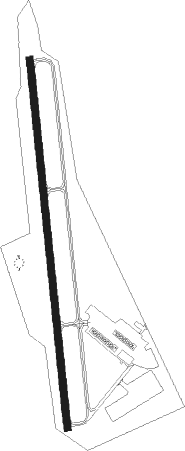
Taylor - Taylor Municipal
Airport details
| Country | United States of America |
| State | Texas |
| Region | K4 |
| Airspace | Houston Oceanic Ctr |
| Municipality | Taylor City Limits |
| Elevation | 600ft (183m) |
| Timezone | GMT -6 |
| Coordinates | 30.57264, -97.44319 |
| Magnetic var | |
| Type | land |
| Available since | X-Plane v10.40 |
| ICAO code | T74 |
| IATA code | n/a |
| FAA code | T74 |
Communication
| Taylor Municipal CTAF/UNICOM | 122.800 |
| Taylor Municipal AUSTIN Approach/Departure | 118.800 |
Nearby beacons
| code | identifier | dist | bearing | frequency |
|---|---|---|---|---|
| CWK | CENTEX VORTAC | 12.4 | 204° | 112.80 |
| IL | IRESH (KILLEEN) NDB | 30.3 | 330° | 278 |
| GRK | GRAY (FORT HOOD) VOR/DME | 33.6 | 321° | 111.80 |
| TPL | DME | 38.2 | 2° | 110.40 |
| RU | GARYS (AUSTIN) NDB | 45.2 | 219° | 272 |
| AGJ | GOOCH SPRINGS VORTAC | 51.4 | 311° | 112.50 |
| IDU | INDUSTRY VORTAC | 58.8 | 125° | 110.20 |
| ROB | ROBINSON (WACO) NDB | 59.1 | 22° | 400 |
Departure and arrival routes
| Transition altitude | 18000ft |
| Transition level | 18000ft |
| SID end points | distance | outbound heading | |
|---|---|---|---|
| RW17 | |||
| SAYBR3 | 32mi | 45° | |
| ILEXY3 | 74mi | 102° | |
| BNDIA3 | 77mi | 228° | |
| MUCKY3 | 74mi | 264° | |
| AEROZ2 | 162mi | 285° | |
| ELOEL3 | 50mi | 318° | |
| RW35 | |||
| SAYBR3 | 32mi | 45° | |
| ILEXY3 | 74mi | 102° | |
| BNDIA3 | 77mi | 228° | |
| MUCKY3 | 74mi | 264° | |
| AEROZ2 | 162mi | 285° | |
| ELOEL3 | 50mi | 318° | |
| STAR starting points | distance | inbound heading | |
|---|---|---|---|
| ALL | |||
| GABOO1 | 22.0 | 199° | |
| BLEWE4 | 40.0 | 200° | |
| BITER9, POTRR1 | 43.2 | 312° | |
Instrument approach procedures
| runway | airway (heading) | route (dist, bearing) |
|---|---|---|
| RW17 | CUDED (178°) | CUDED 3100ft |
| RNAV | CUDED 3100ft OSUGY (8mi, 178°) 2100ft USLIC (3mi, 178°) 1180ft T74 (2mi, 178°) 640ft (5790mi, 107°) 1100ft CWK (5795mi, 287°) 3100ft CWK (turn) |
Holding patterns
| STAR name | hold at | type | turn | heading* | altitude | leg | speed limit |
|---|---|---|---|---|---|---|---|
| BITER9 | WLEEE | VHF | left | 101 (281)° | 1.0min timed | ICAO rules | |
| BLEWE4 | SEWZY | VHF | left | 12 (192)° | 1.0min timed | ICAO rules | |
| *) magnetic outbound (inbound) holding course | |||||||
Disclaimer
The information on this website is not for real aviation. Use this data with the X-Plane flight simulator only! Data taken with kind consent from X-Plane 12 source code and data files. Content is subject to change without notice.
