Daisetta - Liberty Muni
Airport details
| Country | United States of America |
| State | Texas |
| Region | K4 |
| Airspace | Houston Oceanic Ctr |
| Municipality | Liberty |
| Elevation | 67ft (20m) |
| Timezone | GMT -6 |
| Coordinates | 30.07781, -94.69855 |
| Magnetic var | |
| Type | land |
| Available since | X-Plane v10.40 |
| ICAO code | T78 |
| IATA code | n/a |
| FAA code | n/a |
Communication
Nearby Points of Interest:
Kirby-Hill House
-San Jacinto Battleground State Historic Site
-Woman's Club of Beaumont Clubhouse
-Jack Brooks Federal Building
-Saint Anthony Cathedral Basilica
-Edson Hotel
-Beaumont Commercial District
-Idle Hours
-Spindletop
-Washburn Tunnel
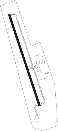
Runway info
| Runway 16 / 34 | ||
| length | 1160m (3806ft) | |
| bearing | 164° / 344° | |
| width | 23m (75ft) | |
| surface | asphalt | |
Nearby beacons
| code | identifier | dist | bearing | frequency |
|---|---|---|---|---|
| DAS | DAISETTA VORTAC | 7.2 | 26° | 116.90 |
| GDE | GOODHUE (BEAUMONT) NDB | 25.3 | 91° | 368 |
| BVP | NIXIN (HOUSTON) NDB | 27.3 | 261° | 326 |
| MHF | TRINITY (SMITH POINT) VOR/DME | 32 | 185° | 113.60 |
| IAH | HUMBLE (HOUSTON) VORTAC | 34.4 | 259° | 116.60 |
| BPT | BEAUMONT VOR/DME | 36.3 | 101° | 114.50 |
| EFD | ELLINGTON (HOUSTON) TACAN | 37.1 | 224° | 109.40 |
| SBI | SABINE PASS VOR/DME | 41.6 | 121° | 115.40 |
| CX | ALIBI (HOUSTON) NDB | 45.6 | 294° | 281 |
| VUH | SCHOLES (GALVESTON) VOR/DME | 49.3 | 192° | 113 |
| UTS | HUNTSVILLE NDB | 61 | 307° | 308 |
Departure and arrival routes
| Transition altitude | 18000ft |
| Transition level | 18000ft |
| SID end points | distance | outbound heading | |
|---|---|---|---|
| ALL | |||
| PSX2 | 198mi | 263° | |
| RW16 | |||
| INDIE8 | 187mi | 24° | |
| LURIC8 | 180mi | 38° | |
| STRYA8 | 190mi | 70° | |
| MMALT5 | 124mi | 100° | |
| HOODO7 | 84mi | 136° | |
| WATFO5 | 118mi | 163° | |
| KARRR6 | 180mi | 230° | |
| BORRN4 | 99mi | 262° | |
| BLTWY7 | 91mi | 323° | |
| STYCK8 | 149mi | 324° | |
| WYLSN8 | 97mi | 329° | |
| RW34 | |||
| INDIE8 | 187mi | 24° | |
| LURIC8 | 180mi | 38° | |
| STRYA8 | 190mi | 70° | |
| MMALT5 | 124mi | 100° | |
| HOODO7 | 84mi | 136° | |
| WATFO5 | 118mi | 163° | |
| KARRR6 | 180mi | 230° | |
| BORRN4 | 99mi | 262° | |
| BLTWY7 | 91mi | 323° | |
| STYCK8 | 149mi | 324° | |
| WYLSN8 | 97mi | 329° | |
| STAR starting points | distance | inbound heading | |
|---|---|---|---|
| ALL | |||
| WHAEL3 | 97.3 | 77° | |
| OHIIO4 | 20.3 | 99° | |
| RIICE8 | 64.3 | 108° | |
Instrument approach procedures
| runway | airway (heading) | route (dist, bearing) |
|---|---|---|
| RW16 | ZAVAK (188°) | ZAVAK HOLMI (6mi, 239°) 2000ft |
| RW16 | ZOTUG (140°) | ZOTUG HOLMI (6mi, 95°) 2000ft |
| RNAV | HOLMI 2000ft PADDI (6mi, 164°) 2000ft T78 (6mi, 164°) 109ft (5649mi, 108°) 470ft WOVOL (5647mi, 288°) 3000ft WOVOL (turn) |
Holding patterns
| STAR name | hold at | type | turn | heading* | altitude | leg | speed limit |
|---|---|---|---|---|---|---|---|
| HUDZY4 | BRWCK | VHF | left | 55 (235)° | DME 20.0mi | ICAO rules | |
| HUDZY4 | WAPPL | VHF | left | 55 (235)° | DME 10.0mi | ICAO rules | |
| OHIIO4 | LYMBO | VHF | right | 71 (251)° | DME 20.0mi | ICAO rules | |
| OHIIO4 | ZEEKK | VHF | right | 46 (226)° | DME 10.0mi | ICAO rules | |
| RIICE8 | BAZBL | VHF | left | 313 (133)° | < 17999ft | 1.0min timed | ICAO rules |
| RIICE8 | CHMPZ | VHF | right | 340 (160)° | 1.0min timed | ICAO rules | |
| RIICE8 | HOMRN | VHF | right | 313 (133)° | < 17999ft | 1.0min timed | ICAO rules |
| RIICE8 | RIICE | VHF | right | 313 (133)° | < 60000ft | DME 10.0mi | ICAO rules |
| RIICE8 | TORNN | VHF | right | 334 (154)° | < 17999ft | 1.0min timed | ICAO rules |
| *) magnetic outbound (inbound) holding course | |||||||
Disclaimer
The information on this website is not for real aviation. Use this data with the X-Plane flight simulator only! Data taken with kind consent from X-Plane 12 source code and data files. Content is subject to change without notice.