Yoakum - Yoakum Muni
Airport details
| Country | United States of America |
| State | Texas |
| Region | K4 |
| Airspace | Houston Oceanic Ctr |
| Municipality | Yoakum |
| Elevation | 365ft (111m) |
| Timezone | GMT -6 |
| Coordinates | 29.31317, -97.13842 |
| Magnetic var | |
| Type | land |
| Available since | X-Plane v10.40 |
| ICAO code | T85 |
| IATA code | n/a |
| FAA code | n/a |
Communication
| Yoakum Muni CTAF | 122.900 |
Nearby Points of Interest:
Lay-Bozka House
-Lavaca County Courthouse
-Terrell-Reuss Streets Historic District
-Cuero Commercial Historic District
-Breeden-Runge Wholesale Grocery Company Building
-Gonzales County Courthouse
-East Navidad River Bridge
-J. T. Jecker House
-O'Connor-Proctor Building
-Burrough-Daniel House
-Little House (Victoria, Texas)
-Pickering House (Victoria, Texas)
-Proctor House
-J. V. Vandenberge House
-William Wheeler House
-Mrs. J. V. Murphy House
-George H. Hauschild Building
-DeLeon Plaza and Bandstand
-Randall Building
-McCabe Building
-E. J. Jecker House
-Fossati's Delicatessen
-Thomas M. O'Connor House
-Tasin House
-Trinity Lutheran Church
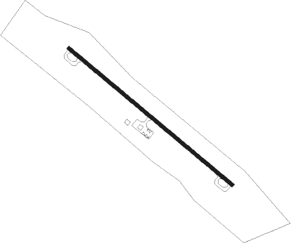
Runway info
| Runway 13 / 31 | ||
| length | 1051m (3448ft) | |
| bearing | 130° / 310° | |
| width | 18m (60ft) | |
| surface | asphalt | |
Nearby beacons
| code | identifier | dist | bearing | frequency |
|---|---|---|---|---|
| VCT | VICTORIA VOR/DME | 26.1 | 159° | 109 |
| ELA | EAGLE LAKE VOR/DME | 47.7 | 67° | 116.40 |
| IDU | INDUSTRY VORTAC | 48.9 | 42° | 110.20 |
| PSX | PALACIOS VORTAC | 54.7 | 123° | 117.30 |
| RU | GARYS (AUSTIN) NDB | 57.3 | 309° | 272 |
Instrument approach procedures
| runway | airway (heading) | route (dist, bearing) |
|---|---|---|
| RW31 | VCT (339°) | VCT CAPVO (14mi, 342°) 2000ft COGAL (5mi, 48°) 2000ft |
| RW31 | WEMAR (200°) | WEMAR FOSAL (26mi, 167°) 2000ft COGAL (5mi, 229°) 2000ft |
| RNAV | COGAL 2000ft COLIR (6mi, 310°) 2000ft T85 (5mi, 310°) 386ft (5779mi, 107°) 1000ft FOSAL (5767mi, 287°) 2000ft FOSAL (turn) |
Disclaimer
The information on this website is not for real aviation. Use this data with the X-Plane flight simulator only! Data taken with kind consent from X-Plane 12 source code and data files. Content is subject to change without notice.