Luling - Carter Memorial
Airport details
| Country | United States of America |
| State | Texas |
| Region | |
| Airspace | Houston Oceanic Ctr |
| Municipality | Luling |
| Elevation | 475ft (145m) |
| Timezone | GMT -6 |
| Coordinates | 29.73255, -97.66129 |
| Magnetic var | |
| Type | land |
| Available since | X-Plane v10.40 |
| ICAO code | T91 |
| IATA code | n/a |
| FAA code | T91 |
Communication
| Carter Memorial CTAF | 122.900 |
Nearby Points of Interest:
M. A. Withers House
-Caldwell County Courthouse Historic District
-Farmers Union Gin Company
-Old Main
-Gonzales County Courthouse
-Katherine Anne Porter House
-Gruene Historic District
-Gruene Family Home
-Lindheimer House
-Carl W. A. Groos House
-Comal County Courthouse
-Comal Power Plant
-Smith Rock Shelter
-Winters-Wimberley House
-Louis and Mathilde Reuter House
-State Highway 3-A Bridge at Cibolo Creek
-Willow-Spence Streets Historic District
-Anthony and Louise Viaer Alumni Hall
-Genaro P. and Carolina Briones House
-Austin Central Fire Station 1
-J. P. Schneider Store
-Sixth Street
-Haehnel Building
-Victory Grill
-Congress Avenue Historic District
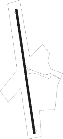
Runway info
| Runway 17 / 35 | ||
| length | 851m (2792ft) | |
| bearing | 176° / 356° | |
| width | 14m (45ft) | |
| surface | asphalt | |
Nearby beacons
| code | identifier | dist | bearing | frequency |
|---|---|---|---|---|
| RU | GARYS (AUSTIN) NDB | 20.2 | 308° | 272 |
| DHK | RANDOLPH TACAN | 33.7 | 252° | 109.90 |
| RND | RANDOLPH VORTAC | 35 | 251° | 112.30 |
| CWK | CENTEX VORTAC | 39.3 | 12° | 112.80 |
| SAT | SAN ANTONIO VORTAC | 42 | 264° | 116.80 |
| AN | ALAMO (SAN ANTONIO) NDB | 47.9 | 262° | 368 |
| SSF | STINSON (SAN ANTONIO) VOR | 49.8 | 239° | 108.40 |
| KSY | KELLY (SAN ANTONIO) TACAN | 52.2 | 250° | 112 |
| VCT | VICTORIA VOR/DME | 61.4 | 141° | 109 |
Disclaimer
The information on this website is not for real aviation. Use this data with the X-Plane flight simulator only! Data taken with kind consent from X-Plane 12 source code and data files. Content is subject to change without notice.