Canton - Denniss Flying Farm
Airport details
| Country | United States of America |
| State | Texas |
| Region | |
| Airspace | Ft Worth Ctr |
| Municipality | Van Zandt County |
| Elevation | 500ft (152m) |
| Timezone | GMT -6 |
| Coordinates | 32.60639, -95.93837 |
| Magnetic var | |
| Type | land |
| Available since | X-Plane v10.40 |
| ICAO code | TA86 |
| IATA code | n/a |
| FAA code | TA86 |
Communication
Nearby Points of Interest:
Matthew Cartwright House
-Warren-Crowell House
-Porter Farm
-Howard L. and Vivian W. Lott House
-Faulk and Gauntt Building
-Royse City Lodge No. 663 A.F. & A.M.
-First Methodist Church of Rockwall
-Post Office Building
-Katy Depot
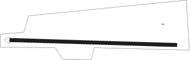
Runway info
| Runway 09 / 27 | ||
| length | 610m (2001ft) | |
| bearing | 95° / 275° | |
| width | 12m (40ft) | |
| surface | grass | |
Nearby beacons
| code | identifier | dist | bearing | frequency |
|---|---|---|---|---|
| MJF | ARVILLA (GREENVILLE) TACAN | 28.3 | 345° | 109.60 |
| CQY | CEDAR CREEK VORTAC | 28.9 | 214° | 114.80 |
| TYR | TYLER VOR/DME | 30.9 | 115° | 114.20 |
| PQF | MESQUITE NDB | 32.2 | 289° | 248 |
| CSZ | CROSSROADS NDB | 32.6 | 182° | 215 |
| UIM | DME | 33.2 | 64° | 114 |
| GV | MAJOR (GREENVILLE) NDB | 33.6 | 347° | 201 |
| FZT | FRANKSTON VOR/DME | 38 | 143° | 111.40 |
| SLR | SULPHUR SPRINGS VOR/DME | 40.7 | 34° | 109 |
| CGQ | POWELL (CORSICANA) NDB | 40.9 | 222° | 344 |
| ABG | AMBASSADOR (BIG SANDY) NDB | 41.7 | 91° | 404 |
| CRS | CORSICANA NDB | 41.7 | 218° | 396 |
| CVE | COWBOY (DALLAS) VOR/DME | 51.6 | 286° | 116.20 |
| BYP | BONHAM VORTAC | 57.8 | 342° | 114.60 |
| PRX | PARIS VOR/DME | 61.3 | 28° | 113.60 |
| LXY | MEXIA NDB | 64.9 | 211° | 329 |
Disclaimer
The information on this website is not for real aviation. Use this data with the X-Plane flight simulator only! Data taken with kind consent from X-Plane 12 source code and data files. Content is subject to change without notice.