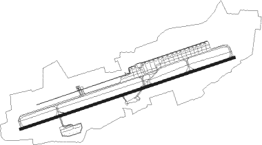
Bridgetown - Barbados/grantley Adams Intl
Airport details
| Country | Barbados |
| State | Christ Church |
| Region | TB |
| Airspace | Piarco Ctr |
| Elevation | 166ft (51m) |
| Timezone | GMT -4 |
| Coordinates | 13.07464, -59.49210 |
| Magnetic var | |
| Type | land |
| Available since | X-Plane v10.35 |
| ICAO code | TBPB |
| IATA code | BGI |
| FAA code | n/a |
Communication
| Barbados/Grantley Adams Intl ADAMS ATIS | 132.725 |
| Barbados/Grantley Adams Intl ADAMS Ground Control | 121.900 |
| Barbados/Grantley Adams Intl ADAMS Tower | 118.700 |
| Barbados/Grantley Adams Intl ADAMS Approach | 129.350 |
| Barbados/Grantley Adams Intl ADAMS Approach | 120.700 |
| Barbados/Grantley Adams Intl ADAMS Approach | 121.200 |
| Barbados/Grantley Adams Intl ADAMS Approach | 128.850 |
Approach frequencies
| ILS-cat-I | RW09 | 110.1 | 18.00mi |
| 3° GS | RW09 | 110.1 | 18.00mi |
Nearby beacons
| code | identifier | dist | bearing | frequency |
|---|---|---|---|---|
| BGI | ADAMS (BRIDGETOWN) VOR/DME | 0.4 | 87° | 112.70 |
Instrument approach procedures
| runway | airway (heading) | route (dist, bearing) |
|---|---|---|
| RW09 | BENUK (102°) | BENUK 3000ft OLIDO (6mi, 166°) 2500ft |
| RW09 | INABA (50°) | INABA 3000ft OLIDO (6mi, 346°) 2500ft |
| RNAV | OLIDO 2500ft ELIXA (5mi, 76°) 2000ft TBPB (6mi, 76°) 219ft ALOKI (12mi, 76°) 2500ft ALOKI (turn) 10000ft | |
| RW27 | DUTAL (282°) | DUTAL 3000ft ALOKI (6mi, 346°) 2500ft |
| RW27 | LERUM (230°) | LERUM 3000ft ALOKI (6mi, 166°) 2500ft |
| RNAV | ALOKI 2500ft NOPOR (5mi, 256°) 2000ft TBPB (7mi, 256°) 210ft OLIDO (12mi, 256°) 2500ft OLIDO (turn) 10000ft |
Disclaimer
The information on this website is not for real aviation. Use this data with the X-Plane flight simulator only! Data taken with kind consent from X-Plane 12 source code and data files. Content is subject to change without notice.
