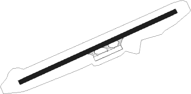
Marigot - Dominica Douglas–charles Intl
Airport details
| Country | Dominica |
| State | Saint Andrew Parish |
| Region | TD |
| Airspace | Piarco Ctr |
| Elevation | 73ft (22m) |
| Timezone | GMT -4 |
| Coordinates | 15.54667, -61.30139 |
| Magnetic var | |
| Type | land |
| Available since | X-Plane v10.40 |
| ICAO code | TDPD |
| IATA code | DOM |
| FAA code | n/a |
Communication
| Dominica Douglas–Charles Intl ATIS | 118.000 |
| Dominica Douglas–Charles Intl Douglas–Charles Tower | 118.900 |
| Dominica Douglas–Charles Intl Raizet Departure | 121.300 |
| Dominica Douglas–Charles Intl Martinique Approach | 121.000 |
| Dominica Douglas–Charles Intl Raizet Approach | 121.300 |
Nearby Points of Interest:
Morne Diablotin National Park
-Morne Trois Pitons National Park
-Four à chaux de Trois-Rivières
-Pont sur le Galion
-Arsenal (Basse-Terre)
-Glacière
-Monastère Saint-Antoine de Basse-Terre
-Bâtiments du Camp Jacob
Nearby beacons
| code | identifier | dist | bearing | frequency |
|---|---|---|---|---|
| DOM | DOUGLAS CHARLES NDB | 0.4 | 53° | 273 |
| PPR | POINTE A PITRE VOR/DME | 45.3 | 342° | 112.90 |
| PTP | POINTE A PITRE NDB | 48.1 | 336° | 385 |
| FOF | MARTINIQUE VOR/DME | 59.6 | 164° | 113.30 |
Departure and arrival routes
| Transition altitude | 9000ft |
| SID end points | distance | outbound heading | |
|---|---|---|---|
| RW09 | |||
| KAROT1 | 45mi | 342° | |
Instrument approach procedures
| runway | airway (heading) | route (dist, bearing) |
|---|---|---|
| RW27 | FOF (344°) | FOF NM30 (22mi, 357°) 6000ft IGROP (30mi, 357°) 3000ft VOLAB (10mi, 339°) 1700ft |
| RW27 | PPR (162°) | PPR ADVUR (40mi, 146°) 2000ft VOLAB (6mi, 159°) 1700ft |
| RW27 | VOLAB (251°) | VOLAB 1700ft |
| RNAV | VOLAB 1700ft KAROT (5mi, 251°) 1700ft MIVAS (3mi, 251°) 624ft VOLAB (8mi, 71°) 1700ft VOLAB (turn) 8000ft |
Disclaimer
The information on this website is not for real aviation. Use this data with the X-Plane flight simulator only! Data taken with kind consent from X-Plane 12 source code and data files. Content is subject to change without notice.
