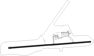
Vieux Fort - St. Lucia/hewanorra Intl
Airport details
| Country | Saint Lucia |
| State | Vieux Fort |
| Region | TL |
| Airspace | Piarco Ctr |
| Elevation | 14ft (4m) |
| Timezone | GMT -4 |
| Coordinates | 13.73222, -60.95195 |
| Magnetic var | |
| Type | land |
| Available since | X-Plane v10.40 |
| ICAO code | TLPL |
| IATA code | UVF |
| FAA code | n/a |
Communication
| St. Lucia/Hewanorra Intl ATIS | 126.150 |
| St. Lucia/Hewanorra Intl Ground Control | 121.600 |
| St. Lucia/Hewanorra Intl Tower | 118.300 |
| St. Lucia/Hewanorra Intl ST LUCIA Approach | 119.800 |
Nearby beacons
| code | identifier | dist | bearing | frequency |
|---|---|---|---|---|
| BNE | HEWANORRA (SAINT LUCIA) NDB | 1.4 | 273° | 305 |
| SLU | GEORGE CHARLES (ST. LUCIA) NDB | 17.2 | 349° | 415 |
| SV | ST VINCENT (SAINT VINCENT I) NDB | 38.9 | 205° | 403 |
| FOF | MARTINIQUE VOR/DME | 51.7 | 355° | 113.30 |
Instrument approach procedures
| runway | airway (heading) | route (dist, bearing) |
|---|---|---|
| RW10 | KISES (174°) | KISES SAVEL (13mi, 205°) 4000ft ILOGO (12mi, 218°) 3000ft TUBED (6mi, 180°) 3000ft |
| RW10 | NUKAK (152°) | NUKAK DERMI (11mi, 192°) 3000ft ILOGO (8mi, 180°) 3000ft TUBED (6mi, 180°) 3000ft |
| RW10 | RIBOR (26°) | RIBOR 356AT (10mi, 341°) 4000ft LIDOG (6mi, 341°) 3000ft TUBED (6mi, 360°) 3000ft |
| RW10 | TIBOT (295°) | TIBOT KOBAK (14mi, 276°) 4000ft 292AT (17mi, 276°) 4000ft LIDOG (6mi, 276°) 3000ft TUBED (6mi, 360°) 3000ft |
| RW10 | TUBED (90°) | TUBED 3000ft |
| RW10 | UMENU (39°) | UMENU LIDOG (13mi, 358°) 3000ft TUBED (6mi, 360°) 3000ft |
| RNAV | TUBED 3000ft BISNO (4mi, 90°) 1800ft MATES (5mi, 90°) 1800ft TLPL (6mi, 91°) 60ft UMIGO (11mi, 90°) 2500ft UMIGO (turn) | |
| RW28 | KISES (174°) | KISES BUDAN (18mi, 143°) 4000ft OKUGA (6mi, 143°) 3000ft UMIGO (8mi, 180°) 2500ft |
| RW28 | RIBOR (26°) | RIBOR KOBAK (21mi, 55°) 3000ft AVASI (5mi, 55°) 3000ft UMIGO (6mi, 0°) 2500ft |
| RW28 | SLU (169°) | SLU URPAL (12mi, 121°) 4200ft OKUGA (5mi, 122°) 3000ft UMIGO (8mi, 180°) 2500ft |
| RW28 | TIBOT (295°) | TIBOT UMIGO (14mi, 315°) 2500ft |
| RW28 | UMIGO (270°) | UMIGO 2500ft |
| RNAV | UMIGO 2500ft MEDOR (5mi, 270°) 1800ft TLPL (6mi, 269°) 60ft TUBED (15mi, 270°) 3000ft TUBED (turn) |
Disclaimer
The information on this website is not for real aviation. Use this data with the X-Plane flight simulator only! Data taken with kind consent from X-Plane 12 source code and data files. Content is subject to change without notice.
