Spencer - Hogue
Airport details
| Country | United States of America |
| State | Tennessee |
| Region | |
| Airspace | Memphis Ctr |
| Municipality | Van Buren County |
| Elevation | 1798ft (548m) |
| Timezone | GMT -6 |
| Coordinates | 35.62825, -85.39487 |
| Magnetic var | |
| Type | land |
| Available since | X-Plane v11.50 |
| ICAO code | TN85 |
| IATA code | n/a |
| FAA code | TN85 |
Communication
| Hogue UNICOM | 122.725 |
Nearby Points of Interest:
Bledsoe County Jail
-Bledsoe County Courthouse
-Dr. James A. Ross House
-Pikeville Chapel African Methodist Episcopal Zion Church
-John Bridgman House
-Bellview School
-Sequatchie County Courthouse
-Sparta Rock House
-Community Building
-Spring Street Service Station
-Northcutts Cove Chapel
-Falcon Rest
-Black House
-Falconhurst
-Dr. Walter Thomison House
-Broyles-Darwin House
-Northcutt Plantation
-Blythe Ferry
-Coalmont Bank Building
-Pioneer Hall
-Cumberland Homesteads
-Cumberland County Courthouse
-Col. A.M. Shook House
-West End Church of Christ Silver Point
-The Arcade
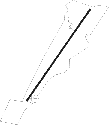
Runway info
| Runway 4 / 22 | ||
| length | 1014m (3327ft) | |
| bearing | 45° / 225° | |
| width | 15m (50ft) | |
| surface | asphalt | |
Nearby beacons
| code | identifier | dist | bearing | frequency |
|---|---|---|---|---|
| HCH | HINCH MTN (CROSSVILLE) VOR/DME | 22.2 | 70° | 117.60 |
| HEM | HUCHN NDB | 23.5 | 332° | 233 |
| DTE | MARK ANTON (DAYTON) NDB | 24.3 | 108° | 394 |
| CQN | DAISY (N.CHATTANOOGA) NDB | 30 | 153° | 341 |
| GQO | CHOO CHOO (CHATTANOOGA) VORTAC | 41.7 | 160° | 115.80 |
| FQW | WALTER HILL (MURFREESBORO) NDB | 51.5 | 289° | 371 |
| LVT | LIVINGSTON VOR/DME | 58.4 | 13° | 108.40 |
| SCX | SCOTT (ONEIDA) NDB | 63.3 | 44° | 403 |
Disclaimer
The information on this website is not for real aviation. Use this data with the X-Plane flight simulator only! Data taken with kind consent from X-Plane 12 source code and data files. Content is subject to change without notice.