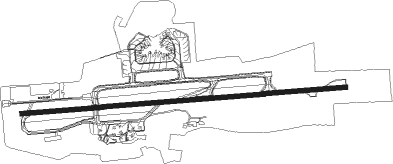
Port Of Spain - Trinidad Piarco Intl
Airport details
| Country | Trinidad and Tobago |
| State | Tunapuna-Piarco |
| Region | TT |
| Airspace | Piarco Ctr |
| Elevation | 57ft (17m) |
| Timezone | GMT -4 |
| Coordinates | 10.59528, -61.33722 |
| Magnetic var | |
| Type | land |
| Available since | X-Plane v10.40 |
| ICAO code | TTPP |
| IATA code | POS |
| FAA code | n/a |
Communication
| Trinidad Piarco Intl ATIS | 126.700 |
| Trinidad Piarco Intl Ground Control | 121.900 |
| Trinidad Piarco Intl Tower | 118.100 |
| Trinidad Piarco Intl Approach | 119.000 |
| Trinidad Piarco Intl Approach | 119.550 |
Approach frequencies
| ILS-cat-I | RW10 | 109.7 | 18.00mi |
| 3° GS | RW10 | 109.7 | 18.00mi |
Nearby beacons
| code | identifier | dist | bearing | frequency |
|---|---|---|---|---|
| TRI | PIARCO (PORT OF SPAIN) NDB | 5 | 270° | 382 |
| POS | PIARCO (PORT OF SPAIN) VOR/DME | 8.3 | 203° | 116.90 |
| TAB | ROBINSON (SCARBOROUGH) NDB | 44.5 | 42° | 323 |
Instrument approach procedures
| runway | airway (heading) | route (dist, bearing) |
|---|---|---|
| RW10 | ANELU (90°) | ANELU 4100ft LEXOR (6mi, 90°) 2500ft |
| RW10 | IMIRA (61°) | IMIRA 4100ft LEXOR (6mi, 360°) 2500ft |
| RW10 | NAPKO (118°) | NAPKO 4100ft 3NM (3mi, 180°) 3300ft LEXOR (3mi, 180°) 2500ft |
| RNAV | LEXOR 2500ft TALUS (5mi, 90°) 1700ft TTPP (6mi, 90°) 80ft (3716mi, 100°) 1500ft IMIRA (3726mi, 280°) 4100ft IMIRA (turn) 4100ft | |
| RW28 | KIVIP (241°) | KIVIP 4100ft 015AT (3mi, 180°) 3300ft BOSAT (3mi, 180°) 2500ft |
| RW28 | MUTAM (298°) | MUTAM 4100ft BOSAT (6mi, 360°) 2500ft |
| RNAV | BOSAT 2500ft DANON (5mi, 270°) 1700ft TTPP (6mi, 270°) 108ft (3716mi, 100°) 1000ft MUTAM (3704mi, 280°) 4100ft MUTAM (turn) 4100ft |
Disclaimer
The information on this website is not for real aviation. Use this data with the X-Plane flight simulator only! Data taken with kind consent from X-Plane 12 source code and data files. Content is subject to change without notice.