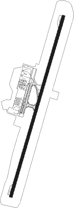
Kingstown - Kingstown Argyle Intl
Airport details
| Country | Saint Vincent and the Grenadines |
| State | [Other] |
| Region | |
| Airspace | Piarco Ctr |
| Municipality | Kingstown |
| Elevation | 136ft (41m) |
| Timezone | GMT -4 |
| Coordinates | 13.14851, -61.15321 |
| Magnetic var | |
| Type | land |
| Available since | X-Plane v10.40 |
| ICAO code | TVSA |
| IATA code | SVD |
| FAA code | n/a |
Communication
| Kingstown Argyle Intl ATIS | 132.550 |
| Kingstown Argyle Intl ARGYLE Ground Control | 121.900 |
| Kingstown Argyle Intl ARGYLE Tower | 118.800 |
| Kingstown Argyle Intl ARGYLE Approach | 120.800 |
Nearby beacons
| code | identifier | dist | bearing | frequency |
|---|---|---|---|---|
| SV | ST VINCENT (SAINT VINCENT I) NDB | 4.2 | 264° | 403 |
| CAI | CANOUAN (ST. VINCENT) NDB | 29.2 | 202° | 302 |
| BNE | HEWANORRA (SAINT LUCIA) NDB | 36.6 | 17° | 305 |
| SLU | GEORGE CHARLES (ST. LUCIA) NDB | 52.6 | 10° | 415 |
Departure and arrival routes
| Transition altitude | 5200ft |
| SID end points | distance | outbound heading | |
|---|---|---|---|
| RW04 | |||
| BNEP1A | 37mi | 17° | |
| GOTE1A | 16mi | 94° | |
| RESA1A | 41mi | 211° | |
| LENA1A | 34mi | 282° | |
| LIDO1A | 29mi | 353° | |
| RW22 | |||
| BNEPL | 37mi | 17° | |
| GOTER | 16mi | 94° | |
| RESAS | 41mi | 211° | |
| LENAL | 34mi | 282° | |
| LIDOG | 29mi | 353° | |
Instrument approach procedures
| runway | airway (heading) | route (dist, bearing) |
|---|---|---|
| RW04 | BNEPL (197°) | BNEPL 3000ft MESDI (25mi, 185°) 3000ft ITGEM (10mi, 185°) 3000ft DEDIK (9mi, 201°) 3000ft ANATA (5mi, 201°) 3000ft GUDAS (7mi, 291°) 3000ft |
| RW04 | DUPUM (296°) | DUPUM 3000ft ANATA (20mi, 265°) 3000ft GUDAS (7mi, 291°) 3000ft |
| RW04 | LENAL (102°) | LENAL 3000ft MIXUV (28mi, 121°) 3000ft GUDAS (6mi, 111°) 3000ft |
| RW04 | RESAS (31°) | RESAS 3000ft GUDAS (30mi, 35°) 3000ft |
| RW04 | UMENU (169°) | UMENU 6NM (7mi, 212°) BOTAB (6mi, 211°) 3000ft MIXUV (12mi, 178°) 3000ft GUDAS (6mi, 111°) 3000ft |
| RNAV | GUDAS 3000ft KESBI (5mi, 21°) 2000ft UKREK (5mi, 21°) 505ft RIGIT (4mi, 21°) ITGEM (7mi, 111°) DEDIK (9mi, 201°) 3000ft ANATA (5mi, 201°) 3000ft GUDAS (7mi, 291°) 3000ft GUDAS (turn) 3000ft |
Disclaimer
The information on this website is not for real aviation. Use this data with the X-Plane flight simulator only! Data taken with kind consent from X-Plane 12 source code and data files. Content is subject to change without notice.
