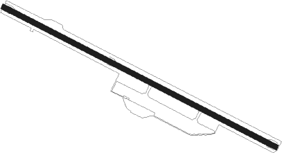
Canouan - Canouan Jetport
Airport details
| Country | Saint Vincent and the Grenadines |
| State | Grenadines |
| Region | TV |
| Airspace | Piarco Ctr |
| Elevation | 16ft (5m) |
| Timezone | GMT -4 |
| Coordinates | 12.70080, -61.34507 |
| Magnetic var | |
| Type | land |
| Available since | X-Plane v10.40 |
| ICAO code | TVSC |
| IATA code | CIW |
| FAA code | n/a |
Communication
| Canouan Jetport Ground Control | 121.600 |
| Canouan Jetport Tower | 118.050 |
Nearby beacons
| code | identifier | dist | bearing | frequency |
|---|---|---|---|---|
| CAI | CANOUAN (ST. VINCENT) NDB | 0.4 | 130° | 302 |
| SV | ST VINCENT (SAINT VINCENT I) NDB | 27.3 | 15° | 403 |
| GND | MAURICE BISHOP(SAINT GEORGE'S) NDB | 48.8 | 212° | 362 |
| GND | MAURICE BISHOP(SAINT GEOR VOR/DME | 49.2 | 212° | 117.10 |
Instrument approach procedures
| runway | airway (heading) | route (dist, bearing) |
|---|---|---|
| RW13 | BERUT (121°) | BERUT 2400ft |
| RW13 | LENAL (146°) | LENAL 5NM (26mi, 154°) 3000ft BERUT (5mi, 154°) 2400ft |
| RW13 | RESAS (51°) | RESAS DARID (9mi, 349°) 3000ft BERUT (5mi, 32°) 2400ft |
| RW13 | SV (195°) | SV GUDOG (21mi, 219°) 3000ft BERUT (5mi, 212°) 2400ft |
| RNAV | BERUT 2400ft ILAKO (5mi, 121°) 1600ft GONET (4mi, 121°) 442ft NABER (12mi, 121°) 2400ft NABER (turn) 2400ft | |
| RW31 | LENAL (146°) | LENAL DANAV (48mi, 136°) 3000ft NABER (5mi, 212°) 2400ft |
| RW31 | NABER (301°) | NABER 2400ft |
| RW31 | RESAS (51°) | RESAS LIBEM (16mi, 96°) 3000ft NABER (5mi, 32°) 2400ft |
| RW31 | SV (195°) | SV DANAV (28mi, 171°) 3000ft NABER (5mi, 212°) 2400ft |
| RNAV | NABER 2400ft ILAGA (5mi, 301°) 1600ft TVSC (5mi, 301°) 66ft (3730mi, 102°) 2000ft NABER (3721mi, 282°) 2400ft NABER (turn) 2400ft |
Disclaimer
The information on this website is not for real aviation. Use this data with the X-Plane flight simulator only! Data taken with kind consent from X-Plane 12 source code and data files. Content is subject to change without notice.
