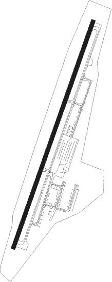
Blackfoot - Mccarley Fld
Airport details
| Country | United States of America |
| State | Idaho |
| Region | K1 |
| Airspace | Salt Lake City Ctr |
| Municipality | Blackfoot |
| Elevation | 4486ft (1367m) |
| Timezone | GMT -7 |
| Coordinates | 43.20925, -112.34959 |
| Magnetic var | |
| Type | land |
| Available since | X-Plane v10.40 |
| ICAO code | U02 |
| IATA code | n/a |
| FAA code | n/a |
Communication
| MCCARLEY FLD CTAF/UNICOM | 122.800 |
Nearby Points of Interest:
United States Post Office–Blackfoot Main
-Idaho Republican Building
-Ross Fork Episcopal Church
-Blackfoot LDS Tabernacle
-Hell's Half Acre Lava Field
-Church of the Assumption (Pocatello, Idaho)
-John Hood House
-Idaho State University Administration Building
-Standrod House
-St. Joseph's Catholic Church (Pocatello, Idaho)
-Pocatello Carnegie Library
-Sullivan-Kinney House
-Montgomery Ward Building
-Bonneville County Courthouse
-Idaho Falls City Building
Runway info
| Runway 1 / 19 | ||
| length | 1315m (4314ft) | |
| bearing | 31° / 211° | |
| width | 23m (75ft) | |
| surface | asphalt | |
Nearby beacons
| code | identifier | dist | bearing | frequency |
|---|---|---|---|---|
| PI | TYHEE (POCATELLO) NDB | 16.4 | 214° | 383 |
| IDA | IDAHO FALLS VOR/DME | 22.3 | 43° | 113.85 |
| PIH | POCATELLO VOR/DME | 24.3 | 222° | 112.60 |
| DBS | DUBOIS VORTAC | 53.1 | 9° | 116.90 |
Departure and arrival routes
| Transition altitude | 18000ft |
| Transition level | 18000ft |
| SID end points | distance | outbound heading | |
|---|---|---|---|
| RW01 | |||
| IDA3 | 22mi | 43° | |
| RW19 | |||
| PIH4 | 24mi | 222° | |
Instrument approach procedures
| runway | airway (heading) | route (dist, bearing) |
|---|---|---|
| RWNVA | IDA (223°) | IDA AMXOJ (11mi, 234°) 7000ft |
| RNAV | AMXOJ 7000ft YILKO (6mi, 211°) 6200ft U02 (6mi, 211°) 4532ft (6372mi, 111°) 4888ft NARBE (6373mi, 291°) PIH (22mi, 223°) 8500ft PIH (turn) | |
| RWNVB | PIH (42°) | PIH MILMK (12mi, 45°) 7000ft |
| RNAV | MILMK 7000ft OHJOJ (7mi, 45°) 6200ft U02 (6mi, 31°) 4521ft (6372mi, 111°) 4888ft JASKI (6370mi, 291°) IDA (20mi, 44°) 7000ft IDA (turn) |
Disclaimer
The information on this website is not for real aviation. Use this data with the X-Plane flight simulator only! Data taken with kind consent from X-Plane 12 source code and data files. Content is subject to change without notice.
