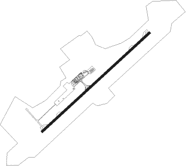
Uralsk
Airport details
| Country | Kazakhstan |
| State | West Kazakhstan Region |
| Region | UA |
| Airspace | Aktobe Ctr |
| Municipality | Terekti District |
| Elevation | 126ft (38m) |
| Timezone | GMT +5 |
| Coordinates | 51.15194, 51.54389 |
| Magnetic var | |
| Type | land |
| Available since | X-Plane v10.40 |
| ICAO code | UARR |
| IATA code | URA |
| FAA code | n/a |
Communication
| Uralsk Uralsk ATIS | 126.500 |
| Uralsk Uralsk Tower | 119.700 |
Approach frequencies
| ILS-cat-I | RW04 | 111.3 | 18.00mi |
| ILS-cat-I | RW22 | 109.7 | 18.00mi |
| 3° GS | RW04 | 111.3 | 18.00mi |
| 3° GS | RW22 | 109.7 | 18.00mi |
Nearby beacons
| code | identifier | dist | bearing | frequency |
|---|---|---|---|---|
| URL | URALSK VOR/DME | 0.1 | 182° | 114.20 |
| S | URALSK NDB | 1.1 | 244° | 214 |
Departure and arrival routes
| Transition altitude | 10000ft |
| SID end points | distance | outbound heading | |
|---|---|---|---|
| RW04 | |||
| EKTE5C | 43mi | 68° | |
| VEVI5C | 43mi | 105° | |
| EDAK5C | 43mi | 118° | |
| DOKU5C | 44mi | 176° | |
| ARIS5C | 43mi | 289° | |
| GUTA5C | 38mi | 313° | |
| RW22 | |||
| EKTE5D | 43mi | 68° | |
| VEVI5D | 43mi | 105° | |
| EDAK5D | 43mi | 118° | |
| DOKU5D | 44mi | 176° | |
| ARIS5D | 43mi | 289° | |
| GUTA5D | 38mi | 313° | |
| STAR starting points | distance | inbound heading | |
|---|---|---|---|
| RW04 | |||
| ARIS5A | 42.5 | 109° | |
| GUTA5A | 37.6 | 133° | |
| EKTE5A | 43.1 | 248° | |
| VEVI5A | 43.1 | 285° | |
| EDAK5A | 43.2 | 298° | |
| DOKU5A | 43.5 | 356° | |
| RW22 | |||
| ARIS5B | 42.5 | 109° | |
| GUTA5B | 37.6 | 133° | |
| EKTE5B | 43.1 | 248° | |
| VEVI5B | 43.1 | 285° | |
| EDAK5B | 43.2 | 298° | |
| DOKU5B | 43.5 | 356° | |
Holding patterns
| STAR name | hold at | type | turn | heading* | altitude | leg | speed limit |
|---|---|---|---|---|---|---|---|
| ARIS5A | URL | NDB | left | 41 (221)° | > 4000ft | 1.0min timed | ICAO rules |
| ARIS5B | URL | NDB | left | 41 (221)° | > 4000ft | 1.0min timed | ICAO rules |
| DOKU5A | URL | NDB | left | 41 (221)° | > 4000ft | 1.0min timed | ICAO rules |
| DOKU5B | URL | NDB | left | 41 (221)° | > 4000ft | 1.0min timed | ICAO rules |
| EDAK5A | URL | NDB | left | 41 (221)° | > 4000ft | 1.0min timed | ICAO rules |
| EDAK5B | URL | NDB | left | 41 (221)° | > 4000ft | 1.0min timed | ICAO rules |
| EKTE5A | URL | NDB | left | 41 (221)° | > 4000ft | 1.0min timed | ICAO rules |
| EKTE5B | URL | NDB | left | 41 (221)° | > 4000ft | 1.0min timed | ICAO rules |
| GUTA5A | URL | NDB | left | 41 (221)° | > 4000ft | 1.0min timed | ICAO rules |
| GUTA5B | URL | NDB | left | 41 (221)° | > 4000ft | 1.0min timed | ICAO rules |
| VEVI5A | URL | NDB | left | 41 (221)° | > 4000ft | 1.0min timed | ICAO rules |
| VEVI5B | URL | NDB | left | 41 (221)° | > 4000ft | 1.0min timed | ICAO rules |
| *) magnetic outbound (inbound) holding course | |||||||
Disclaimer
The information on this website is not for real aviation. Use this data with the X-Plane flight simulator only! Data taken with kind consent from X-Plane 12 source code and data files. Content is subject to change without notice.