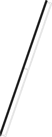
Gyumri
Airport details
| Country | Armenia |
| State | Shirak Province |
| Region | UD |
| Airspace | Yerevan Ctr |
| Municipality | Gyumri |
| Elevation | 5000ft (1524m) |
| Timezone | GMT +4 |
| Coordinates | 40.75048, 43.85933 |
| Magnetic var | |
| Type | land |
| Available since | X-Plane v10.40 |
| ICAO code | UDSG |
| IATA code | LWN |
| FAA code | n/a |
Communication
| GYUMRI ATIS | 128.700 |
| GYUMRI GYUMRI Tower | 120.600 |
| GYUMRI GYUMRI Approach | 127.700 |
Approach frequencies
| ILS-cat-I | RW02 | 110.3 | 18.00mi |
| 3° GS | RW02 | 110.3 | 18.00mi |
Nearby Points of Interest:
Church in Kazachi post
-Sergey Merkurov House-Museum
-Saint Michael the Archangel's Church, Gyumri
-Busts of Avetik Isahakyan in Gyumri
-Horom citadel
-House Museum of Minas Avetisyan
-Armenia
-Hogevank Monastery
-Saint George Church of Garnahovit
-Haykadzor Lusavorich church
-Lake Arpi National Park
-Surb Hovhannes Church, Melikgyugh
-Monumental Complex in Aparan
-Kevork Chavoush Museum
-Gharakilisa church of the Holy Mother of God
-Gargar Saint Hovhannes church
Nearby beacons
| code | identifier | dist | bearing | frequency |
|---|---|---|---|---|
| GM | SHIRAK (GYUMRI) NDB | 1.4 | 210° | 668 |
| KAR | KARS NDB | 36.3 | 256° | 431 |
| ZVR | ZVARTNOTS VOR/DME | 42.3 | 142° | 112.30 |
| ER | EREBUNI (YEREVAN) NDB | 46.1 | 134° | 496 |
| GDR | IGDIR NDB | 46.7 | 178° | 388 |
| Y | EREBUNI (YEREVAN) NDB | 47.2 | 138° | |
| YN | EREBUNI (YEREVAN) NDB | 47.6 | 138° | 580 |
| FH | EREBUNI (YEREVAN) NDB | 47.8 | 143° | 465 |
| BKU | DME | 58.4 | 341° | 110.60 |
Departure and arrival routes
| Transition altitude | 11500ft |
| SID end points | distance | outbound heading | |
|---|---|---|---|
| RW02 | |||
| ASMI1C | 18mi | 103° | |
| TIBL1C | 22mi | 175° | |
| RW20 | |||
| ASMI1G | 18mi | 103° | |
| TIBL1G | 22mi | 175° | |
| STAR starting points | distance | inbound heading | |
|---|---|---|---|
| RW02 | |||
| ARR02 | 23.3 | 169° | |
| RW20 | |||
| ASMI1J | 17.8 | 283° | |
| TIBL1J | 21.9 | 355° | |
Instrument approach procedures
| runway | airway (heading) | route (dist, bearing) |
|---|---|---|
| RW02 | ASMIK (283°) | ASMIK SG449 (20mi, 249°) 9500ft SG450 (5mi, 288°) 8500ft |
| RW02 | GM (30°) | GM 10000ft SG448 (7mi, 148°) 9500ft SG449 (8mi, 210°) 9500ft SG450 (5mi, 288°) 8500ft |
| RW02 | TIBLO (355°) | TIBLO SG450 (12mi, 318°) 8500ft |
| RNAV | SG450 8500ft EDIGU (6mi, 30°) 7000ft UDSG (7mi, 30°) 4993ft SG447 (2mi, 30°) 5700ft GM (3mi, 210°) 10000ft GM (turn) 10000ft | |
| RW20 | BERDO (234°) | BERDO 11500ft SG451 (8mi, 288°) 11000ft |
| RNAV | SG451 11000ft IDRUS (5mi, 210°) 10000ft UDSG (14mi, 210°) 5050ft SG453 (6mi, 210°) 6000ft BERDO (26mi, 49°) 11500ft BERDO (turn) 11500ft |
Holding patterns
| STAR name | hold at | type | turn | heading* | altitude | leg | speed limit |
|---|---|---|---|---|---|---|---|
| ARR02 | GM | FIX | left | 329 (149)° | > 10000ft | 1.0min timed | 215 |
| ASMI1J | BERDO | VHF | left | 198 (18)° | > 11500ft | 1.0min timed | 215 |
| TABA1J | BERDO | VHF | left | 198 (18)° | > 11500ft | 1.0min timed | 215 |
| TIBL1J | BERDO | VHF | left | 198 (18)° | > 11500ft | 1.0min timed | 215 |
| *) magnetic outbound (inbound) holding course | |||||||
Disclaimer
The information on this website is not for real aviation. Use this data with the X-Plane flight simulator only! Data taken with kind consent from X-Plane 12 source code and data files. Content is subject to change without notice.
