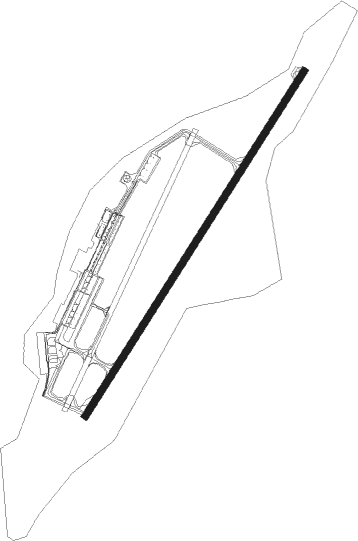
Yakutsk
Airport details
| Country | Russian Federation |
| State | Sakha Republic |
| Region | UE |
| Airspace | Yakutsk Ctr |
| Municipality | Yakutsk |
| Elevation | 328ft (100m) |
| Timezone | GMT +9 |
| Coordinates | 62.09222, 129.76511 |
| Magnetic var | |
| Type | land |
| Available since | X-Plane v10.40 |
| ICAO code | UEEE |
| IATA code | YKS |
| FAA code | n/a |
Communication
| Yakutsk ATIS | 126.200 |
| Yakutsk Ground | 121.700 |
| Yakutsk Tower | 120.000 |
| Yakutsk Approach | 129.300 |
| Yakutsk Departure | 129.300 |
Approach frequencies
| ILS-cat-I | RW23L | 111.7 | 18.00mi |
| 3° GS | RW23L | 111.7 | 18.00mi |
Nearby Points of Interest:
Holy Trinity Cathedral (Yakutsk)
Nearby beacons
| code | identifier | dist | bearing | frequency |
|---|---|---|---|---|
| UTS | YAKUTSK VOR/DME | 0.5 | 89° | 112.30 |
| V | YAKUTSK NDB | 1.2 | 229° | 685 |
| M | YAKUTSK NDB | 1.7 | 63° | 685 |
| VD | YAKUTSK NDB | 2.7 | 234° | 334 |
| MF | YAKUTSK NDB | 3.2 | 61° | 334 |
Departure and arrival routes
| Transition altitude | 3609ft |
| SID end points | distance | outbound heading | |
|---|---|---|---|
| RW05R | |||
| TUROP1, TURO5E | 27mi | 6° | |
| SORI5E, SORIP1 | 27mi | 29° | |
| GIME5E, GIMEK1 | 27mi | 36° | |
| TEKD5E, TEKDI1 | 27mi | 46° | |
| IDES5E, IDESA1 | 27mi | 54° | |
| NENAL1, NENA5E | 27mi | 69° | |
| DOBU5E, DOBUS1 | 27mi | 76° | |
| AGMAT1, AGMA5E | 27mi | 83° | |
| KUTEG1, KUTE5E | 27mi | 93° | |
| BESIB1, BESI5E | 27mi | 98° | |
| OKTU5E, OKTUR1 | 27mi | 109° | |
| OGLI5E, OGLIS1 | 27mi | 163° | |
| DENI5E, DENIB1 | 27mi | 210° | |
| DIRO5E, DIROM1 | 27mi | 234° | |
| OKSIN1, OKSI5E | 27mi | 257° | |
| LEPRI1, LEPR5E | 27mi | 262° | |
| RUTI5E, RUTIK1 | 27mi | 268° | |
| ABGUR1, ABGU5E | 27mi | 275° | |
| BAGUS1, BAGU5E | 27mi | 279° | |
| REDKA1, REDK5E | 27mi | 284° | |
| NIBE5E | 27mi | 289° | |
| TEGM5E, TEGMA1 | 27mi | 311° | |
| GOBO5E, GOBON1 | 27mi | 358° | |
| RW23L | |||
| TURO5F, TUROP3 | 27mi | 6° | |
| SORI5F, SORIP3 | 27mi | 29° | |
| GIME5F, GIMEK3 | 27mi | 36° | |
| TEKD5F, TEKDI3 | 27mi | 46° | |
| IDES5F, IDESA3 | 27mi | 54° | |
| NENAL3, NENA5F | 27mi | 69° | |
| DOBU5F, DOBUS3 | 27mi | 76° | |
| AGMAT3, AGMA5F | 27mi | 83° | |
| KUTEG3, KUTE5F | 27mi | 93° | |
| BESIB3, BESI5F | 27mi | 98° | |
| OKTU5F, OKTUR3 | 27mi | 109° | |
| OGLIS3, OGLI5F | 27mi | 163° | |
| DENIB3, DENI5F | 27mi | 210° | |
| DIRO5F, DIROM3 | 27mi | 234° | |
| OKSI5F, OKSIN3 | 27mi | 257° | |
| LEPRI3, LEPR5F | 27mi | 262° | |
| RUTIK3, RUTI5F | 27mi | 268° | |
| ABGUR3, ABGU5F | 27mi | 275° | |
| BAGU5F, BAGUS3 | 27mi | 279° | |
| REDKA3, REDK5F | 27mi | 284° | |
| NIBE5F | 27mi | 289° | |
| TEGM5F, TEGMA3 | 27mi | 311° | |
| GOBON3, GOBO5F | 27mi | 358° | |
| STAR starting points | distance | inbound heading | |
|---|---|---|---|
| RW05R | |||
| ABGU2A | 26.7 | 95° | |
| NENA2A | 27.0 | 249° | |
| RW23L | |||
| DIRO5D | 26.7 | 54° | |
| OKSI5D | 26.6 | 77° | |
| RUTI5D | 19.5 | 80° | |
| LEPR5D | 26.6 | 82° | |
| ABGU5D, ABGU4B, ABGU4A | 26.7 | 95° | |
| BAGU5D | 26.7 | 99° | |
| REDK5D | 26.8 | 104° | |
| NIBE5D | 26.7 | 109° | |
| TEGM5D | 26.9 | 131° | |
| GOBO5D | 27.0 | 178° | |
| TURO5D | 21.6 | 181° | |
| SORI5D | 26.9 | 209° | |
| GIME5D | 27.0 | 216° | |
| TEKD5D | 26.8 | 226° | |
| IDES5D | 27.0 | 234° | |
| NENA5D | 27.0 | 249° | |
| DOBU5D | 27.0 | 256° | |
| BESI5D | 26.9 | 278° | |
| OGLI5D | 26.9 | 343° | |
Instrument approach procedures
| runway | airway (heading) | route (dist, bearing) |
|---|---|---|
| RW05R | EE001 (21°) | EE001 EE004 (6mi, 290°) 3610ft |
| RW05R | EE002 (57°) | EE002 EE004 (6mi, 58°) 3610ft |
| RW05R | EE003 (76°) | EE003 EE004 (6mi, 109°) 3610ft |
| RNAV | EE004 3610ft EE005 (5mi, 58°) 2620ft EE006 (4mi, 58°) 1150ft UEEE (3mi, 55°) 372ft (6451mi, 244°) 1640ft EE008 (6458mi, 64°) EE001 (5mi, 238°) 3610ft | |
| RW23L | EE011 (195°) | EE011 EE014 (6mi, 109°) 2620ft |
| RW23L | EE012 (239°) | EE012 EE014 (6mi, 238°) 2620ft |
| RW23L | EE013 (259°) | EE013 EE014 (6mi, 289°) 2620ft |
| RNAV | EE014 2620ft EE063 (5mi, 238°) 1630ft EE076 (2mi, 238°) 1160ft EE064 (2mi, 238°) 666ft (6452mi, 244°) 1630ft EE073 (6458mi, 64°) EE013 (4mi, 58°) 2620ft |
Disclaimer
The information on this website is not for real aviation. Use this data with the X-Plane flight simulator only! Data taken with kind consent from X-Plane 12 source code and data files. Content is subject to change without notice.