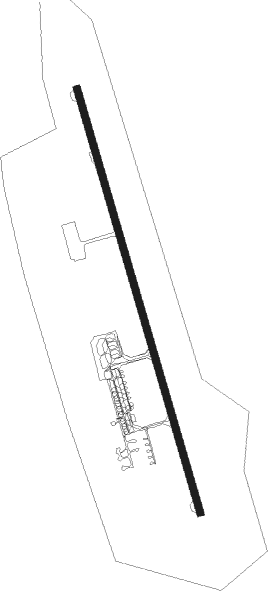
Blagoveschensk - Ignatyevo
Airport details
| Country | Russian Federation |
| State | Amur Oblast |
| Region | UH |
| Airspace | Khabarovsk Ctr |
| Municipality | Blagoveshchensk |
| Elevation | 638ft (194m) |
| Timezone | GMT +9 |
| Coordinates | 50.42556, 127.41250 |
| Magnetic var | |
| Type | land |
| Available since | X-Plane v10.40 |
| ICAO code | UHBB |
| IATA code | BQS |
| FAA code | n/a |
Communication
| Ignatyevo ATIS | 126.400 |
| Ignatyevo BLAGOVESCHENSK START | 127.200 |
Approach frequencies
| ILS-cat-I | RW36 | 108.7 | 18.00mi |
| 3.1° GS | RW36 | 108.7 | 18.00mi |
Nearby beacons
| code | identifier | dist | bearing | frequency |
|---|---|---|---|---|
| B | IGNATYEVO (BLAGOVESHCHENSK) NDB | 1.2 | 342° | 220 |
| L | BLAGOVESHCHENSK NDB | 1.5 | 162° | 220 |
| BLG | BLAGOVESHCHENSK VOR/DME | 2 | 157° | 113.60 |
| BM | IGNATYEVO (BLAGOVESHCHENSK) NDB | 3 | 342° | 350 |
| LZ | BLAGOVESHCHENSK NDB | 3 | 162° | 350 |
| HEK | HEIHE VOR/DME | 15.9 | 202° | 114 |
| WZ | SREDNEBELOYE NDB | 26.9 | 71° | 460 |
Departure and arrival routes
| Transition altitude | 3593ft |
| Transition level | 5000ft |
| SID end points | distance | outbound heading | |
|---|---|---|---|
| RW18 | |||
| RUNE1G, RUNE1F, RUNE1J, RUNE1X, RUNE1H | 29mi | 17° | |
| WZ1J, WZ1F | 27mi | 71° | |
| AMER1J, AMER1H, AMER1G, AMER1F | 31mi | 106° | |
| RW36 | |||
| RUNE1Q, RUNE1R, RUNE1S, RUNE1P | 29mi | 17° | |
| WZ1S, WZ1P, WZ1Z | 27mi | 71° | |
| AMER1S, AMER1R, AMER1Q, AMER1P, AMER1Z | 31mi | 106° | |
| STAR starting points | distance | inbound heading | |
|---|---|---|---|
| RW18 | |||
| RUNE1B, RUNE1A, RUNE1E, RUNE1C | 29.2 | 197° | |
| WZ1T, WZ1C, WZ1B, WZ1A, WZ1E | 26.9 | 251° | |
| AMER1B, AMER1A, AMER1C, AMER1E, AMER1T | 30.6 | 286° | |
| RW36 | |||
| RUNE1N, RUNE1M, RUNE1L, RUNE1K, RUNE1U | 29.2 | 197° | |
| WZ1K, WZ1L, WZ1N, WZ1M | 26.9 | 251° | |
| AMER1N, AMER1M, AMER1L, AMER1K | 30.6 | 286° | |
Instrument approach procedures
| runway | airway (heading) | route (dist, bearing) |
|---|---|---|
| RW18 | BB003 (197°) | BB003 2100ft BB002 (6mi, 208°) 2000ft |
| RNAV | BB002 2000ft BB001 (5mi, 207°) 1600ft UHBB (4mi, 162°) 615ft (6773mi, 248°) 1300ft BB004 (6780mi, 68°) WZ (18mi, 63°) | |
| RW36 | BB023 (282°) | BB023 BB022 (5mi, 238°) BB021 (5mi, 272°) BB020 (4mi, 281°) 2200ft |
| RNAV | BB020 2200ft BB019 (3mi, 322°) 1900ft 1NM (2mi, 342°) 1270ft BB018 (turn) 917ft (6774mi, 248°) 1100ft BB024 (6783mi, 68°) BB023 (5mi, 107°) 2200ft |
Holding patterns
| STAR name | hold at | type | turn | heading* | altitude | leg | speed limit |
|---|---|---|---|---|---|---|---|
| AMER1N | BB023 | VHF | right | 95 (275)° | 7000ft - 8000ft | 1.0min timed | 185 |
| RUNE1N | BB023 | VHF | right | 95 (275)° | 7000ft - 8000ft | 1.0min timed | 185 |
| RUNE1U | BB023 | VHF | right | 95 (275)° | 7000ft - 8000ft | 1.0min timed | 185 |
| SIML1N | BB023 | VHF | right | 95 (275)° | 7000ft - 8000ft | 1.0min timed | 185 |
| WZ1A | WZ | FIX | right | 179 (359)° | 8000ft - 12000ft | 1.0min timed | 185 |
| WZ1B | WZ | FIX | right | 179 (359)° | 8000ft - 12000ft | 1.0min timed | 185 |
| WZ1C | WZ | FIX | right | 179 (359)° | 8000ft - 12000ft | 1.0min timed | 185 |
| WZ1E | WZ | FIX | right | 179 (359)° | 8000ft - 12000ft | 1.0min timed | 185 |
| WZ1K | WZ | FIX | right | 179 (359)° | 8000ft - 12000ft | 1.0min timed | 185 |
| WZ1L | WZ | FIX | right | 179 (359)° | 8000ft - 12000ft | 1.0min timed | 185 |
| WZ1M | WZ | FIX | right | 179 (359)° | 8000ft - 12000ft | 1.0min timed | 185 |
| WZ1N | BB023 | VHF | right | 95 (275)° | 7000ft - 8000ft | 1.0min timed | 185 |
| WZ1N | WZ | FIX | right | 179 (359)° | 8000ft - 12000ft | 1.0min timed | 185 |
| WZ1T | WZ | FIX | right | 179 (359)° | 8000ft - 12000ft | 1.0min timed | 185 |
| *) magnetic outbound (inbound) holding course | |||||||
Disclaimer
The information on this website is not for real aviation. Use this data with the X-Plane flight simulator only! Data taken with kind consent from X-Plane 12 source code and data files. Content is subject to change without notice.