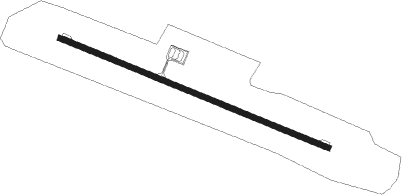
Kurilsk - Iturup
Airport details
| Country | Russian Federation |
| State | Sakhalin Oblast |
| Region | UH |
| Airspace | Khabarovsk Ctr |
| Municipality | Kurilsky District |
| Elevation | 387ft (118m) |
| Timezone | GMT +11 |
| Coordinates | 45.25639, 147.95583 |
| Magnetic var | |
| Type | land |
| Available since | X-Plane v11.40 |
| ICAO code | UHSI |
| IATA code | ITU |
| FAA code | n/a |
Communication
| Iturup Tower | 127.700 |
Approach frequencies
| ILS-cat-I | RW13 | 111.3 | 18.00mi |
| ILS-cat-I | RW31 | 111.1 | 18.00mi |
| 3° GS | RW13 | 111.3 | 18.00mi |
| 3° GS | RW31 | 111.1 | 18.00mi |
Runway info
| Runway 13 / 31 | ||
| length | 2297m (7536ft) | |
| bearing | 110° / 290° | |
| width | 42m (138ft) | |
| surface | concrete | |
| blast zone | 50m (164ft) / 50m (164ft) | |
Nearby beacons
| code | identifier | dist | bearing | frequency |
|---|---|---|---|---|
| PTR | ITURUP VOR/DME | 1.1 | 110° | 110.60 |
| T | ITURUP NDB | 1.1 | 289° | 311 |
| TP | ITURUP NDB | 1.2 | 110° | 547 |
| TR | ITURUP NDB | 2.7 | 289° | 623 |
Departure and arrival routes
| Transition altitude | 7277ft |
| Transition level | 10000ft |
| SID end points | distance | outbound heading | |
|---|---|---|---|
| RW13 | |||
| ROTN1E, ROTN1G, ROTN1W, ROTN2A | 12mi | 222° | |
| SARE2A, SARE1W, SARE1G, SARE1E | 19mi | 288° | |
| RW31 | |||
| SARE1F, SARE1H, SARE2B | 19mi | 288° | |
| STAR starting points | distance | inbound heading | |
|---|---|---|---|
| RW13 | |||
| ROTN1J, ROTN1M, ROTN1Z, ROTN2C | 11.9 | 42° | |
| SARE2C, SARE1Z, SARE1J | 19.0 | 108° | |
| RW31 | |||
| ROTN1K, ROTN1L, ROTN2D | 11.9 | 42° | |
| SARE2D, SARE1L, SARE1K | 19.0 | 108° | |
Instrument approach procedures
| runway | airway (heading) | route (dist, bearing) |
|---|---|---|
| RW13-Y | SARET (108°) | SARET SI013 (10mi, 106°) 2600ft |
| RW13-Y | SI012 (152°) | SI012 7280ft SI013 (10mi, 207°) 2600ft |
| RW13-Y | SI017 (90°) | SI017 SI013 (6mi, 57°) 2600ft |
| RNAV | SI013 1520ft SI014 (5mi, 109°) 1520ft SI015 (1mi, 109°) 1090ft UHSI (3mi, 110°) 413ft SI010 (12mi, 107°) SI011 (9mi, 32°) SI012 (22mi, 290°) 7280ft | |
| RW13-Z | SARET (108°) | SARET SI013 (10mi, 106°) 2600ft |
| RW13-Z | SI012 (152°) | SI012 7280ft SI013 (10mi, 207°) 2600ft |
| RW13-Z | SI017 (90°) | SI017 SI013 (6mi, 57°) 2600ft |
| RNAV | SI013 1520ft SI014 (5mi, 109°) 1520ft SI015 (1mi, 109°) 1090ft UHSI (3mi, 110°) 413ft SI018 (6mi, 107°) SI019 (9mi, 32°) SI012 (16mi, 290°) 7280ft | |
| RW31 | SI002 (338°) | SI002 7280ft SI003 (7mi, 110°) 5960ft SI004 (6mi, 36°) 3660ft |
| RNAV | SI004 3660ft SI005 (5mi, 290°) 2680ft SI006 (5mi, 290°) 1070ft UHSI (3mi, 290°) 428ft SI001 (12mi, 280°) SI002 (18mi, 118°) 7280ft |
Holding patterns
| STAR name | hold at | type | turn | heading* | altitude | leg | speed limit |
|---|---|---|---|---|---|---|---|
| ROTN1J | PTR | NDB | left | 125 (305)° | 7280ft - 13000ft | 1.0min timed | ICAO rules |
| ROTN1K | PTR | NDB | left | 125 (305)° | 7280ft - 13000ft | 1.0min timed | ICAO rules |
| ROTN1L | SI002 | VHF | left | 305 (125)° | 7280ft - 13000ft | 1.0min timed | 225 |
| ROTN1Z | T | FIX | left | 125 (305)° | 7280ft - 13000ft | 1.0min timed | ICAO rules |
| ROTN2C | TR | NDB | left | 125 (305)° | 7280ft - 13000ft | 1.0min timed | ICAO rules |
| ROTN2D | TP | FIX | right | 305 (125)° | 7280ft - 13000ft | 1.0min timed | ICAO rules |
| SARE1J | PTR | NDB | left | 125 (305)° | 7280ft - 13000ft | 1.0min timed | ICAO rules |
| SARE1K | PTR | NDB | left | 125 (305)° | 7280ft - 13000ft | 1.0min timed | ICAO rules |
| SARE1L | SI002 | VHF | left | 305 (125)° | 7280ft - 13000ft | 1.0min timed | 225 |
| SARE1Z | T | FIX | left | 125 (305)° | 7280ft - 13000ft | 1.0min timed | ICAO rules |
| SARE2C | TR | NDB | left | 125 (305)° | 7280ft - 13000ft | 1.0min timed | ICAO rules |
| SARE2D | TP | FIX | right | 305 (125)° | 7280ft - 13000ft | 1.0min timed | ICAO rules |
| *) magnetic outbound (inbound) holding course | |||||||
Disclaimer
The information on this website is not for real aviation. Use this data with the X-Plane flight simulator only! Data taken with kind consent from X-Plane 12 source code and data files. Content is subject to change without notice.
