Kharkiv - Kharkiv North
Airport details
| Country | Ukraine |
| State | Kharkiv Oblast |
| Region | |
| Airspace | Dnipro Ctr |
| Municipality | Kharkiv |
| Elevation | 600ft (183m) |
| Timezone | GMT +2 |
| Coordinates | 50.02668, 36.27172 |
| Magnetic var | |
| Type | land |
| Available since | X-Plane v10.40 |
| ICAO code | UKHV |
| IATA code | n/a |
| FAA code | n/a |
Communication
| KHARKIV NORTH Sokolniky Tower | 120.950 |
| KHARKIV NORTH Sokolniky Tower | 126.950 |
Nearby Points of Interest:
Derzhprom
-Bust of Pushkin in Kharkiv
-Fire station №3 in Kharkiv
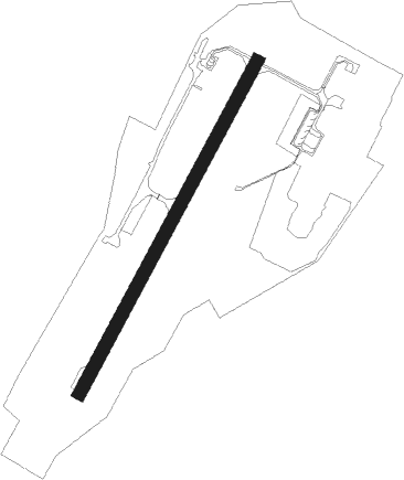
Runway info
| Runway 02 / 20 | ||
| length | 1803m (5915ft) | |
| bearing | 45° / 225° | |
| width | 60m (197ft) | |
| surface | concrete | |
| displ threshold | 50m (164ft) / 50m (164ft) | |
Nearby beacons
| code | identifier | dist | bearing | frequency |
|---|---|---|---|---|
| KHR | KHARKIV VOR/DME | 5.9 | 169° | 116.50 |
| BX | BELGOROD NDB | 38.6 | 33° | 718 |
| B | BELGOROD NDB | 38.8 | 30° | 350 |
| BL | BELGOROD VOR/DME | 38.8 | 29° | 110 |
| A | BELGOROD NDB | 39.2 | 25° | 350 |
Disclaimer
The information on this website is not for real aviation. Use this data with the X-Plane flight simulator only! Data taken with kind consent from X-Plane 12 source code and data files. Content is subject to change without notice.