Nikolayev - Mykolaiv Intl
Airport details
| Country | Ukraine |
| State | Mykolaiv Oblast |
| Region | UK |
| Airspace | Odesa Ctr |
| Municipality | Костянтинівська сільська громада |
| Elevation | 184ft (56m) |
| Timezone | GMT +2 |
| Coordinates | 47.05524, 31.91796 |
| Magnetic var | |
| Type | land |
| Available since | X-Plane v10.40 |
| ICAO code | UKON |
| IATA code | NLV |
| FAA code | n/a |
Communication
| Mykolaiv Intl Tower | 120.700 |
Nearby Points of Interest:
Mykolaiv Observatory
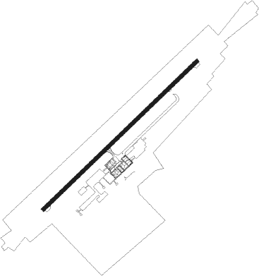
Runway info
| Runway 04 / 22 | ||
| length | 2559m (8396ft) | |
| bearing | 61° / 241° | |
| width | 44m (144ft) | |
| surface | asphalt | |
| blast zone | 45m (148ft) / 43m (141ft) | |
Nearby beacons
| code | identifier | dist | bearing | frequency |
|---|---|---|---|---|
| NI | MYKOLAIV NDB | 1 | 245° | 509 |
| HE | KHERSON NDB | 33.8 | 127° | 10.650 |
Departure and arrival routes
| Transition altitude | 10010ft |
| SID end points | distance | outbound heading | |
|---|---|---|---|
| RW04 | |||
| KESA1K | 57mi | 52° | |
| RAPU1K | 27mi | 169° | |
| KOSA1K | 47mi | 208° | |
| MOKA1K | 29mi | 244° | |
| BITR1K | 35mi | 339° | |
| RW22 | |||
| KESA1L | 57mi | 52° | |
| RAPU1L | 27mi | 169° | |
| KOSA1L | 47mi | 208° | |
| MOKA1L | 29mi | 244° | |
| BITR1L | 35mi | 339° | |
Disclaimer
The information on this website is not for real aviation. Use this data with the X-Plane flight simulator only! Data taken with kind consent from X-Plane 12 source code and data files. Content is subject to change without notice.