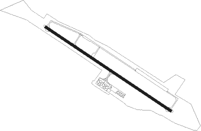
Apatity/kirov - Apatity
Airport details
| Country | Russian Federation |
| State | Murmansk Oblast |
| Region | UL |
| Municipality | Kirovsk Urban Okrug |
| Elevation | 523ft (159m) |
| Timezone | GMT +3 |
| Coordinates | 67.46278, 33.58556 |
| Magnetic var | |
| Type | land |
| Available since | X-Plane v10.32 |
| ICAO code | ULMK |
| IATA code | KVK |
| FAA code | n/a |
Communication
| Apatity Twr | 121.200 |
Approach frequencies
| ILS-cat-I | RW11 | 110.5 | 18.00mi |
| 3° GS | RW11 | 110.5 | 18.00mi |
Nearby beacons
| code | identifier | dist | bearing | frequency |
|---|---|---|---|---|
| I | KHIBINY (APATITY) NDB | 1.2 | 287° | 595 |
| IO | KHIBINY (APATITY) NDB | 2.9 | 287° |
Departure and arrival routes
| Transition altitude | 8000ft |
| Transition level | 8000ft |
| SID end points | distance | outbound heading | |
|---|---|---|---|
| RW11 | |||
| RATL2E, RATL2D | 18mi | 107° | |
| SOTO2E, SOTO2D | 23mi | 130° | |
| ARMA2E, ARMA2D | 19mi | 193° | |
| PILA2E, PILA2D | 18mi | 269° | |
| RW29 | |||
| RATL2F, RATL2C | 18mi | 107° | |
| SOTO2C, SOTO2F | 23mi | 130° | |
| ARMA2F, ARMA2C | 19mi | 193° | |
| PILA2F, PILA2C | 18mi | 269° | |
| STAR starting points | distance | inbound heading | |
|---|---|---|---|
| ALL | |||
| ARMA3D | 18.9 | 13° | |
| PILA3D | 18.4 | 89° | |
| RATL3D | 17.6 | 287° | |
| RW11 | |||
| ARMA3B, ARMA3E | 18.9 | 13° | |
| PILA3E, PILA3B | 18.4 | 89° | |
| RATL3B, RATL3E | 17.6 | 287° | |
| SOTO3E, SOTO3B | 22.7 | 310° | |
| RW29 | |||
| ARMA3A | 18.9 | 13° | |
| PILA3A | 18.4 | 89° | |
| RATL3A | 17.6 | 287° | |
| SOTO3A | 22.7 | 310° | |
Instrument approach procedures
| runway | airway (heading) | route (dist, bearing) |
|---|---|---|
| RW11 | MK001 (93°) | MK001 2820ft MK016 (6mi, 64°) 2820ft |
| RW11 | MK019 (58°) | MK019 2820ft MK001 (11mi, 287°) 2820ft MK016 (6mi, 64°) 2820ft |
| RNAV | MK016 2820ft MK023 (5mi, 107°) 2160ft 24THR (3mi, 107°) 1340ft ULMK (3mi, 107°) 568ft (4287mi, 206°) 930ft MK017 (4287mi, 27°) MK018 (6mi, 244°) MK019 (6mi, 287°) 2820ft | |
| RW29 | MK004 (309°) | MK004 2130ft MK005 (6mi, 64°) 2130ft |
| RNAV | MK005 2130ft MK015 (6mi, 287°) 2130ft MK007 (4mi, 287°) 770ft (4287mi, 207°) 930ft MK024 (4287mi, 26°) MK025 (7mi, 244°) MK026 (12mi, 110°) MK004 (11mi, 101°) 2130ft |
Holding patterns
| STAR name | hold at | type | turn | heading* | altitude | leg | speed limit |
|---|---|---|---|---|---|---|---|
| ARMA3A | MK004 | VHF | right | 202 (22)° | 2950ft - 10000ft | 1.0min timed | 215 |
| ARMA3B | MK019 | VHF | right | 112 (292)° | 2980ft - 10000ft | 1.0min timed | 215 |
| ARMA3D | I | VHF | left | 130 (310)° | 35000ft - 53000ft | 1.5min timed | ICAO rules |
| ARMA3E | IO | FIX | left | 124 (304)° | 4300ft - 10000ft | 1.0min timed | 200 |
| PILA3A | MK004 | VHF | right | 202 (22)° | 2950ft - 10000ft | 1.0min timed | 215 |
| PILA3D | I | VHF | left | 130 (310)° | 35000ft - 53000ft | 1.5min timed | ICAO rules |
| PILA3E | IO | FIX | left | 124 (304)° | 4300ft - 10000ft | 1.0min timed | 200 |
| RATL3A | MK004 | VHF | right | 202 (22)° | 2950ft - 10000ft | 1.0min timed | 215 |
| RATL3B | MK019 | VHF | right | 112 (292)° | 2980ft - 10000ft | 1.0min timed | 215 |
| RATL3D | I | VHF | left | 130 (310)° | 35000ft - 53000ft | 1.5min timed | ICAO rules |
| RATL3E | IO | FIX | left | 124 (304)° | 4300ft - 10000ft | 1.0min timed | 200 |
| SOTO3A | MK004 | VHF | right | 202 (22)° | 2950ft - 10000ft | 1.0min timed | 215 |
| SOTO3B | MK019 | VHF | right | 112 (292)° | 2980ft - 10000ft | 1.0min timed | 215 |
| SOTO3D | I | VHF | left | 130 (310)° | 35000ft - 53000ft | 1.5min timed | ICAO rules |
| SOTO3E | IO | FIX | left | 124 (304)° | 4300ft - 10000ft | 1.0min timed | 200 |
| *) magnetic outbound (inbound) holding course | |||||||
Disclaimer
The information on this website is not for real aviation. Use this data with the X-Plane flight simulator only! Data taken with kind consent from X-Plane 12 source code and data files. Content is subject to change without notice.