Pskov - Pskov / Псков
Airport details
| Country | Russian Federation |
| State | Pskov Oblast |
| Region | UL |
| Airspace | St Petersburg Ctr |
| Municipality | Pskov |
| Elevation | 153ft (47m) |
| Timezone | GMT +3 |
| Coordinates | 57.78390, 28.39560 |
| Magnetic var | |
| Type | land |
| Available since | X-Plane v10.40 |
| ICAO code | ULOO |
| IATA code | PKV |
| FAA code | n/a |
Communication
| Pskov / Псков Tower | 122.000 |
Nearby Points of Interest:
Pogankiny's Chambers in Pskov
-Buildings of Former Cadet Corps, Pskov
-Churches of the Pskov School of Architecture
-Saint Anastasia Chapel
-Meyer's House, Pskov
-Snetogorsko-Murovitskiy Protected Area
-Fortress of Izborsk
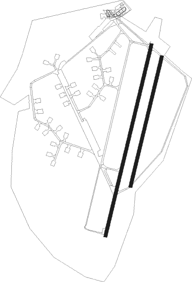
Runway info
Runway 01R / 19L  | ||
| length | 1702m (5584ft) | |
| bearing | 31° / 211° | |
| width | 43m (141ft) | |
| surface | dirt | |
| Runway 01 / 19 | ||
| length | 2522m (8274ft) | |
| bearing | 31° / 211° | |
| width | 44m (144ft) | |
| surface | concrete | |
| blast zone | 0m (0ft) / 47m (154ft) | |
Nearby beacons
| code | identifier | dist | bearing | frequency |
|---|---|---|---|---|
| N | KRESTY (PSKOV) NDB | 1.1 | 31° | 620 |
| P | KRESTY (PSKOV) NDB | 1.1 | 212° | 620 |
| NP | KRESTY (PSKOV) NDB | 2.7 | 31° | 300 |
| PK | KRESTY (PSKOV) NDB | 2.9 | 212° | 300 |
Departure and arrival routes
| Transition altitude | 3435ft |
| SID end points | distance | outbound heading | |
|---|---|---|---|
| RW01 | |||
| IRBU2J, IRBU2A | 23mi | 51° | |
| BEPU2J, BEPU2A | 24mi | 93° | |
| ORTO2A, ORTO2J | 26mi | 272° | |
| RW19 | |||
| IRBU2K, IRBU2D | 23mi | 51° | |
| BEPU2K, BEPU2D | 24mi | 93° | |
| ORTO2D, ORTO2K, ORTO2Z | 26mi | 272° | |
| STAR starting points | distance | inbound heading | |
|---|---|---|---|
| ALL | |||
| ORTO2L | 25.6 | 92° | |
| ABMI2L | 20.4 | 252° | |
| BEPU2L | 24.0 | 273° | |
| RW01 | |||
| ORTO2G | 25.6 | 92° | |
| ABMI2G | 20.4 | 252° | |
| BEPU2G | 24.0 | 273° | |
| RW19 | |||
| ORTO2H, ORTO2F | 25.6 | 92° | |
| ABMI2H, ABMI2F | 20.4 | 252° | |
| BEPU2F, BEPU2H | 24.0 | 273° | |
Instrument approach procedures
| runway | airway (heading) | route (dist, bearing) |
|---|---|---|
| RW01 | OO103 (66°) | OO103 1790ft OO102 (6mi, 100°) 1790ft |
| RW01 | OO105 (328°) | OO105 1790ft OO104 (4mi, 266°) OO102 (2mi, 280°) 1790ft |
| RNAV | OO102 1790ft OO101 (4mi, 31°) 1790ft ULOO (6mi, 31°) 203ft OO114 (3mi, 31°) OO113 (9mi, 145°) OO105 (4mi, 211°) 1790ft | |
| RW19 | OO108 (244°) | OO108 1800ft OO107 (6mi, 280°) 1800ft |
| RW19 | OO109 (159°) | OO109 1800ft OO107 (6mi, 100°) 1800ft |
| RNAV | OO107 1800ft OO106 (5mi, 211°) 1800ft ULOO (6mi, 211°) 205ft OO111 (2mi, 212°) OO110 (10mi, 70°) OO108 (5mi, 32°) 1800ft |
Holding patterns
| STAR name | hold at | type | turn | heading* | altitude | leg | speed limit |
|---|---|---|---|---|---|---|---|
| ABMI2F | NP | FIX | left | 9 (189)° | > 1960ft | 1.0min timed | ICAO rules |
| ABMI2L | N | FIX | left | 9 (189)° | > 1960ft | 1.0min timed | ICAO rules |
| BEPU2F | NP | FIX | left | 9 (189)° | > 1960ft | 1.0min timed | ICAO rules |
| BEPU2L | N | FIX | left | 9 (189)° | > 1960ft | 1.0min timed | ICAO rules |
| ORTO2F | NP | FIX | left | 9 (189)° | > 1960ft | 1.0min timed | ICAO rules |
| ORTO2L | N | FIX | left | 9 (189)° | > 1960ft | 1.0min timed | ICAO rules |
| *) magnetic outbound (inbound) holding course | |||||||
Disclaimer
The information on this website is not for real aviation. Use this data with the X-Plane flight simulator only! Data taken with kind consent from X-Plane 12 source code and data files. Content is subject to change without notice.