Brest
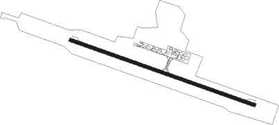
Airport details
| Country | Belarus |
| State | Brest Region |
| Region | UM |
| Airspace | Minsk Ctr |
| Municipality | Тэльмінскі сельскі Савет |
| Elevation | 465ft (142m) |
| Timezone | GMT +3 |
| Coordinates | 52.10833, 23.89639 |
| Magnetic var | |
| Type | land |
| Available since | X-Plane v10.40 |
| ICAO code | UMBB |
| IATA code | BQT |
| FAA code | n/a |
Communication
| Brest Approach | 127.700 |
Approach frequencies
| ILS-cat-I | RW29 | 110.3 | 18.00mi |
| 2.7° GS | RW29 | 110.3 | 18.00mi |
Nearby Points of Interest:
Church of the Nativity of Our Lady in Šebryn
-Saint Paraskeva Orthodox church in Zbirahi
-Simeon Stylites church in Brest
-Puškinskaja Street 10, Brest
-Lienina Street 11, Brest
-Lienina Street 9, Brest
-Church of the Nativity of the Virgin Mary in Hieršony
-Saint Paraskeva church in Čarnaŭčycy
-Orthodox Church of St Nicholas the Miracle-Maker in Oziaty
-Saint Nicholas church in Vialikija Siachnovičy
-Church of the Exaltation of the Holy Cross in Vistyčy
Nearby beacons
| code | identifier | dist | bearing | frequency |
|---|---|---|---|---|
| BRT | BREST VOR/DME | 0.3 | 277° | 113.75 |
| B | BREST NDB | 1.2 | 105° | 485 |
| C | BREST NDB | 1.2 | 285° | 485 |
| RUD | SKUPOWO VOR/DME | 43.9 | 345° | 115.10 |
Departure and arrival routes
| Transition altitude | 6000ft |
| SID end points | distance | outbound heading | |
|---|---|---|---|
| RW11 | |||
| SURU1A | 30mi | 36° | |
| DOMA1A | 44mi | 65° | |
| MAPA1A | 43mi | 77° | |
| DIVI1A | 43mi | 86° | |
| TADU1A | 32mi | 105° | |
| TOSP1A | 10mi | 248° | |
| LETK1A | 19mi | 279° | |
| ABER1A | 26mi | 280° | |
| RW29 | |||
| SURU1B | 30mi | 36° | |
| DOMA1B | 44mi | 65° | |
| MAPA1B | 43mi | 77° | |
| DIVI1B | 43mi | 86° | |
| TADU1B | 32mi | 105° | |
| TOSP1B | 10mi | 248° | |
| LETK1B | 19mi | 279° | |
| ABER1B | 26mi | 280° | |
| STAR starting points | distance | inbound heading | |
|---|---|---|---|
| RW11 | |||
| BIGL1C | 26.5 | 43° | |
| ABER2C | 26.3 | 100° | |
| SURU1C | 29.6 | 216° | |
| DOMA1C | 43.7 | 245° | |
| MAPA1C | 42.7 | 257° | |
| DIVI1C | 42.7 | 266° | |
| TADU1C | 31.7 | 285° | |
| RW29 | |||
| BIGL1D | 26.5 | 43° | |
| ABER1D | 26.3 | 100° | |
| SURU1D | 29.6 | 216° | |
| DOMA1D | 43.7 | 245° | |
| MAPA1D | 42.7 | 257° | |
| DIVI1D | 42.7 | 266° | |
| TADU1D | 31.7 | 285° | |
Holding patterns
| STAR name | hold at | type | turn | heading* | altitude | leg | speed limit |
|---|---|---|---|---|---|---|---|
| ABER1D | BRT | NDB | right | 107 (287)° | > 4000ft | 1.0min timed | ICAO rules |
| BIGL1C | BRT | NDB | right | 107 (287)° | > 4000ft | 1.0min timed | ICAO rules |
| DIVI1C | BRT | NDB | right | 107 (287)° | > 4000ft | 1.0min timed | ICAO rules |
| MAPA1C | BRT | NDB | right | 107 (287)° | > 4000ft | 1.0min timed | ICAO rules |
| TADU1C | BRT | NDB | right | 107 (287)° | > 4000ft | 1.0min timed | ICAO rules |
| *) magnetic outbound (inbound) holding course | |||||||
Disclaimer
The information on this website is not for real aviation. Use this data with the X-Plane flight simulator only! Data taken with kind consent from X-Plane 12 source code and data files. Content is subject to change without notice.