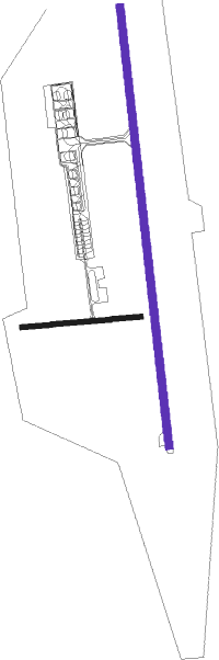
Hrodna - Grodno
Airport details
| Country | Belarus |
| State | Hrodna Region |
| Region | UM |
| Airspace | Minsk Ctr |
| Municipality | Абухаўскі сельскі Савет |
| Elevation | 439ft (134m) |
| Timezone | GMT +3 |
| Coordinates | 53.60194, 24.05389 |
| Magnetic var | |
| Type | land |
| Available since | X-Plane v10.40 |
| ICAO code | UMMG |
| IATA code | GNA |
| FAA code | n/a |
Communication
| Grodno Ground and Tower | 134.500 |
Approach frequencies
| ILS-cat-I | RW17 | 109.5 | 18.00mi |
| 2.7° GS | RW17 | 109.5 | 18.00mi |
Nearby Points of Interest:
Church of the Transfiguration of Christ in Komatava
-Paniamoń Manor
-Building of Peasant Land Bank, Hrodna
-Lyamus brigitskogo monastery, Grodno
-Master's house in Hrodna
-Batorówka Palace in Grodno
-Muraŭjoŭ House
-Category:Savieckaja Street 17, Hrodna
-Savieckaja Street 23, Hrodna
-Savieckaja Street 25, Hrodna
-Category:Savieckaja Street 12, Hrodna
-Savieckaja Street 14, Hrodna
-Lyamus on Gorodnitsa
-Kryvaja aficyna
-Vialikaja Trajeckaja Street, Hrodna
-Saint Alexander Nevsky Orthodox church in Indura

Nearby beacons
| code | identifier | dist | bearing | frequency |
|---|---|---|---|---|
| GRD | HRODNA VOR/DME | 0.3 | 20° | 115.75 |
| G | HRODNA NDB | 1.2 | 357° | 920 |
| W | HRODNA NDB | 1.3 | 177° | 920 |
| WF | HRODNA NDB | 2.8 | 177° | 452 |
| GP | HRODNA NDB | 2.9 | 356° | 452 |
| RUD | SKUPOWO VOR/DME | 47.9 | 204° | 115.10 |
| VLK | DME | 52.1 | 45° | 116.70 |
Departure and arrival routes
| Transition altitude | 6000ft |
| SID end points | distance | outbound heading | |
|---|---|---|---|
| RW17 | |||
| PEPA2A | 38mi | 82° | |
| KOME2A | 37mi | 103° | |
| OGRE2A | 31mi | 139° | |
| POTA2A | 33mi | 158° | |
| GRIN2A | 35mi | 170° | |
| GORA2A | 26mi | 201° | |
| SOTE2A | 22mi | 294° | |
| TUMK2A, TUMK2K | 22mi | 336° | |
| RW35 | |||
| PEPA2B | 38mi | 82° | |
| KOME2B | 37mi | 103° | |
| OGRE2B | 31mi | 139° | |
| POTA2B | 33mi | 158° | |
| GRIN2B | 35mi | 170° | |
| GORA2B | 26mi | 201° | |
| SOTE2B | 22mi | 294° | |
| TUMK2B, TUMK2L | 22mi | 336° | |
| STAR starting points | distance | inbound heading | |
|---|---|---|---|
| RW17 | |||
| GORA2C | 26.0 | 21° | |
| ENOB2C, ENOB2N | 15.1 | 89° | |
| SOTE2C | 22.4 | 114° | |
| TUMK2N, TUMK2C | 21.5 | 156° | |
| PEPA2C | 38.1 | 262° | |
| KOME2C | 36.5 | 283° | |
| OGRE2C | 30.8 | 319° | |
| POTA2C | 32.8 | 338° | |
| GRIN2C | 35.0 | 350° | |
| RW35 | |||
| GORA2D | 26.0 | 21° | |
| ENOB2D | 15.1 | 89° | |
| SOTE2D | 22.4 | 114° | |
| TUMK2M, TUMK2D | 21.5 | 156° | |
| PEPA2D | 38.1 | 262° | |
| KOME2D | 36.5 | 283° | |
| OGRE2D | 30.8 | 319° | |
| POTA2D | 32.8 | 338° | |
| GRIN2D | 35.0 | 350° | |
Holding patterns
| STAR name | hold at | type | turn | heading* | altitude | leg | speed limit |
|---|---|---|---|---|---|---|---|
| ENOB2C | GRD | NDB | right | 170 (350)° | > 4000ft | 1.0min timed | ICAO rules |
| GORA2C | GRD | NDB | right | 170 (350)° | > 4000ft | 1.0min timed | ICAO rules |
| GRIN2C | GRD | NDB | right | 170 (350)° | > 4000ft | 1.0min timed | ICAO rules |
| OGRE2C | GRD | NDB | right | 170 (350)° | > 4000ft | 1.0min timed | ICAO rules |
| POTA2C | GRD | NDB | right | 170 (350)° | > 4000ft | 1.0min timed | ICAO rules |
| SOTE2D | GRD | NDB | right | 170 (350)° | > 4000ft | 1.0min timed | ICAO rules |
| TUMK2D | GRD | NDB | right | 170 (350)° | > 4000ft | 1.0min timed | ICAO rules |
| TUMK2M | GRD | NDB | right | 170 (350)° | > 4000ft | 1.0min timed | ICAO rules |
| *) magnetic outbound (inbound) holding course | |||||||
Disclaimer
The information on this website is not for real aviation. Use this data with the X-Plane flight simulator only! Data taken with kind consent from X-Plane 12 source code and data files. Content is subject to change without notice.