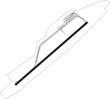
Kemerovo
Airport details
| Country | Russian Federation |
| State | Kemerovo Oblast–Kuzbass |
| Region | UN |
| Airspace | Novosibirsk Ctr |
| Municipality | Kemerovo |
| Elevation | 860ft (262m) |
| Timezone | GMT +7 |
| Coordinates | 55.27615, 86.11475 |
| Magnetic var | |
| Type | land |
| Available since | X-Plane v10.40 |
| ICAO code | UNEE |
| IATA code | KEJ |
| FAA code | n/a |
Communication
| Kemerovo ATIS | 128.700 |
| Kemerovo Kemerovo Ground | 119.000 |
| Kemerovo Kemerovo Tower | 118.300 |
| Kemerovo Kemerovo Approach | 125.500 |
Approach frequencies
| ILS-cat-I | RW23 | 109.1 | 18.00mi |
| 2.7° GS | RW23 | 109.1 | 18.00mi |
Nearby beacons
| code | identifier | dist | bearing | frequency |
|---|---|---|---|---|
| N | KEMEROVO NDB | 1 | 73° | 995 |
| NC | KEMEROVO NDB | 2.5 | 70° | 489 |
Departure and arrival routes
| Transition altitude | 2513ft |
| SID end points | distance | outbound heading | |
|---|---|---|---|
| RW05 | |||
| NATUP1 | 49mi | 10° | |
| ERUPA1 | 52mi | 77° | |
| LATPO1 | 50mi | 87° | |
| OBABU1 | 46mi | 105° | |
| MOTOK1 | 49mi | 153° | |
| ASBET1 | 50mi | 197° | |
| RISPA1 | 39mi | 241° | |
| RUMIG1 | 50mi | 264° | |
| NATIR1 | 49mi | 267° | |
| KD1 | 127mi | 270° | |
| NALED1 | 45mi | 321° | |
| RW23 | |||
| NATUP3 | 49mi | 10° | |
| ERUPA3 | 52mi | 77° | |
| LATPO3 | 50mi | 87° | |
| OBABU3 | 46mi | 105° | |
| MOTOK3 | 49mi | 153° | |
| ASBET3 | 50mi | 197° | |
| RISPA3 | 39mi | 241° | |
| RUMIG3 | 50mi | 264° | |
| NATIR3 | 49mi | 267° | |
| KD3 | 127mi | 270° | |
| NALED3 | 45mi | 321° | |
| STAR starting points | distance | inbound heading | |
|---|---|---|---|
| RW05 | |||
| ASBE2A, ASBE2B, ASBE2G | 49.9 | 17° | |
| RISP2B, RISP2G, RISP2A | 39.1 | 61° | |
| RUMI2A, RUMI2G | 49.7 | 84° | |
| NATI2A, NATI2B, NATI2G | 48.7 | 87° | |
| KD2A, KD2B, KD2G | 126.8 | 90° | |
| NALE2A, NALE2G, NALE2B | 44.7 | 141° | |
| NATU2B, NATU2G, NATU2A | 48.8 | 190° | |
| ERUP2G, ERUP2A, ERUP2B | 51.5 | 257° | |
| MODK2G, MODK2B, MODK2A | 50.4 | 261° | |
| LATP2B, LATP2A, LATP2G | 50.2 | 267° | |
| OBAB2G, OBAB2B, OBAB2A | 45.6 | 285° | |
| MOTO2G, MOTO2B, MOTO2A | 49.0 | 333° | |
| RW23 | |||
| ASBE4G, ASBE4B, ASBE4A | 49.9 | 17° | |
| RISP4G, RISP4B, RISP4A | 39.1 | 61° | |
| RUMI4G | 49.7 | 84° | |
| NATI4G, NATI4B, NATI4A | 48.7 | 87° | |
| KD4A, KD4B, KD4G | 126.8 | 90° | |
| NALE4G, NALE4B, NALE4A | 44.7 | 141° | |
| NATU4G, NATU4B, NATU4A | 48.8 | 190° | |
| ERUP4A, ERUP4B, ERUP4G | 51.5 | 257° | |
| MODK4A, MODK4B, MODK4G | 50.4 | 261° | |
| LATP4B, LATP4A, LATP4G | 50.2 | 267° | |
| OBAB4B, OBAB4G, OBAB4A | 45.6 | 285° | |
| MOTO4A, MOTO4G, MOTO4B | 49.0 | 333° | |
Instrument approach procedures
| runway | airway (heading) | route (dist, bearing) |
|---|---|---|
| RW05 | EE101 (82°) | EE101 2520ft EE104 (5mi, 127°) 2520ft |
| RW05 | EE102 (66°) | EE102 2520ft EE104 (5mi, 66°) 2520ft |
| RW05 | EE103 (44°) | EE103 2520ft EE104 (5mi, 307°) 2520ft |
| RNAV | EE104 2520ft EE105 (5mi, 67°) 2520ft UNEE (7mi, 66°) 881ft (5272mi, 237°) 1490ft EE106 (5275mi, 57°) 2520ft EE103 (11mi, 247°) | |
| RW23 | EE201 (247°) | EE201 2520ft EE205 (5mi, 247°) 2520ft |
| RW23 | EE202 (263°) | EE202 2520ft EE205 (5mi, 307°) 2520ft |
| RW23 | EE203 (224°) | EE203 2520ft EE205 (5mi, 127°) 2520ft |
| RNAV | EE205 2520ft EE206 (5mi, 247°) 2520ft UNEE (6mi, 248°) 893ft (5272mi, 237°) 1510ft EE204 (5275mi, 57°) 2520ft EE202 (11mi, 66°) |
Disclaimer
The information on this website is not for real aviation. Use this data with the X-Plane flight simulator only! Data taken with kind consent from X-Plane 12 source code and data files. Content is subject to change without notice.
