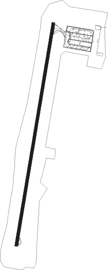
Gelendzhik
Airport details
| Country | Russian Federation |
| State | Krasnodar Krai |
| Region | UR |
| Airspace | Rostov-na-donu Ctr |
| Municipality | Gelendzhik |
| Elevation | 129ft (39m) |
| Timezone | GMT +3 |
| Coordinates | 44.59322, 38.02026 |
| Magnetic var | |
| Type | land |
| Available since | X-Plane v10.40 |
| ICAO code | URKG |
| IATA code | GDZ |
| FAA code | n/a |
Communication
| Gelendzhik Gelendzhik Transit Operations | 131.125 |
| Gelendzhik Gelendzhik Tower | 122.700 |
| Gelendzhik Gelendzhik Radar | 129.180 |
Approach frequencies
| ILS-cat-I | RW01 | 110.1 | 18.00mi |
| 2.6° GS | RW01 | 110.1 | 18.00mi |
Nearby beacons
| code | identifier | dist | bearing | frequency |
|---|---|---|---|---|
| GN | GELENDZHIK NDB | 1.1 | 199° | |
| GNV | GELENDZHIK VOR/DME | 1.2 | 201° | 114.30 |
| DV | DZHUBGA NDB | 33.8 | 112° | 420 |
| SM | SMOLENSKAYA NDB | 35 | 77° | 662 |
| AP | ANAPA NDB | 37.7 | 305° | 480 |
| P | VITYAZEVO (ANAPA) NDB | 37.7 | 303° | 780 |
| N | VITYAZEVO (ANAPA) NDB | 37.8 | 300° | 780 |
| AN | ANAPA NDB | 37.9 | 298° | 480 |
Departure and arrival routes
| Transition altitude | 4724ft |
| Transition level | 6000ft |
| SID end points | distance | outbound heading | |
|---|---|---|---|
| RW01 | |||
| OSNI1C, OSNI3C | 12mi | 79° | |
| KUTO1C, KUTO3C | 23mi | 138° | |
| LIMA1C, LIMA3C | 25mi | 207° | |
| NALU3C, NALU1C | 27mi | 260° | |
| DORO3C, DORO1C | 20mi | 275° | |
| RW19 | |||
| OSNI3B, OSNI1A, OSNI1B | 12mi | 79° | |
| KUTO1A, KUTO1B, KUTO3B | 23mi | 138° | |
| LIMA3B, LIMA1B, LIMA1A | 25mi | 207° | |
| NALU1A, NALU1B, NALU3B | 27mi | 260° | |
| DORO1B, DORO1A, DORO3B | 20mi | 275° | |
| STAR starting points | distance | inbound heading | |
|---|---|---|---|
| RW01 | |||
| LIMA2A, LIMA2B, LIMA2C, LIMA4A, LIMA4C, LIMAS2, LIMAS4 | 24.6 | 27° | |
| NALU2A, NALUD2, NALU2B, NALU2C, NALU4A, NALU4C, NALUD4 | 27.2 | 80° | |
| DOROL4, DORO2C, DORO2A, DORO2B, DORO4A, DORO4C, DOROL2 | 19.7 | 95° | |
| KUTON4, KUTO2A, KUTO2B, KUTO2C, KUTO4A, KUTO4C, KUTON2 | 23.1 | 318° | |
Holding patterns
| STAR name | hold at | type | turn | heading* | altitude | leg | speed limit |
|---|---|---|---|---|---|---|---|
| DORO2A | GNV | NDB | left | 187 (7)° | 6000ft - 10000ft | 1.0min timed | ICAO rules |
| DORO4A | GN | FIX | left | 190 (10)° | 6000ft - 10000ft | 1.0min timed | ICAO rules |
| KUTO2A | GNV | NDB | left | 187 (7)° | 6000ft - 10000ft | 1.0min timed | ICAO rules |
| KUTO2B | KUTON | VHF | left | 137 (317)° | 6000ft - 10000ft | 1.0min timed | ICAO rules |
| KUTO2C | KUTON | VHF | left | 137 (317)° | 6000ft - 10000ft | 1.0min timed | ICAO rules |
| KUTO4A | GN | FIX | left | 190 (10)° | 6000ft - 10000ft | 1.0min timed | ICAO rules |
| KUTO4C | KUTON | VHF | left | 137 (317)° | 6000ft - 10000ft | 1.0min timed | ICAO rules |
| KUTON2 | KUTON | VHF | left | 137 (317)° | 6000ft - 10000ft | 1.0min timed | ICAO rules |
| KUTON4 | KUTON | VHF | left | 137 (317)° | 6000ft - 10000ft | 1.0min timed | ICAO rules |
| LIMA2A | GNV | NDB | left | 187 (7)° | 6000ft - 10000ft | 1.0min timed | ICAO rules |
| LIMA2B | LIMAS | VHF | left | 306 (126)° | 22000ft - 29000ft | 1.5min timed | 264 |
| LIMA2C | LIMAS | VHF | left | 306 (126)° | 22000ft - 29000ft | 1.5min timed | 264 |
| LIMA4A | GN | FIX | left | 190 (10)° | 6000ft - 10000ft | 1.0min timed | ICAO rules |
| LIMA4C | LIMAS | VHF | left | 306 (126)° | 22000ft - 29000ft | 1.5min timed | 264 |
| LIMAS2 | LIMAS | VHF | left | 306 (126)° | 22000ft - 29000ft | 1.5min timed | 264 |
| LIMAS4 | LIMAS | VHF | left | 306 (126)° | 22000ft - 29000ft | 1.5min timed | 264 |
| NALU2A | GNV | NDB | left | 187 (7)° | 6000ft - 10000ft | 1.0min timed | ICAO rules |
| NALU4A | GN | FIX | left | 190 (10)° | 6000ft - 10000ft | 1.0min timed | ICAO rules |
| OSNI2A | GNV | NDB | left | 187 (7)° | 6000ft - 10000ft | 1.0min timed | ICAO rules |
| OSNI4A | GN | FIX | left | 190 (10)° | 6000ft - 10000ft | 1.0min timed | ICAO rules |
| *) magnetic outbound (inbound) holding course | |||||||
Disclaimer
The information on this website is not for real aviation. Use this data with the X-Plane flight simulator only! Data taken with kind consent from X-Plane 12 source code and data files. Content is subject to change without notice.
