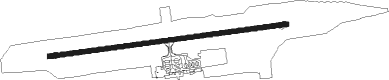
Grozny
Airport details
| Country | Russian Federation |
| State | Chechnya |
| Region | UR |
| Airspace | Rostov-na-donu Ctr |
| Municipality | Grozny |
| Elevation | 538ft (164m) |
| Timezone | GMT +3 |
| Coordinates | 43.38820, 45.69984 |
| Magnetic var | |
| Type | land |
| Available since | X-Plane v11.05 |
| ICAO code | URMG |
| IATA code | GRV |
| FAA code | n/a |
Communication
| Grozny ATIS | 127.200 |
| Grozny TRANZIT | 134.800 |
| Grozny TAXIING | 120.200 |
| Grozny KRUG | 120.200 |
Approach frequencies
| ILS-cat-I | RW26 | 108.7 | 18.00mi |
| 2.6° GS | RW26 | 108.7 | 18.00mi |
Nearby Points of Interest:
Barskiy dom
-Mass grave of the Red Army soldiers who died during the 100-Day Battles
-Obelisk to the heroes of the Civil War
Nearby beacons
| code | identifier | dist | bearing | frequency |
|---|---|---|---|---|
| WK | SEVERNY (GROZNY) NDB | 1.2 | 88° | 408 |
| S | MAGAS NDB | 31.6 | 265° | 554 |
| SC | MAGAS NDB | 33.1 | 265° | 276 |
Departure and arrival routes
| Transition altitude | 6120ft |
| Transition level | 8000ft |
| SID end points | distance | outbound heading | |
|---|---|---|---|
| RW08 | |||
| PINT1T, PINT1U, PINT1Y | 26mi | 66° | |
| REMK1U, REMK1T | 20mi | 106° | |
| AMLU1T, AMLU1U | 22mi | 280° | |
| NEGU1U, NEGU1T | 24mi | 322° | |
| RW26 | |||
| PINT1Z, PINT1W, PINT1S | 26mi | 66° | |
| REMK1S, REMK1W | 20mi | 106° | |
| AMLU1W, AMLU1S | 22mi | 280° | |
| NEGU1S, NEGU1W | 24mi | 322° | |
| STAR starting points | distance | inbound heading | |
|---|---|---|---|
| ALL | |||
| AMLU1X | 21.7 | 100° | |
| NEGU1X | 24.0 | 142° | |
| PINT1X | 26.3 | 246° | |
| REMK1X | 19.5 | 286° | |
| RW08 | |||
| AMLU1P | 21.7 | 100° | |
| NEGU1P | 24.0 | 142° | |
| PINT1P | 26.3 | 246° | |
| REMK1P | 19.5 | 286° | |
| RW26 | |||
| AMLU1R | 21.7 | 100° | |
| NEGU1R | 24.0 | 142° | |
| PINT1R | 26.3 | 246° | |
| REMK1R | 19.5 | 286° | |
Holding patterns
| STAR name | hold at | type | turn | heading* | altitude | leg | speed limit |
|---|---|---|---|---|---|---|---|
| AMLU1X | WK | FIX | right | 79 (259)° | 8000ft - 10000ft | 1.0min timed | ICAO rules |
| NEGU1X | WK | FIX | right | 79 (259)° | 8000ft - 10000ft | 1.0min timed | ICAO rules |
| PINT1X | WK | FIX | right | 79 (259)° | 8000ft - 10000ft | 1.0min timed | ICAO rules |
| REMK1X | WK | FIX | right | 79 (259)° | 8000ft - 10000ft | 1.0min timed | ICAO rules |
| *) magnetic outbound (inbound) holding course | |||||||
Disclaimer
The information on this website is not for real aviation. Use this data with the X-Plane flight simulator only! Data taken with kind consent from X-Plane 12 source code and data files. Content is subject to change without notice.