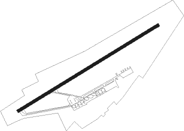
Nalchik
Airport details
| Country | Russian Federation |
| State | Kabardino-Balkaria |
| Region | UR |
| Airspace | Rostov-na-donu Ctr |
| Municipality | Nalchik |
| Elevation | 1461ft (445m) |
| Timezone | GMT +3 |
| Coordinates | 43.51019, 43.63709 |
| Magnetic var | |
| Type | land |
| Available since | X-Plane v10.40 |
| ICAO code | URMN |
| IATA code | NAL |
| FAA code | n/a |
Communication
| Nalchik Tower | 118.300 |
| Nalchik Approach | 126.900 |
Approach frequencies
| ILS-cat-I | RW24 | 111.5 | 18.00mi |
| 2.6° GS | RW24 | 111.5 | 18.00mi |
Nearby Points of Interest:
Blue Lakes
-Tatartup
Nearby beacons
| code | identifier | dist | bearing | frequency |
|---|---|---|---|---|
| N | NALCHIK NDB | 1.1 | 63° | 350 |
| NF | NALCHIK NDB | 2.7 | 67° | 718 |
| CH | VLADIKAVKAZ NDB | 44.8 | 108° | 250 |
| MNW | MINERALNYYE VODY VOR/DME | 50.5 | 321° | 117.10 |
| MD | MINERALNYYE VODY NDB | 52.6 | 320° | 468 |
Departure and arrival routes
| Transition altitude | 5000ft |
| Transition level | 6000ft |
| SID end points | distance | outbound heading | |
|---|---|---|---|
| RW06 | |||
| OKAR1H, OKAR1C, OKAR1D, OKAR1E, OKAR1G, OKAR1J | 22mi | 27° | |
| MEMZ1J, MEMZ1C, MEMZ1D, MEMZ1E | 23mi | 76° | |
| TAFI1C, TAFI1D, TAFI1E, TAFI1G, TAFI1H, TAFI1J | 15mi | 107° | |
| NAMO1J, NAMO1H, NAMO1E, NAMO1D, NAMO1C, NAMO1G | 20mi | 254° | |
| DUFL1J, DUFL1C, DUFL1D, DUFL1E, DUFL1G, DUFL1H | 28mi | 266° | |
| MOZA1C, MOZA1H, MOZA1J, MOZA1E, MOZA1G, MOZA1D | 25mi | 294° | |
| ABGA1H, ABGA1G, ABGA1E, ABGA1D, ABGA1C, ABGA1J | 16mi | 338° | |
| STAR starting points | distance | inbound heading | |
|---|---|---|---|
| RW24 | |||
| DUFL1A, DUFL1B, DUFL1F | 28.0 | 86° | |
| MOZA1F, MOZA1B, MOZA1A | 25.1 | 114° | |
| ABGA1A, ABGA1B, ABGA1F | 15.8 | 158° | |
| OKAR1B, OKAR1F, OKAR1A | 21.5 | 207° | |
| MEMZ1B, MEMZ1F, MEMZ1A | 22.8 | 256° | |
| TAFI1F, TAFI1B, TAFI1A | 14.6 | 287° | |
Instrument approach procedures
| runway | airway (heading) | route (dist, bearing) |
|---|---|---|
| RW24 | MN001 (237°) | MN001 5000ft MN002 (5mi, 210°) 3000ft |
| RNAV | MN002 3000ft MN003 (3mi, 250°) 3000ft MN004 (5mi, 250°) 1639ft (3505mi, 225°) 2000ft MN005 (3507mi, 45°) MN006 (9mi, 86°) 5000ft MN006 (turn) |
Holding patterns
| STAR name | hold at | type | turn | heading* | altitude | leg | speed limit |
|---|---|---|---|---|---|---|---|
| ABGA1A | N | VHF | right | 223 (43)° | 19000ft - 29000ft | 1.5min timed | 264 |
| ABGA1B | NF | FIX | right | 56 (236)° | 7000ft - 10000ft | 1.0min timed | 215 |
| ABGA1F | MN006 | VHF | right | 236 (56)° | 5000ft - 10000ft | 1.0min timed | 215 |
| DUFL1A | N | VHF | right | 223 (43)° | 19000ft - 29000ft | 1.5min timed | 264 |
| DUFL1B | NF | FIX | right | 56 (236)° | 7000ft - 10000ft | 1.0min timed | 215 |
| DUFL1F | MN006 | VHF | right | 236 (56)° | 5000ft - 10000ft | 1.0min timed | 215 |
| MEMZ1A | N | VHF | right | 223 (43)° | 19000ft - 29000ft | 1.5min timed | 264 |
| MEMZ1B | NF | FIX | right | 56 (236)° | 7000ft - 10000ft | 1.0min timed | 215 |
| MOZA1A | N | VHF | right | 223 (43)° | 19000ft - 29000ft | 1.5min timed | 264 |
| MOZA1B | NF | FIX | right | 56 (236)° | 7000ft - 10000ft | 1.0min timed | 215 |
| MOZA1F | MN006 | VHF | right | 236 (56)° | 5000ft - 10000ft | 1.0min timed | 215 |
| OKAR1A | N | VHF | right | 223 (43)° | 19000ft - 29000ft | 1.5min timed | 264 |
| OKAR1B | NF | FIX | right | 56 (236)° | 7000ft - 10000ft | 1.0min timed | 215 |
| TAFI1A | N | VHF | right | 223 (43)° | 19000ft - 29000ft | 1.5min timed | 264 |
| TAFI1B | NF | FIX | right | 56 (236)° | 7000ft - 10000ft | 1.0min timed | 215 |
| *) magnetic outbound (inbound) holding course | |||||||
Disclaimer
The information on this website is not for real aviation. Use this data with the X-Plane flight simulator only! Data taken with kind consent from X-Plane 12 source code and data files. Content is subject to change without notice.