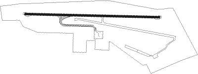
Sunzha - Magas
Airport details
| Country | Russian Federation |
| State | Ingushetia |
| Region | UR |
| Airspace | Rostov-na-donu Ctr |
| Municipality | городской округ Сунжа |
| Elevation | 1207ft (368m) |
| Timezone | GMT +3 |
| Coordinates | 43.32354, 45.01217 |
| Magnetic var | |
| Type | land |
| Available since | X-Plane v10.40 |
| ICAO code | URMS |
| IATA code | IGT |
| FAA code | n/a |
Communication
| Magas Tower | 119.150 |
Approach frequencies
| ILS-cat-I | RW09 | 108.9 | 18.00mi |
| 3° GS | RW09 | 108.9 | 18.00mi |
Nearby beacons
| code | identifier | dist | bearing | frequency |
|---|---|---|---|---|
| S | MAGAS NDB | 1.4 | 274° | 554 |
| SC | MAGAS NDB | 2.9 | 274° | 276 |
| WLK | BESLAN VOR/DME | 17.9 | 252° | 115.60 |
| CH | VLADIKAVKAZ NDB | 20.2 | 255° | 250 |
| WK | SEVERNY (GROZNY) NDB | 31.5 | 85° | 408 |
| GUD | DME | 54.8 | 212° | 110.80 |
Departure and arrival routes
| Transition altitude | 4170ft |
| Transition level | 6000ft |
| SID end points | distance | outbound heading | |
|---|---|---|---|
| RW09 | |||
| AMLU1Z, AMLU1X, AMLU1W, AMLU1E, AMLU1B, AMLU1A | 13mi | 53° | |
| DIKU1E, DIKU1B, DIKU1A | 19mi | 254° | |
| TAFI1A, TAFI1B, TAFI1E | 47mi | 275° | |
| RW27 | |||
| AMLU1Y, AMLU1V, AMLU1F, AMLU1D, AMLU1C | 13mi | 53° | |
| DIKU1C, DIKU1D, DIKU1F | 19mi | 254° | |
| TAFI1C, TAFI1D, TAFI1F | 47mi | 275° | |
| STAR starting points | distance | inbound heading | |
|---|---|---|---|
| RW09 | |||
| DIKU1J, DIKU1K, DIKU1L | 19.1 | 74° | |
| TAFI1L, TAFI1K, TAFI1J | 46.8 | 95° | |
| AMLU1J, AMLU1U, AMLU1L, AMLU1K | 12.7 | 233° | |
| RW27 | |||
| DIKU1M, DIKU1K | 19.1 | 74° | |
| TAFI1K, TAFI1M | 46.8 | 95° | |
| AMLU1M, AMLU1K | 12.7 | 233° | |
Holding patterns
| STAR name | hold at | type | turn | heading* | altitude | leg | speed limit |
|---|---|---|---|---|---|---|---|
| AMLU1J | SC | FIX | left | 89 (269)° | > 4760ft | 1.0min timed | 170 |
| AMLU1K | S | VHF | left | 306 (126)° | 22000ft - 29000ft | 1.5min timed | 264 |
| AMLU1L | MS002 | VHF | right | 269 (89)° | > 4930ft | 1.0min timed | 230 |
| AMLU1M | MS202 | VHF | left | 89 (269)° | > 3940ft | 1.0min timed | 230 |
| AMLU1U | MS002 | VHF | right | 269 (89)° | > 4930ft | 1.0min timed | 230 |
| DIKU1J | SC | FIX | left | 89 (269)° | > 4760ft | 1.0min timed | 170 |
| DIKU1K | S | VHF | left | 306 (126)° | 22000ft - 29000ft | 1.5min timed | 264 |
| DIKU1L | MS002 | VHF | right | 269 (89)° | > 4930ft | 1.0min timed | 230 |
| DIKU1M | MS202 | VHF | left | 89 (269)° | > 3940ft | 1.0min timed | 230 |
| TAFI1J | SC | FIX | left | 89 (269)° | > 4760ft | 1.0min timed | 170 |
| TAFI1K | S | VHF | left | 306 (126)° | 22000ft - 29000ft | 1.5min timed | 264 |
| TAFI1L | MS002 | VHF | right | 269 (89)° | > 4930ft | 1.0min timed | 230 |
| TAFI1M | MS202 | VHF | left | 89 (269)° | > 3940ft | 1.0min timed | 230 |
| *) magnetic outbound (inbound) holding course | |||||||
Disclaimer
The information on this website is not for real aviation. Use this data with the X-Plane flight simulator only! Data taken with kind consent from X-Plane 12 source code and data files. Content is subject to change without notice.
