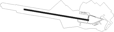
Taganrog - Yuzhny
Airport details
| Country | Russian Federation |
| State | Rostov Oblast |
| Region | UR |
| Airspace | Rostov-na-donu Ctr |
| Municipality | Taganrog |
| Elevation | 118ft (36m) |
| Timezone | GMT +3 |
| Coordinates | 47.19830, 38.84911 |
| Magnetic var | |
| Type | land |
| Available since | X-Plane v10.40 |
| ICAO code | URRT |
| IATA code | TGK |
| FAA code | n/a |
Communication
Nearby Points of Interest:
Gully of Petrushino
-Alexander I Palace
-Raftopulo hotel building
-Bishop House
-Idelson Pharmacy
-Alexandrovskiye Trade Rows
-Sharonov house
-museum of I.D. Vasilenko
-house of Zherebtsov
-House of Shtalberg
-House of Sirotinykh
-Lukin House
-Taganrog Post Office
-Frunze Street 39, Taganrog
-Gorky Park
-House of Zolotaryov
-Italiansky Lane 18, Taganrog
-mansion Handrina
-Khalizov house
Nearby beacons
| code | identifier | dist | bearing | frequency |
|---|---|---|---|---|
| MS | YUZHNY (TAGANROG) NDB | 1.1 | 100° | 350 |
| U | YUZHNY (TAGANROG) NDB | 1.3 | 280° | 735 |
| UF | YUZHNY (TAGANROG) NDB | 2.8 | 280° | 350 |
| SB | SAMBEK NDB | 50.9 | 60° | 414 |
Departure and arrival routes
| Transition altitude | 3080ft |
| Transition level | 5000ft |
| SID end points | distance | outbound heading | |
|---|---|---|---|
| RW10 | |||
| OKMA5C, OKMA5B, OKMA5A | 20mi | 106° | |
| KENE5C, KENE5B, KENE5A | 20mi | 196° | |
| RW28 | |||
| OKMA5D, OKMA5E, OKMA5F | 20mi | 106° | |
| KENE5D, KENE5E, KENE5F | 20mi | 196° | |
| STAR starting points | distance | inbound heading | |
|---|---|---|---|
| RW10 | |||
| KENE5K, KENE5L, KENE5P, KENE5R | 19.5 | 16° | |
| OKMA5R, OKMA5P, OKMA5L, OKMA5K | 19.6 | 286° | |
| RW28 | |||
| KENE5M, KENE5Q, KENE5S | 19.5 | 16° | |
| OKMA5T, OKMA5S, OKMA5Q, OKMA5N, OKMA5M | 19.6 | 286° | |
Instrument approach procedures
| runway | airway (heading) | route (dist, bearing) |
|---|---|---|
| RW10 | RT101 (118°) | RT101 1760ft RT105 (5mi, 200°) 1760ft |
| RW10 | RT104 (83°) | RT104 1760ft RT105 (5mi, 20°) 1760ft |
| RNAV | RT105 1760ft RT106 (5mi, 100°) 1760ft URRT (6mi, 100°) 168ft RT107 (2mi, 100°) 780ft RT103 (10mi, 259°) 1760ft RT104 (5mi, 280°) 1760ft | |
| RW28 | RT281 (263°) | RT281 1710ft RT282 (5mi, 200°) 1710ft |
| RW28 | RT283 (296°) | RT283 1710ft RT282 (4mi, 20°) 1710ft |
| RNAV | RT282 1710ft RT287 (5mi, 280°) 1710ft URRT (6mi, 280°) 119ft RT286 (2mi, 280°) 730ft RT284 (10mi, 127°) 1710ft RT283 (5mi, 92°) 1710ft |
Disclaimer
The information on this website is not for real aviation. Use this data with the X-Plane flight simulator only! Data taken with kind consent from X-Plane 12 source code and data files. Content is subject to change without notice.