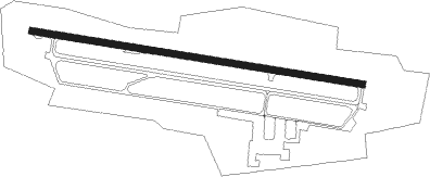
Chelyabinsk - Balandino
Airport details
| Country | Russian Federation |
| State | Chelyabinsk Oblast |
| Region | US |
| Airspace | Yekaterinburg Ctr |
| Municipality | Chelyabinsk |
| Elevation | 769ft (234m) |
| Timezone | GMT +5 |
| Coordinates | 55.30583, 61.50361 |
| Magnetic var | |
| Type | land |
| Available since | X-Plane v10.32 |
| ICAO code | USCC |
| IATA code | CEK |
| FAA code | n/a |
Communication
| BALANDINO CHELYABINSK START | 125.200 |
| BALANDINO CHELYABINSK Approach | 124.700 |
| BALANDINO CHELYABINSK Approach | 124.000 |
Approach frequencies
| ILS-cat-I | RW27 | 108.7 | 18.00mi |
| ILS-cat-I | RW09 | 109.9 | 18.00mi |
| 3° GS | RW27 | 108.7 | 18.00mi |
| 3° GS | RW09 | 109.9 | 18.00mi |
Nearby Points of Interest:
Yaroslavskogo Square
-Vosstavshikh Square
Nearby beacons
| code | identifier | dist | bearing | frequency |
|---|---|---|---|---|
| LBN | CHELYABINSK VOR/DME | 0.4 | 85° | 113.30 |
| L | BALANDINO (CHELYABINSK) NDB | 1.3 | 278° | 392 |
| K | BALANDINO (CHELYABINSK) NDB | 1.4 | 98° | 367 |
| KS | BALANDINO (CHELYABINSK) NDB | 2.9 | 98° | 412 |
| LB | BALANDINO (CHELYABINSK) NDB | 2.9 | 278° | 452 |
Departure and arrival routes
| Transition altitude | 5692ft |
| Transition level | 8000ft |
| SID end points | distance | outbound heading | |
|---|---|---|---|
| RW09 | |||
| LERD2E, LERD2M, LERD2G | 39mi | 64° | |
| NOMG2G, NOMG2M, NOMG2E | 50mi | 75° | |
| LERT2M, LERT2G, LERT2E | 44mi | 136° | |
| GERS2M, GERS2G, GERS2E | 47mi | 238° | |
| BEDO2E, BEDO2M, BEDO2G | 47mi | 267° | |
| PESA2M, PESA2G, PESA2E | 37mi | 343° | |
| RW27 | |||
| LERD2F, LERD2K, LERD2N | 39mi | 64° | |
| NOMG2K, NOMG2F, NOMG2N | 50mi | 75° | |
| LERT2K, LERT2F, LERT2N | 44mi | 136° | |
| GERS2Y, GERS2N, GERS2K, GERS2F | 47mi | 238° | |
| BEDO2F, BEDO2K, BEDO2N | 47mi | 267° | |
| PESA2F, PESA2K, PESA2N | 37mi | 343° | |
| STAR starting points | distance | inbound heading | |
|---|---|---|---|
| ALL | |||
| GERS2H | 46.8 | 58° | |
| LUTA2H, LUTA2W | 46.0 | 94° | |
| ASLI2H | 36.5 | 201° | |
| LERD2H | 38.8 | 244° | |
| UTAB2H | 52.4 | 264° | |
| LERT2W, LERT2H | 43.9 | 316° | |
| RW09 | |||
| GERS2C, GERS2L | 46.8 | 58° | |
| LUTA2L, LUTA2X, LUTA2C | 46.0 | 94° | |
| ASLI2C, ASLI2L | 36.5 | 201° | |
| LERD2L, LERD2C | 38.8 | 244° | |
| UTAB2L, UTAB2C | 52.4 | 264° | |
| LERT2L, LERT2C, LERT2X | 43.9 | 316° | |
| RW27 | |||
| GERS2D, GERS2J | 46.8 | 58° | |
| LUTA2V, LUTA2J, LUTA2D | 46.0 | 94° | |
| ASLI2D, ASLI2J | 36.5 | 201° | |
| LERD2J, LERD2D | 38.8 | 244° | |
| UTAB2J, UTAB2D | 52.4 | 264° | |
| LERT2V, LERT2J, LERT2D | 43.9 | 316° | |
Instrument approach procedures
| runway | airway (heading) | route (dist, bearing) |
|---|---|---|
| RW09 | CC203 (110°) | CC203 4100ft CC202 (6mi, 134°) 2600ft |
| RNAV | CC202 2600ft CC201 (3mi, 98°) 2000ft USCC (5mi, 98°) 809ft (4459mi, 228°) 1500ft CC213 (4464mi, 48°) 2800ft CC214 (9mi, 283°) CC203 (6mi, 252°) 4100ft | |
| RW27 | CC216 (263°) | CC216 4500ft CC205 (6mi, 231°) 3000ft |
| RNAV | CC205 3000ft CC204 (5mi, 278°) 2000ft USCC (5mi, 278°) 787ft (4459mi, 228°) 1500ft CC213 (4464mi, 48°) CC216 (11mi, 103°) 4500ft |
Holding patterns
| STAR name | hold at | type | turn | heading* | altitude | leg | speed limit |
|---|---|---|---|---|---|---|---|
| ASLI2D | CC216 | VHF | right | 11 (191)° | 2200ft - 9000ft | 1.0min timed | 230 |
| ASLI2H | LBN | NDB | left | 270 (90)° | 3000ft - 9000ft | 1.0min timed | 230 |
| ASLI2J | KS | FIX | right | 90 (270)° | 2600ft - 9000ft | 1.0min timed | 230 |
| ASLI2L | LB | FIX | left | 270 (90)° | 2600ft - 9000ft | 1.0min timed | 230 |
| GERS2H | LBN | NDB | left | 270 (90)° | 3000ft - 9000ft | 1.0min timed | 230 |
| GERS2J | KS | FIX | right | 90 (270)° | 2600ft - 9000ft | 1.0min timed | 230 |
| GERS2L | LB | FIX | left | 270 (90)° | 2600ft - 9000ft | 1.0min timed | 230 |
| LERD2D | CC216 | VHF | right | 11 (191)° | 2200ft - 9000ft | 1.0min timed | 230 |
| LERD2H | LBN | NDB | left | 270 (90)° | 3000ft - 9000ft | 1.0min timed | 230 |
| LERD2J | KS | FIX | right | 90 (270)° | 2600ft - 9000ft | 1.0min timed | 230 |
| LERD2L | LB | FIX | left | 270 (90)° | 2600ft - 9000ft | 1.0min timed | 230 |
| LERT2C | CC213 | VHF | right | 90 (270)° | 2800ft - 9000ft | 1.0min timed | 230 |
| LERT2V | KS | FIX | right | 90 (270)° | 2600ft - 9000ft | 1.0min timed | 230 |
| LERT2W | LBN | NDB | left | 270 (90)° | 3000ft - 9000ft | 1.0min timed | 230 |
| LERT2X | LB | FIX | left | 270 (90)° | 2600ft - 9000ft | 1.0min timed | 230 |
| LUTA2D | CC216 | VHF | right | 11 (191)° | 2200ft - 9000ft | 1.0min timed | 230 |
| LUTA2V | KS | FIX | right | 90 (270)° | 2600ft - 9000ft | 1.0min timed | 230 |
| LUTA2W | LBN | NDB | left | 270 (90)° | 3000ft - 9000ft | 1.0min timed | 230 |
| LUTA2X | LB | FIX | left | 270 (90)° | 2600ft - 9000ft | 1.0min timed | 230 |
| UTAB2C | CC213 | VHF | right | 90 (270)° | 2800ft - 9000ft | 1.0min timed | 230 |
| UTAB2D | CC216 | VHF | right | 11 (191)° | 2200ft - 9000ft | 1.0min timed | 230 |
| UTAB2H | LBN | NDB | left | 270 (90)° | 3000ft - 9000ft | 1.0min timed | 230 |
| UTAB2J | KS | FIX | right | 90 (270)° | 2600ft - 9000ft | 1.0min timed | 230 |
| UTAB2L | LB | FIX | left | 270 (90)° | 2600ft - 9000ft | 1.0min timed | 230 |
| *) magnetic outbound (inbound) holding course | |||||||
Disclaimer
The information on this website is not for real aviation. Use this data with the X-Plane flight simulator only! Data taken with kind consent from X-Plane 12 source code and data files. Content is subject to change without notice.