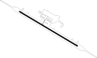
Bovanenkovo
Airport details
| Country | Russian Federation |
| State | Yamalo-Nenets Autonomous Okrug |
| Region | US |
| Airspace | Tyumen Ctr |
| Municipality | Yamalsky Rayon |
| Elevation | 21ft (6m) |
| Timezone | GMT +5 |
| Coordinates | 70.31528, 68.33361 |
| Magnetic var | |
| Type | land |
| Available since | X-Plane v11.51r1 |
| ICAO code | USDB |
| IATA code | n/a |
| FAA code | n/a |
Communication
| Bovanenkovo Bovanenkovo-Informatsiya | 126.000 |
Nearby beacons
| code | identifier | dist | bearing | frequency |
|---|---|---|---|---|
| BN | BOVANENKOVO NDB | 0.3 | 87° | 450 |
Departure and arrival routes
| Transition altitude | 3960ft |
| Transition level | 6000ft |
| SID end points | distance | outbound heading | |
|---|---|---|---|
| RW10 | |||
| POKA1D, POKA1A | 22mi | 71° | |
| DEGI1A, DEGI1D | 22mi | 103° | |
| KEMI1A, KEMI1D | 22mi | 135° | |
| ATNI1D, ATNI1A | 22mi | 234° | |
| UNKO1D, UNKO1A | 22mi | 263° | |
| RENL1D, RENL1A | 22mi | 308° | |
| RW28 | |||
| POKA1E, POKA1B | 22mi | 71° | |
| DEGI1B, DEGI1E | 22mi | 103° | |
| KEMI1B, KEMI1E | 22mi | 135° | |
| ATNI1E, ATNI1B | 22mi | 234° | |
| UNKO1B, UNKO1E | 22mi | 263° | |
| RENL1B, RENL1E | 22mi | 308° | |
| STAR starting points | distance | inbound heading | |
|---|---|---|---|
| RW10 | |||
| ATNI1F | 21.5 | 54° | |
| UNKO1F | 21.5 | 83° | |
| RENL1F | 21.5 | 128° | |
| POKA1F | 21.5 | 251° | |
| DEGI1F | 21.5 | 283° | |
| KEMI1F | 21.5 | 315° | |
| RW28 | |||
| ATNI1G | 21.5 | 54° | |
| UNKO1G | 21.5 | 83° | |
| RENL1G | 21.5 | 128° | |
| POKA1G | 21.5 | 251° | |
| DEGI1G | 21.5 | 283° | |
| KEMI1G | 21.5 | 315° | |
Instrument approach procedures
| runway | airway (heading) | route (dist, bearing) |
|---|---|---|
| RW10 | DB004 (92°) | DB004 1650ft DB007 (5mi, 64°) 1320ft |
| RW10 | DB006 (124°) | DB006 1320ft DB007 (5mi, 244°) 1320ft |
| RNAV | DB007 1320ft DB008 (5mi, 103°) 1320ft USDB (5mi, 103°) 78ft DB001 (3mi, 104°) DB006 (14mi, 298°) 1320ft | |
| RW28 | DB009 (272°) | DB009 1320ft DB012 (5mi, 245°) 1320ft |
| RW28 | DB011 (305°) | DB011 1650ft DB012 (5mi, 65°) 1320ft |
| RNAV | DB012 1320ft DB013 (5mi, 284°) 1320ft USDB (5mi, 284°) 80ft DB002 (3mi, 283°) DB009 (14mi, 95°) 1320ft |
Disclaimer
The information on this website is not for real aviation. Use this data with the X-Plane flight simulator only! Data taken with kind consent from X-Plane 12 source code and data files. Content is subject to change without notice.
