Yekaterinburg - Yekaterinburg-koltsovo
Airport details
| Country | Russian Federation |
| State | Sverdlovsk Oblast |
| Region | US |
| Airspace | Yekaterinburg Ctr |
| Municipality | Yekaterinburg |
| Elevation | 767ft (234m) |
| Timezone | GMT +5 |
| Coordinates | 56.74656, 60.82087 |
| Magnetic var | |
| Type | land |
| Available since | X-Plane v10.40 |
| ICAO code | USSS |
| IATA code | SVX |
| FAA code | n/a |
Communication
| Yekaterinburg-Koltsovo ATIS | 127.800 |
| Yekaterinburg-Koltsovo Ground | 119.000 |
| Yekaterinburg-Koltsovo Start | 124.300 |
| Yekaterinburg-Koltsovo Radar | 118.700 |
| Yekaterinburg-Koltsovo Transit | 131.900 |
| Yekaterinburg-Koltsovo Approach | 125.900 |
Approach frequencies
| ILS-cat-II | RW26L | 109.5 | 18.00mi |
| ILS-cat-I | RW08R | 109.9 | 18.00mi |
| ILS-cat-I | RW26R | 110.5 | 18.00mi |
| ILS-cat-I | RW08L | 111.7 | 18.00mi |
| 3.2° GS | RW26R | 110.5 | 18.00mi |
| 3° GS | RW26L | 109.5 | 18.00mi |
| 3° GS | RW08R | 109.9 | 18.00mi |
| 3° GS | RW08L | 111.7 | 18.00mi |
Nearby Points of Interest:
Lower Iset Works Direction Building
-Sports and Technology Club, Yekaterinburg
-Uktussky bridge
-Church of Saint Elisabeth, Yekaterinburg
-Church Of Michael The Archangel, Ekaterinburg
-Ural Federal University
-Ural State Technical University
-Old Believers church of Saint Nicholas (Yekaterinburg)
-Trinity Church of the same faith
-Central Library named after A. I. Herzen
-Church of the Exaltation of the Holy Cross in Yekaterinburg
-Zheleznov's mansion
-Hospital of Emergency Medical Service, Yekaterinburg
-Filitz Mansion, Yekaterinburg
-Diocesan School, Yekaterinburg
-Gospromural building estate
-Category:8 March street 62, Yekaterinburg
-Sverdlovsk regional universal scientific library named after V. G. Belinsky
-Volga-Ural Military District headquarters
-House of Merchant Babikov
-House of rittmeister Pereyaslavtsev, Yekaterinburg
-Ural State University
-Lenina Avenue 46, Yekaterinburg
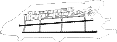
Runway info
Runway 08L / 26R  | ||
| length | 2994m (9823ft) | |
| bearing | 90° / 270° | |
| width | 45m (148ft) | |
| surface | asphalt | |
| displ threshold | 0m (0ft) / 247m (810ft) | |
| Runway 08R / 26L | ||
| length | 3015m (9892ft) | |
| bearing | 92° / 272° | |
| width | 45m (148ft) | |
| surface | concrete | |
| displ threshold | 0m (0ft) / 320m (1050ft) | |
| blast zone | 50m (164ft) / 0m (0ft) | |
Nearby beacons
| code | identifier | dist | bearing | frequency |
|---|---|---|---|---|
| U | KOLTSOVO (YEKATERINBURG) NDB | 0.6 | 96° | 749 |
| D | KOLTSOVO (YEKATERINBURG) NDB | 0.7 | 108° | 388 |
| EKB | KOLTSOVO (YEKATERINBURG) VOR/DME | 0.8 | 262° | 113.20 |
Departure and arrival routes
| Transition altitude | 4000ft |
| SID end points | distance | outbound heading | |
|---|---|---|---|
| RW08L | |||
| DOSU6F, DOSU6J | 38mi | 47° | |
| ASLI6F, ASLI6J | 59mi | 133° | |
| ALUM6B | 23mi | 151° | |
| MIKU6J | 59mi | 241° | |
| INLE6F, INLE6B | 29mi | 241° | |
| LUNA6J | 58mi | 273° | |
| UMTE6B, UMTE6F, UMTE6Y | 22mi | 274° | |
| RW08R | |||
| DOSU6J, DOSU6E | 38mi | 47° | |
| ASLI6J, ASLI6E | 59mi | 133° | |
| ALUM6A | 23mi | 151° | |
| INLE6A, INLE6E | 29mi | 241° | |
| MIKU6J | 59mi | 241° | |
| LUNA6J | 58mi | 273° | |
| UMTE6Z, UMTE6E, UMTE6A | 22mi | 274° | |
| RW26L | |||
| DOSU6H, DOSU6K | 38mi | 47° | |
| ASLI6H, ASLI6K, ASLI6L | 59mi | 133° | |
| ALUM6D | 23mi | 151° | |
| MIKU6K | 59mi | 241° | |
| INLE6H, INLE6D | 29mi | 241° | |
| LUNA6K | 58mi | 273° | |
| UMTE6D, UMTE6H | 22mi | 274° | |
| RW26R | |||
| DOSU6K, DOSU6G | 38mi | 47° | |
| ASLI6K, ASLI6L, ASLI6G | 59mi | 133° | |
| ALUM6C | 23mi | 151° | |
| MIKU6K | 59mi | 241° | |
| INLE6G, INLE6C | 29mi | 241° | |
| LUNA6K | 58mi | 273° | |
| UMTE6C, UMTE6G | 22mi | 274° | |
| STAR starting points | distance | inbound heading | |
|---|---|---|---|
| RW08 (ALL) | |||
| LOMB6P | 59.4 | 79° | |
| BIKM6P | 57.3 | 101° | |
| NEKE6P | 56.8 | 297° | |
| RW08L | |||
| PESA6V | 16.2 | 25° | |
| GOGT6M | 24.1 | 46° | |
| NEBI6V | 22.6 | 65° | |
| REPS6R, SOPU6R, BIKM6R | 25.8 | 81° | |
| LOMB6V | 26.6 | 81° | |
| BAGO6M | 29.4 | 83° | |
| UMTE6M | 22.4 | 94° | |
| LOMB6R, PESA6R, NEKE6R, NEBI6R | 26.7 | 101° | |
| BIKM6V | 25.9 | 101° | |
| REPS6V, SOPU6V | 15.2 | 152° | |
| BEGM6M | 16.2 | 241° | |
| NEKE6V | 16.4 | 330° | |
| ALUM6M | 23.0 | 331° | |
| RW08R | |||
| PESA6V | 16.2 | 25° | |
| GOGT6N | 24.1 | 46° | |
| NEBI6V | 22.6 | 65° | |
| REPS6R, SOPU6R, BIKM6R | 25.8 | 81° | |
| LOMB6V | 26.6 | 81° | |
| BAGO6N | 29.4 | 83° | |
| UMTE6N | 22.4 | 94° | |
| PESA6R, LOMB6R, NEKE6R, NEBI6R | 26.7 | 101° | |
| BIKM6V | 25.9 | 101° | |
| REPS6V, SOPU6V | 15.2 | 152° | |
| BEGM6N | 16.2 | 241° | |
| NEKE6V | 16.4 | 330° | |
| ALUM6N | 23.0 | 331° | |
| RW26 (ALL) | |||
| NEBI6W, NEBI6S | 57.1 | 45° | |
| LOMB6S, LOMB6Q, LOMB6W | 59.4 | 79° | |
| BIKM6W, BIKM6Q, BIKM6S, BIKM6T, BIKM6U | 57.3 | 101° | |
| REPS6W, REPS6S | 50.6 | 242° | |
| SOPU6W, SOPU6S | 45.1 | 252° | |
| NEKE6W, NEKE6S, NEKE6Q | 56.8 | 297° | |
| PESA6W, PESA6S | 53.1 | 329° | |
| RW26L | |||
| GOGT6N | 24.1 | 46° | |
| BAGO6N | 29.4 | 83° | |
| UMTE6N | 22.4 | 94° | |
| BEGM6N | 16.2 | 241° | |
| ALUM6N | 23.0 | 331° | |
| RW26R | |||
| GOGT6M | 24.1 | 46° | |
| BAGO6M | 29.4 | 83° | |
| UMTE6M | 22.4 | 94° | |
| BEGM6M | 16.2 | 241° | |
| ALUM6M | 23.0 | 331° | |
Instrument approach procedures
| runway | airway (heading) | route (dist, bearing) |
|---|---|---|
| RW08L | SS015 (84°) | SS015 SS025 (5mi, 67°) 2700ft |
| RW08L | SS016 (99°) | SS016 SS025 (6mi, 126°) 2700ft |
| RNAV | SS025 2700ft SS026 (5mi, 90°) 2400ft USSS (7mi, 90°) 786ft SS028 (6mi, 91°) SS029 (9mi, 172°) SS010 (29mi, 267°) | |
| RW08R | SS015 (84°) | SS015 SS002 (6mi, 64°) 2700ft |
| RW08R | SS016 (99°) | SS016 SS002 (5mi, 122°) 2700ft |
| RNAV | SS002 2700ft SS030 (5mi, 92°) 2400ft USSS (6mi, 91°) 785ft SS032 (6mi, 94°) SS029 (9mi, 172°) SS010 (29mi, 267°) | |
| RW26L | SS043 (289°) | SS043 SS061 (5mi, 350°) 2700ft |
| RW26L | SS053 (252°) | SS053 SS061 (7mi, 188°) 2700ft |
| RNAV | SS061 2700ft SS062 (4mi, 272°) 2400ft USSS (5mi, 275°) 811ft SS064 (14mi, 271°) SS060 (11mi, 196°) SS038 (15mi, 98°) | |
| RW26R | SS043 (289°) | SS043 SS035 (6mi, 0°) 2700ft |
| RW26R | SS053 (252°) | SS053 SS035 (6mi, 180°) 2700ft |
| RNAV | SS035 2700ft SS055 (5mi, 270°) 2400ft USSS (5mi, 271°) 814ft SS059 (14mi, 270°) SS060 (10mi, 197°) SS038 (15mi, 98°) |
Holding patterns
| STAR name | hold at | type | turn | heading* | altitude | leg | speed limit |
|---|---|---|---|---|---|---|---|
| ALUM6M | U | VHF | right | 33 (213)° | 1.0min timed | ICAO rules | |
| ALUM6N | D | VHF | right | 2 (182)° | 1.0min timed | ICAO rules | |
| BAGO6M | U | VHF | right | 33 (213)° | 1.0min timed | ICAO rules | |
| BAGO6N | D | VHF | right | 2 (182)° | 1.0min timed | ICAO rules | |
| BEGM6M | U | VHF | right | 33 (213)° | 1.0min timed | ICAO rules | |
| BEGM6N | D | VHF | right | 2 (182)° | 1.0min timed | ICAO rules | |
| BIKM6S | SS038 | VHF | right | 296 (116)° | 2700ft - 7000ft | 1.0min timed | 240 |
| BIKM6T | SS038 | VHF | right | 296 (116)° | 2700ft - 7000ft | 1.0min timed | 240 |
| BIKM6W | SS038 | VHF | right | 296 (116)° | 2700ft - 7000ft | 1.0min timed | 240 |
| GOGT6M | U | VHF | right | 33 (213)° | 1.0min timed | ICAO rules | |
| GOGT6N | D | VHF | right | 2 (182)° | 1.0min timed | ICAO rules | |
| LOMB6Q | D237K | VHF | right | 237 (57)° | 2700ft - 9000ft | DME 5.3mi | 225 |
| LOMB6S | SS038 | VHF | right | 296 (116)° | 2700ft - 7000ft | 1.0min timed | 240 |
| LOMB6W | SS038 | VHF | right | 296 (116)° | 2700ft - 7000ft | 1.0min timed | 240 |
| NEBI6R | SS010 | VHF | right | 106 (286)° | 6000ft - 9000ft | 1.0min timed | 220 |
| NEBI6S | SS038 | VHF | right | 296 (116)° | 2700ft - 7000ft | 1.0min timed | 240 |
| NEBI6W | SS038 | VHF | right | 296 (116)° | 2700ft - 7000ft | 1.0min timed | 240 |
| NEKE6R | SS010 | VHF | right | 106 (286)° | 6000ft - 9000ft | 1.0min timed | 220 |
| PESA6R | SS010 | VHF | right | 106 (286)° | 6000ft - 9000ft | 1.0min timed | 220 |
| UMTE6M | U | VHF | right | 33 (213)° | 1.0min timed | ICAO rules | |
| UMTE6N | D | VHF | right | 2 (182)° | 1.0min timed | ICAO rules | |
| *) magnetic outbound (inbound) holding course | |||||||
Disclaimer
The information on this website is not for real aviation. Use this data with the X-Plane flight simulator only! Data taken with kind consent from X-Plane 12 source code and data files. Content is subject to change without notice.