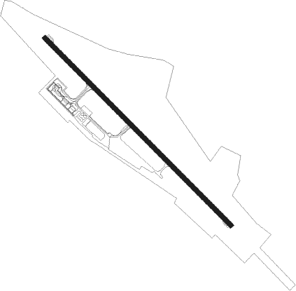
Urgench
Airport details
| Country | Uzbekistan |
| State | Xorazm Region |
| Region | UT |
| Municipality | Urgench |
| Elevation | 318ft (97m) |
| Timezone | GMT +5 |
| Coordinates | 41.58333, 60.64500 |
| Magnetic var | |
| Type | land |
| Available since | X-Plane v10.40 |
| ICAO code | UTNU |
| IATA code | UGC |
| FAA code | n/a |
Communication
| Urgench Tower | 118.300 |
| Urgench Approach | 126.000 |
Approach frequencies
| ILS-cat-I | RW31 | 109.5 | 18.00mi |
| 3° GS | RW31 | 109.5 | 18.00mi |
Nearby Points of Interest:
Itchan Kala gates and wall
-Public Baths of Anush Khan
-Konya Ark
Nearby beacons
| code | identifier | dist | bearing | frequency |
|---|---|---|---|---|
| URG | URGENCH VOR/DME | 0.5 | 114° | 114.20 |
| N | URGENCH NDB | 1.3 | 135° | 485 |
| R | URGENCH NDB | 1.4 | 308° | 485 |
| NU | URGENCH NDB | 2.9 | 133° | 983 |
| RG | URGENCH NDB | 2.9 | 310° | 983 |
| R | DAZHOGUZ NDB | 39.3 | 282° | 662 |
| DSH | DASHOGUZ VOR/DME | 39.5 | 282° | 112 |
| RP | DASHOGUZ NDB | 40.9 | 281° | 322 |
| ZR | NUKUS NDB | 68.2 | 311° | 435 |
Departure and arrival routes
| Transition altitude | 2300ft |
| Transition level | 5000ft |
| SID end points | distance | outbound heading | |
|---|---|---|---|
| RW13 | |||
| MAKI1F | 32mi | 16° | |
| NESV1F | 42mi | 56° | |
| EVTE1F | 52mi | 76° | |
| DIKN1F | 50mi | 87° | |
| VASI1F | 53mi | 106° | |
| DARV1F | 19mi | 218° | |
| OTBO1F | 21mi | 256° | |
| SOVO1F | 25mi | 283° | |
| AZRE1F | 34mi | 331° | |
| RW31 | |||
| MAKI1E | 32mi | 16° | |
| NESV1E | 42mi | 56° | |
| EVTE1E | 52mi | 76° | |
| DIKN1E | 50mi | 87° | |
| VASI1E | 53mi | 106° | |
| DARV1E | 19mi | 218° | |
| OTBO1E | 21mi | 256° | |
| SOVO1E | 25mi | 283° | |
| AZRE1E | 34mi | 331° | |
| STAR starting points | distance | inbound heading | |
|---|---|---|---|
| RW13 | |||
| DARV1C | 19.2 | 38° | |
| OTBO1C | 21.1 | 76° | |
| SOVO1C | 24.9 | 103° | |
| AZRE1C | 33.9 | 151° | |
| MAKI1C | 31.6 | 196° | |
| NESV1C | 41.5 | 236° | |
| EVTE1C | 52.2 | 256° | |
| DIKN1C | 49.7 | 267° | |
| VASI1C | 53.4 | 286° | |
| RW31 | |||
| DARV1A | 19.2 | 38° | |
| OTBO1A | 21.1 | 76° | |
| SOVO1A | 24.9 | 103° | |
| AZRE1A | 33.9 | 151° | |
| MAKI1A | 31.6 | 196° | |
| NESV1A | 41.5 | 236° | |
| EVTE1A | 52.2 | 256° | |
| DIKN1A | 49.7 | 267° | |
| VASI1A | 53.4 | 286° | |
Disclaimer
The information on this website is not for real aviation. Use this data with the X-Plane flight simulator only! Data taken with kind consent from X-Plane 12 source code and data files. Content is subject to change without notice.
