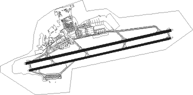
Tashkent - Islam Karimov Intl
Airport details
| Country | Uzbekistan |
| State | Uzbekistan |
| Region | UT |
| Municipality | Tashkent |
| Elevation | 1416ft (432m) |
| Timezone | GMT +5 |
| Coordinates | 41.25667, 69.28167 |
| Magnetic var | |
| Type | land |
| Available since | X-Plane v10.40 |
| ICAO code | UTTT |
| IATA code | TAS |
| FAA code | n/a |
Communication
| Islam Karimov Intl ATIS | 126.800 |
| Islam Karimov Intl CLD | 129.400 |
| Islam Karimov Intl Ground Control | 121.700 |
| Islam Karimov Intl Tower | 120.400 |
| Islam Karimov Intl Approach | 125.200 |
| Islam Karimov Intl RADAR | 119.400 |
Approach frequencies
| ILS-cat-II | RW08L | 110.5 | 18.00mi |
| ILS-cat-I | RW26R | 108.5 | 18.00mi |
| ILS-cat-I | RW08R | 111.7 | 18.00mi |
| 3° GS | RW26R | 108.5 | 18.00mi |
| 3° GS | RW08L | 110.5 | 18.00mi |
| 3° GS | RW08R | 111.7 | 18.00mi |
Runway info
Runway 08L / 26R  | ||
| length | 3992m (13097ft) | |
| bearing | 84° / 264° | |
| width | 60m (197ft) | |
| surface | asphalt | |
| displ threshold | 249m (817ft) / 253m (830ft) | |
| Runway 08R / 26L | ||
| length | 3897m (12785ft) | |
| bearing | 84° / 264° | |
| width | 45m (148ft) | |
| surface | asphalt | |
| displ threshold | 200m (656ft) / 204m (669ft) | |
Nearby beacons
| code | identifier | dist | bearing | frequency |
|---|---|---|---|---|
| TKT | TASHKENT VOR/DME | 1.2 | 266° | 113.20 |
| SR | SERGELI NDB | 5 | 219° | 743 |
| CV | SYRDARYA NDB | 38.1 | 233° | 535 |
Departure and arrival routes
| Transition altitude | 6000ft |
| SID end points | distance | outbound heading | |
|---|---|---|---|
| RW08 (ALL) | |||
| BAMU1A | 36mi | 12° | |
| TISI1A | 44mi | 99° | |
| SR08 | 18mi | 160° | |
| KUFI1A | 38mi | 233° | |
| OGRI1A | 58mi | 254° | |
| DODU1A | 23mi | 285° | |
| RW26 (ALL) | |||
| BAMU1B | 36mi | 12° | |
| TISI1B | 44mi | 99° | |
| SR26 | 18mi | 160° | |
| KUFI1B | 38mi | 233° | |
| OGRI1B | 58mi | 254° | |
| DODU1B | 23mi | 285° | |
| STAR starting points | distance | inbound heading | |
|---|---|---|---|
| ALL | |||
| KUFI1X | 38.1 | 53° | |
| DIBA1X | 60.8 | 91° | |
| DODU1X | 23.0 | 105° | |
| RW08 (ALL) | |||
| KUFI1Z | 38.1 | 53° | |
| DIBA1Z | 60.8 | 91° | |
| DODU1Z | 23.0 | 105° | |
| TISI1Z | 44.4 | 279° | |
| RW26 (ALL) | |||
| KUFI1W | 38.1 | 53° | |
| TISI1W | 44.4 | 279° | |
Holding patterns
| STAR name | hold at | type | turn | heading* | altitude | leg | speed limit |
|---|---|---|---|---|---|---|---|
| DIBA1X | DIBAD | VHF | right | 271 (91)° | > 9000ft | 1.0min timed | ICAO rules |
| DIBA1X | SR | FIX | left | 76 (256)° | 1.0min timed | ICAO rules | |
| DIBA1Z | DIBAD | VHF | right | 271 (91)° | > 9000ft | 1.0min timed | ICAO rules |
| DIBA1Z | PIVIN | VHF | right | 268 (88)° | > 4000ft | 1.0min timed | ICAO rules |
| DODU1X | DODUR | VHF | right | 305 (125)° | > 6000ft | 1.0min timed | ICAO rules |
| DODU1X | SR | FIX | left | 76 (256)° | 1.0min timed | ICAO rules | |
| DODU1Z | DODUR | VHF | right | 305 (125)° | > 6000ft | 1.0min timed | ICAO rules |
| KUFI1W | KUFIM | VHF | right | 220 (40)° | > 8000ft | 1.0min timed | ICAO rules |
| KUFI1X | KUFIM | VHF | right | 220 (40)° | > 8000ft | 1.0min timed | ICAO rules |
| KUFI1X | SR | FIX | left | 76 (256)° | 1.0min timed | ICAO rules | |
| KUFI1Z | KUFIM | VHF | right | 220 (40)° | > 8000ft | 1.0min timed | ICAO rules |
| KUFI1Z | LIMGU | VHF | right | 208 (28)° | > 4000ft | 1.0min timed | ICAO rules |
| TISI1W | RORSU | VHF | left | 105 (285)° | > 8000ft | 1.0min timed | ICAO rules |
| TISI1Z | LIMGU | VHF | right | 208 (28)° | > 4000ft | 1.0min timed | ICAO rules |
| *) magnetic outbound (inbound) holding course | |||||||
Disclaimer
The information on this website is not for real aviation. Use this data with the X-Plane flight simulator only! Data taken with kind consent from X-Plane 12 source code and data files. Content is subject to change without notice.