Ivanovo - Ivanovo Yuzhny
Airport details
| Country | Russian Federation |
| State | Ivanovo Oblast |
| Region | UU |
| Airspace | Moscow Ctr |
| Municipality | Коляновское сельское поселение |
| Elevation | 410ft (125m) |
| Timezone | GMT +3 |
| Coordinates | 56.94250, 40.93222 |
| Magnetic var | |
| Type | land |
| Available since | X-Plane v10.40 |
| ICAO code | UUBI |
| IATA code | IWA |
| FAA code | n/a |
Communication
| Ivanovo Yuzhny Tower | 127.100 |
Approach frequencies
| ILS-cat-I | RW29 | 110.3 | 18.00mi |
| 3° GS | RW29 | 110.3 | 18.00mi |
Nearby Points of Interest:
Museum of People's Artist of Russia Alexander Morozov
-Stepanov street 9, Ivanovo
-Museum of Industry and Art
-Nikolsky Cathedral of Nikolo-Shartomsky Monastery
-Church of the Theotokos Joy of All Who Sorrow
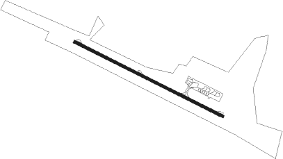
Runway info
| Runway 11 / 29 | ||
| length | 2498m (8196ft) | |
| bearing | 108° / 288° | |
| width | 42m (138ft) | |
| surface | asphalt | |
| blast zone | 50m (164ft) / 50m (164ft) | |
Nearby beacons
| code | identifier | dist | bearing | frequency |
|---|---|---|---|---|
| A | YUZHNY (IVANOVO) NDB | 1.2 | 288° | 670 |
| D | YUZHNY (IVANOVO) NDB | 1.2 | 108° | 670 |
| DD | YUZHNY (IVANOVO) NDB | 2.8 | 109° | 326 |
| AL | YUZHNY (IVANOVO) NDB | 2.9 | 288° | 326 |
| VA | DOBRYNSKOYE NDB | 42.2 | 206° | 307 |
| RG | TUNOSHNA (YAROSLAVL) NDB | 44.5 | 313° | 315 |
| KA | (YAROSLAVL) DME | 44.6 | 309° | 109.40 |
| R | TUNOSHNA (YAROSLAVL) NDB | 44.6 | 310° | 650 |
| WR | DME | 53.2 | 217° | 109 |
Departure and arrival routes
| Transition altitude | 2380ft |
| SID end points | distance | outbound heading | |
|---|---|---|---|
| RW11 | |||
| ROKU1A | 20mi | 152° | |
| OLAT1A | 20mi | 275° | |
| RW29 | |||
| ROKU1B | 20mi | 152° | |
| OLAT1B, OLAT1E | 20mi | 275° | |
| STAR starting points | distance | inbound heading | |
|---|---|---|---|
| RW11 | |||
| OLAT1C | 20.1 | 95° | |
| ROKU1C | 20.2 | 332° | |
| RW29 | |||
| OLAT1D | 20.1 | 95° | |
| ROKU1D | 20.2 | 332° | |
Holding patterns
| STAR name | hold at | type | turn | heading* | altitude | leg | speed limit |
|---|---|---|---|---|---|---|---|
| OLAT1C | A | VHF | left | 220 (40)° | 5000ft - 14000ft | 1.0min timed | 229 |
| OLAT1D | D | VHF | left | 320 (140)° | 15000ft - 20000ft | 1.5min timed | 240 |
| ROKU1C | A | VHF | left | 220 (40)° | 5000ft - 14000ft | 1.0min timed | 229 |
| ROKU1D | D | VHF | left | 320 (140)° | 15000ft - 20000ft | 1.5min timed | 240 |
| *) magnetic outbound (inbound) holding course | |||||||
Disclaimer
The information on this website is not for real aviation. Use this data with the X-Plane flight simulator only! Data taken with kind consent from X-Plane 12 source code and data files. Content is subject to change without notice.