Greshnevo - Yaroslavl' (levtsovo)
Airport details
| Country | Russian Federation |
| State | Yaroslavl Oblast |
| Region | UU |
| Airspace | Moscow Ctr |
| Municipality | Заволжское сельское поселение |
| Elevation | 413ft (126m) |
| Timezone | GMT +3 |
| Coordinates | 57.73000, 40.04500 |
| Magnetic var | |
| Type | land |
| Available since | X-Plane v10.40 |
| ICAO code | UUBX |
| IATA code | n/a |
| FAA code | n/a |
Communication
| Yaroslavl' (Levtsovo) Tower | 122.300 |
Nearby Points of Interest:
Church of the Nativity of Christ, Ponomaryovo
-Charyshnikov House
-Pavilions on Volzhskaya embankment in Yaroslavl
-Governor's Palace in Yaroslavl
-Volzhskie Vorota Bridge
-Monument to the Fighters for Soviet Power
-Demidovsky Garden Square
-Eternal flame in Yaroslavl
-Trading Arcades, Yaroslavl
-historical centre of Yaroslavl
-Butusov District
-Maksim Bahdanovich Museum, Yaroslavl
-Yaroslavl Art Institute
-Yaroslavl Higher Military Air Defence School
-Petropavlovsky Park
-Holy Mandylion church
-Ponizovkin's Palace
-Kazan Church (Petropavlovskoye-on-Bykov mountains)
-Holy Trinity church
-Church of the Holy Mandylion (Nikolo-Zabolotye)
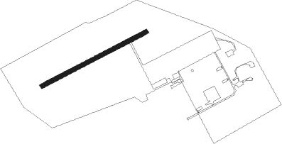
Runway info
| Runway 06 / 24 | ||
| length | 649m (2129ft) | |
| bearing | 77° / 257° | |
| width | 23m (75ft) | |
| surface | asphalt | |
Nearby beacons
| code | identifier | dist | bearing | frequency |
|---|---|---|---|---|
| R | TUNOSHNA (YAROSLAVL) NDB | 10.7 | 137° | 650 |
| KA | (YAROSLAVL) DME | 10.8 | 142° | 109.40 |
| RG | TUNOSHNA (YAROSLAVL) NDB | 10.8 | 127° | 315 |
| AL | YUZHNY (IVANOVO) NDB | 52.7 | 133° | 326 |
| A | YUZHNY (IVANOVO) NDB | 54.2 | 132° | 670 |
| D | YUZHNY (IVANOVO) NDB | 56.5 | 131° | 670 |
| DD | YUZHNY (IVANOVO) NDB | 57.9 | 130° | 326 |
Disclaimer
The information on this website is not for real aviation. Use this data with the X-Plane flight simulator only! Data taken with kind consent from X-Plane 12 source code and data files. Content is subject to change without notice.