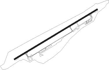
Yaroslavl - Tunoshna
Airport details
| Country | Russian Federation |
| State | Yaroslavl Oblast |
| Region | UU |
| Airspace | Moscow Ctr |
| Municipality | Туношенское сельское поселение |
| Elevation | 305ft (93m) |
| Timezone | GMT +3 |
| Coordinates | 57.56055, 40.15750 |
| Magnetic var | |
| Type | land |
| Available since | X-Plane v10.40 |
| ICAO code | UUDL |
| IATA code | IAR |
| FAA code | n/a |
Communication
| Tunoshna ATIS | 127.350 |
| Tunoshna Tower | 120.300 |
Approach frequencies
| ILS-cat-I | RW23 | 110.5 | 18.00mi |
| 3° GS | RW23 | 110.5 | 18.00mi |
Nearby beacons
| code | identifier | dist | bearing | frequency |
|---|---|---|---|---|
| KA | (YAROSLAVL) DME | 0.5 | 83° | 109.40 |
| R | TUNOSHNA (YAROSLAVL) NDB | 1.2 | 75° | 650 |
| RG | TUNOSHNA (YAROSLAVL) NDB | 2.9 | 75° | 315 |
| AL | YUZHNY (IVANOVO) NDB | 42.2 | 130° | 326 |
| A | YUZHNY (IVANOVO) NDB | 43.7 | 129° | 670 |
| D | YUZHNY (IVANOVO) NDB | 46 | 128° | 670 |
| DD | YUZHNY (IVANOVO) NDB | 47.4 | 127° | 326 |
Departure and arrival routes
| Transition altitude | 2602ft |
| SID end points | distance | outbound heading | |
|---|---|---|---|
| RW05 | |||
| LIRB1L, LIRB1A | 33mi | 5° | |
| ISKO1L, ISKO1A | 17mi | 50° | |
| POGA1A, POGA1D, POGA1E, POGA1L | 13mi | 185° | |
| RIRA1L, RIRA1D, RIRA1A | 32mi | 282° | |
| MAGO1L, MAGO1A | 31mi | 323° | |
| RW23 | |||
| LIRB1M, LIRB1B | 33mi | 5° | |
| ISKO1M, ISKO1B | 17mi | 50° | |
| POGA1M, POGA1B, POGA1F | 13mi | 185° | |
| RIRA1B, RIRA1M | 32mi | 282° | |
| MAGO1M, MAGO1B | 31mi | 323° | |
| STAR starting points | distance | inbound heading | |
|---|---|---|---|
| RW05 | |||
| POGA1K, POGA1N | 13.2 | 5° | |
| RANT1N | 29.6 | 85° | |
| MAGO1K, MAGO1N | 31.2 | 143° | |
| ISKO1N | 17.1 | 230° | |
| RW23 | |||
| POGA1P, POGA1G | 13.2 | 5° | |
| RANT1P, RANT1G | 29.6 | 85° | |
| MAGO1P, MAGO1H, MAGO1G | 31.2 | 143° | |
| ISKO1P, ISKO1G | 17.1 | 230° | |
Instrument approach procedures
| runway | airway (heading) | route (dist, bearing) |
|---|---|---|
| RW05 | DL405 (81°) | DL405 2590ft DL305 (6mi, 92°) 2260ft |
| RW05 | DL505 (54°) | DL505 2590ft DL305 (6mi, 317°) 2260ft |
| RNAV | DL305 2260ft DL205 (5mi, 75°) 2260ft UUDL (7mi, 75°) 336ft DL051 (4mi, 75°) DL705 (8mi, 212°) DL505 (10mi, 255°) 2590ft | |
| RW23 | DL323 (229°) | DL323 2600ft DL223 (6mi, 137°) 2270ft |
| RW23 | DL423 (273°) | DL423 2600ft DL223 (6mi, 317°) 2270ft |
| RNAV | DL223 1620ft DL023 (5mi, 255°) 1620ft UUDL (5mi, 255°) 352ft (3952mi, 215°) 1620ft DL523 (3954mi, 35°) DL423 (5mi, 75°) 2600ft |
Holding patterns
| STAR name | hold at | type | turn | heading* | altitude | leg | speed limit |
|---|---|---|---|---|---|---|---|
| ISKO1G | R | VHF | left | 127 (307)° | 3000ft - 9000ft | 1.0min timed | ICAO rules |
| ISKO1N | DL705 | VHF | left | 51 (231)° | 2590ft - 3240ft | 1.0min timed | 220 |
| ISKO1P | DL523 | VHF | right | 253 (73)° | 2600ft - 3260ft | 1.0min timed | 215 |
| MAGO1G | R | VHF | left | 127 (307)° | 3000ft - 9000ft | 1.0min timed | ICAO rules |
| MAGO1K | DL405 | VHF | left | 276 (96)° | 2590ft - 4900ft | 1.0min timed | 230 |
| MAGO1N | DL705 | VHF | left | 51 (231)° | 2590ft - 3240ft | 1.0min timed | 220 |
| POGA1G | R | VHF | left | 127 (307)° | 3000ft - 9000ft | 1.0min timed | ICAO rules |
| POGA1K | DL405 | VHF | left | 276 (96)° | 2590ft - 4900ft | 1.0min timed | 230 |
| RANT1G | R | VHF | left | 127 (307)° | 3000ft - 9000ft | 1.0min timed | ICAO rules |
| RANT1N | DL405 | VHF | left | 276 (96)° | 2590ft - 4900ft | 1.0min timed | 230 |
| RANT1P | DL523 | VHF | right | 253 (73)° | 2600ft - 3260ft | 1.0min timed | 215 |
| *) magnetic outbound (inbound) holding course | |||||||
Disclaimer
The information on this website is not for real aviation. Use this data with the X-Plane flight simulator only! Data taken with kind consent from X-Plane 12 source code and data files. Content is subject to change without notice.
