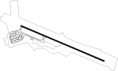
Belgorod
Airport details
| Country | Russian Federation |
| State | Belgorod Oblast |
| Region | UU |
| Airspace | Moscow Ctr |
| Municipality | Belgorod |
| Elevation | 731ft (223m) |
| Timezone | GMT +3 |
| Coordinates | 50.64449, 36.58092 |
| Magnetic var | |
| Type | land |
| Available since | X-Plane v10.40 |
| ICAO code | UUOB |
| IATA code | EGO |
| FAA code | n/a |
Communication
| Belgorod TAXIING | 121.700 |
| Belgorod Tower | 118.200 |
| Belgorod Approach | 133.000 |
| Belgorod Approach | 124.000 |
Approach frequencies
| ILS-cat-I | RW29 | 110.5 | 18.00mi |
| 2.8° GS | RW29 | 110.5 | 18.00mi |
Nearby Points of Interest:
Category:Administration of Belgorod Oblast
-Marfo-Mariinsky Monastery in Belgorod
-Dormition Church Belgorod
-Belgorod fortress
-Krapivnoe site of ancient settlement
-Dmitrievka site of ancient settlement
-Nezhegolsk
-Prokhorovka field
Nearby beacons
| code | identifier | dist | bearing | frequency |
|---|---|---|---|---|
| A | BELGOROD NDB | 0.7 | 296° | 350 |
| BL | BELGOROD VOR/DME | 1.1 | 105° | 110 |
| B | BELGOROD NDB | 1.5 | 105° | 350 |
| BX | BELGOROD NDB | 3.1 | 106° | 718 |
| KHR | KHARKIV VOR/DME | 44.3 | 202° | 116.50 |
Departure and arrival routes
| Transition altitude | 3031ft |
| SID end points | distance | outbound heading | |
|---|---|---|---|
| RW11 | |||
| MEBU1E, MEBU1G, MEBU1S | 30mi | 33° | |
| ASDE1S, ASDE1G, ASDE1E | 33mi | 83° | |
| KUBO6E, KUBO6G, KUBO6S | 22mi | 143° | |
| BODR6E, BODR6G, BODR6S | 32mi | 262° | |
| LEMB6E, LEMB6S, LEMB6G | 28mi | 282° | |
| RW29 | |||
| MEBU1F, MEBU1V, MEBU1H | 30mi | 33° | |
| ASDE1V, ASDE1H, ASDE1F | 33mi | 83° | |
| KUBO6H, KUBO6F, KUBO6V | 22mi | 143° | |
| BODR6V, BODR6F, BODR6H | 32mi | 262° | |
| LEMB6F, LEMB6H, LEMB6V | 28mi | 282° | |
| STAR starting points | distance | inbound heading | |
|---|---|---|---|
| ALL | |||
| NALE6L | 20.2 | 16° | |
| LEMB6L | 28.3 | 102° | |
| ABAL1L | 31.4 | 249° | |
| ASDE1L | 32.9 | 263° | |
| RW11 | |||
| NALE6Q, NALE6J | 20.2 | 16° | |
| LEMB6Q, LEMB6J | 28.3 | 102° | |
| ABAL1Q, ABAL1J | 31.4 | 249° | |
| ASDE1Q, ASDE1J | 32.9 | 263° | |
| RW29 | |||
| NALE6K, NALE6R | 20.2 | 16° | |
| LEMB6K, LEMB6R | 28.3 | 102° | |
| ABAL1K, ABAL1R | 31.4 | 249° | |
| ASDE1R, ASDE1K | 32.9 | 263° | |
Instrument approach procedures
| runway | airway (heading) | route (dist, bearing) |
|---|---|---|
| RW11 | OB103 (93°) | OB103 2500ft OB102 (6mi, 59°) 2300ft |
| RW11 | OB104 (128°) | OB104 2500ft OB102 (6mi, 191°) 2300ft |
| RNAV | OB102 2300ft OB101 (6mi, 108°) 2300ft OB106 (5mi, 108°) 952ft OB107 (4mi, 108°) OB105 (12mi, 313°) OB104 (6mi, 288°) 2500ft | |
| RW29 | OB293 (307°) | OB293 2500ft OB292 (6mi, 12°) 2500ft |
| RW29 | OB294 (273°) | OB294 2500ft OB292 (6mi, 240°) 2500ft |
| RNAV | OB292 2500ft OB291 (5mi, 288°) 2300ft OB296 (5mi, 288°) 903ft OB297 (5mi, 288°) OB295 (12mi, 90°) OB294 (6mi, 108°) 2500ft |
Holding patterns
| STAR name | hold at | type | turn | heading* | altitude | leg | speed limit |
|---|---|---|---|---|---|---|---|
| ABAL1J | A | VHF | left | 220 (40)° | 5000ft - 14000ft | 1.0min timed | 229 |
| ABAL1K | B | VHF | right | 140 (320)° | 15000ft - 20000ft | 1.5min timed | 240 |
| ABAL1L | BL | NDB | right | 109 (289)° | 2400ft - 9000ft | 1.0min timed | 210 |
| ABAL1Q | OB104 | VHF | left | 50 (230)° | 2100ft - 9000ft | 1.0min timed | 210 |
| ABAL1R | OB294 | VHF | right | 39 (219)° | 2100ft - 9000ft | 1.0min timed | 210 |
| ASDE1J | A | VHF | left | 220 (40)° | 5000ft - 14000ft | 1.0min timed | 229 |
| ASDE1K | B | VHF | right | 140 (320)° | 15000ft - 20000ft | 1.5min timed | 240 |
| ASDE1L | BL | NDB | right | 109 (289)° | 2400ft - 9000ft | 1.0min timed | 210 |
| ASDE1Q | OB104 | VHF | left | 50 (230)° | 2100ft - 9000ft | 1.0min timed | 210 |
| ASDE1R | OB294 | VHF | right | 39 (219)° | 2100ft - 9000ft | 1.0min timed | 210 |
| LEMB6J | A | VHF | left | 220 (40)° | 5000ft - 14000ft | 1.0min timed | 229 |
| LEMB6K | B | VHF | right | 140 (320)° | 15000ft - 20000ft | 1.5min timed | 240 |
| LEMB6L | BL | NDB | right | 109 (289)° | 2400ft - 9000ft | 1.0min timed | 210 |
| LEMB6Q | OB102 | VHF | left | 289 (109)° | 2100ft - 9000ft | 1.0min timed | 210 |
| LEMB6R | OB294 | VHF | right | 39 (219)° | 2100ft - 9000ft | 1.0min timed | 210 |
| NALE6J | A | VHF | left | 220 (40)° | 5000ft - 14000ft | 1.0min timed | 229 |
| NALE6K | B | VHF | right | 140 (320)° | 15000ft - 20000ft | 1.5min timed | 240 |
| NALE6L | BL | NDB | right | 109 (289)° | 2400ft - 9000ft | 1.0min timed | 210 |
| *) magnetic outbound (inbound) holding course | |||||||
Disclaimer
The information on this website is not for real aviation. Use this data with the X-Plane flight simulator only! Data taken with kind consent from X-Plane 12 source code and data files. Content is subject to change without notice.