Lipetsk
Airport details
| Country | Russian Federation |
| State | Lipetsk Oblast |
| Region | UU |
| Airspace | Moscow Ctr |
| Municipality | Кузьмино-Отвержский сельсовет |
| Elevation | 585ft (178m) |
| Timezone | GMT +3 |
| Coordinates | 52.70034, 39.52980 |
| Magnetic var | |
| Type | land |
| Available since | X-Plane v10.40 |
| ICAO code | UUOL |
| IATA code | LPK |
| FAA code | n/a |
Communication
| Lipetsk Transit | 127.400 |
| Lipetsk Tower | 126.300 |
Nearby Points of Interest:
Puppet theatre, Lipetsk
-Lenin Street 7 - Gubin House
-Government building in Lipetsk
-Sobornaya Square
-Saint Michael Church
-Holy Trinity Church
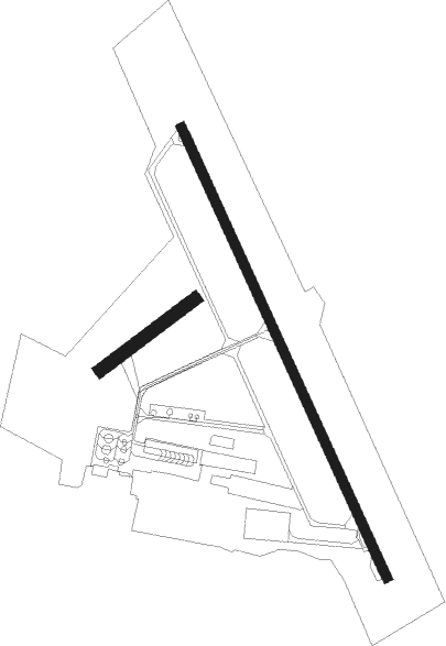
Runway info
Runway 05 / 23  | ||
| length | 558m (1831ft) | |
| bearing | 69° / 249° | |
| width | 60m (197ft) | |
| surface | grass | |
| Runway 15 / 33 | ||
| length | 2345m (7694ft) | |
| bearing | 149° / 329° | |
| width | 45m (148ft) | |
| surface | concrete | |
| displ threshold | 2m (7ft) / 300m (984ft) | |
| blast zone | 48m (157ft) / 51m (167ft) | |
Nearby beacons
| code | identifier | dist | bearing | frequency |
|---|---|---|---|---|
| I | LIPETSK NDB | 1 | 128° | 400 |
| D | LIPETSK NDB | 1.2 | 352° | 400 |
| TS | ZADONSK NDB | 28.7 | 243° | 360 |
| WR | VORONEZH NDB | 53 | 202° | 289 |
| W | CHERTOVITSKOYE (VORONEZH) NDB | 53.7 | 200° | 595 |
| A | CHERTOVITSKOYE (VORONEZH) NDB | 54.8 | 197° | 595 |
| AP | VORONEZH NDB | 56 | 194° | 289 |
| ZF | PRIDACHA (VORONEZH) NDB | 60.3 | 192° | 495 |
| PE | DME | 63.7 | 146° | 117.20 |
| PT | PETROVSKOYE NDB | 63.7 | 146° | 475 |
| RV | DME-ILS | 64.4 | 36° | 109.10 |
Departure and arrival routes
| Transition altitude | 2890ft |
| Transition level | 5000ft |
| SID end points | distance | outbound heading | |
|---|---|---|---|
| RW15 | |||
| NEGL1H, NEGL1F, NEGL1E | 43mi | 6° | |
| DISK1G, DISK1D | 44mi | 148° | |
| UROB1J, UROB1L, UROB1M | 19mi | 241° | |
| RW33 | |||
| NEGL1J, NEGL1G | 43mi | 6° | |
| DISK1H, DISK1F, DISK1E | 44mi | 148° | |
| UROB1K, UROB1N, UROB1P | 19mi | 241° | |
| STAR starting points | distance | inbound heading | |
|---|---|---|---|
| RW15 | |||
| UROB1Q, UROB1S | 19.1 | 61° | |
| OSPE1F, OSPE1H | 49.5 | 140° | |
| RW33 | |||
| UROB1T, UROB1R | 19.1 | 61° | |
| OSPE1J, OSPE1G | 49.5 | 140° | |
Instrument approach procedures
| runway | airway (heading) | route (dist, bearing) |
|---|---|---|
| RW15 | OL002 (119°) | OL002 2900ft OL001 (6mi, 78°) 2900ft |
| RW15 | OL003 (197°) | OL003 2900ft OL001 (6mi, 258°) 2900ft |
| RNAV | OL001 2900ft OL005 (5mi, 149°) 2300ft UUOL (6mi, 153°) 627ft OL006 (4mi, 143°) OL004 (11mi, 20°) OL003 (5mi, 329°) 2900ft | |
| RW33 | OL011 (13°) | OL011 2900ft OL010 (6mi, 77°) 2900ft |
| RW33 | OL012 (297°) | OL012 2900ft OL010 (6mi, 258°) 2900ft |
| RNAV | OL010 2900ft OL014 (5mi, 329°) 2300ft UUOL (6mi, 325°) 621ft OL015 (4mi, 335°) OL013 (11mi, 115°) OL012 (5mi, 149°) 2900ft |
Holding patterns
| STAR name | hold at | type | turn | heading* | altitude | leg | speed limit |
|---|---|---|---|---|---|---|---|
| OSPE1F | D | VHF | left | 320 (140)° | 15000ft - 20000ft | 1.5min timed | 240 |
| OSPE1G | I | VHF | right | 25 (205)° | 14000ft - 14000ft | 1.0min timed | 229 |
| OSPE1J | OL012 | VHF | left | 60 (240)° | 2200ft - 8000ft | 1.0min timed | 230 |
| RATG1F | D | VHF | left | 320 (140)° | 15000ft - 20000ft | 1.5min timed | 240 |
| RATG1G | I | VHF | right | 25 (205)° | 14000ft - 14000ft | 1.0min timed | 229 |
| RATG1H | OL003 | VHF | right | 330 (150)° | 2100ft - 8000ft | 1.0min timed | 230 |
| UROB1Q | D | VHF | left | 320 (140)° | 15000ft - 20000ft | 1.5min timed | 240 |
| UROB1R | I | VHF | right | 25 (205)° | 14000ft - 14000ft | 1.0min timed | 229 |
| *) magnetic outbound (inbound) holding course | |||||||
Disclaimer
The information on this website is not for real aviation. Use this data with the X-Plane flight simulator only! Data taken with kind consent from X-Plane 12 source code and data files. Content is subject to change without notice.