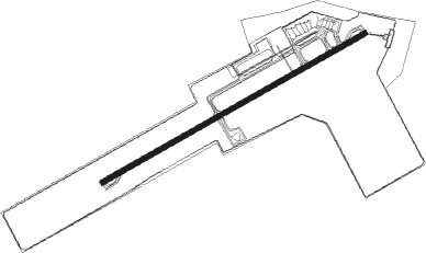
Indore - Devi Ahilyabai Holkar
Airport details
| Country | India |
| State | Madhya Pradesh |
| Region | VA |
| Airspace | Mumbai Ctr |
| Municipality | Indore |
| Elevation | 1850ft (564m) |
| Timezone | GMT +5.5 |
| Coordinates | 22.72333, 75.80547 |
| Magnetic var | |
| Type | land |
| Available since | X-Plane v10.40 |
| ICAO code | VAID |
| IATA code | IDR |
| FAA code | n/a |
Communication
| Devi Ahilyabai Holkar INDORE Tower | 122.800 |
| Devi Ahilyabai Holkar INDORE Approach | 122.300 |
| Devi Ahilyabai Holkar INDORE Tower Dep | 118.500 |
Approach frequencies
| ILS-cat-I | RW25 | 110.9 | 18.00mi |
| 3° GS | RW25 | 110.9 | 18.00mi |
Nearby beacons
| code | identifier | dist | bearing | frequency |
|---|---|---|---|---|
| IID | INDORE VOR/DME | 1.6 | 244° | 116.70 |
Instrument approach procedures
| runway | airway (heading) | route (dist, bearing) |
|---|---|---|
| RW07-Y | ID501 (91°) | ID501 4000ft ID504 (7mi, 153°) 4000ft |
| RW07-Y | ID502 (67°) | ID502 4000ft ID504 (7mi, 67°) 4000ft |
| RW07-Y | ID503 (41°) | ID503 4000ft ID504 (7mi, 333°) 4000ft |
| RNAV | ID504 4000ft ID505 (7mi, 67°) 3900ft VAID (7mi, 67°) 1888ft ID506 (7mi, 67°) ID507 (7mi, 333°) ID501 (21mi, 247°) ID504 (7mi, 153°) 4000ft ID504 (turn) 4000ft | |
| RW25-Y | ID401 (220°) | ID401 4000ft ID404 (7mi, 153°) 4000ft |
| RW25-Y | ID402 (247°) | ID402 4000ft ID404 (7mi, 247°) 4000ft |
| RW25-Y | ID403 (272°) | ID403 4000ft ID404 (7mi, 333°) 4000ft |
| RNAV | ID404 4000ft ID405 (7mi, 247°) 3900ft VAID (7mi, 247°) 1889ft ID406 (8mi, 247°) ID407 (7mi, 333°) ID401 (21mi, 67°) ID404 (7mi, 153°) 4000ft ID404 (turn) 4000ft |
Disclaimer
The information on this website is not for real aviation. Use this data with the X-Plane flight simulator only! Data taken with kind consent from X-Plane 12 source code and data files. Content is subject to change without notice.
