Colombo - Bandaranaike Intl.
Airport details
| Country | Sri Lanka |
| State | Western Province |
| Region | VC |
| Airspace | Colombo Ctr |
| Municipality | Negombo |
| Elevation | 27ft (8m) |
| Timezone | GMT +5.5 |
| Coordinates | 7.18019, 79.88530 |
| Magnetic var | |
| Type | land |
| Available since | X-Plane v10.32 |
| ICAO code | VCBI |
| IATA code | CMB |
| FAA code | n/a |
Communication
| Bandaranaike Intl. ATIS | 127.200 |
| Bandaranaike Intl. COLOMBO Ground Control | 121.900 |
| Bandaranaike Intl. COLOMBO Tower | 118.700 |
| Bandaranaike Intl. COLOMBO Tower | 123.800 |
| Bandaranaike Intl. COLOMBO Approach | 120.900 |
Approach frequencies
| ILS-cat-I | RW22 | 110.3 | 18.00mi |
| ILS-cat-I | RW04 | 109.9 | 18.00mi |
| 3° GS | RW22 | 110.3 | 18.00mi |
| 3° GS | RW04 | 109.9 | 18.00mi |
Nearby Points of Interest:
Kalutara fort
-Arandora fort
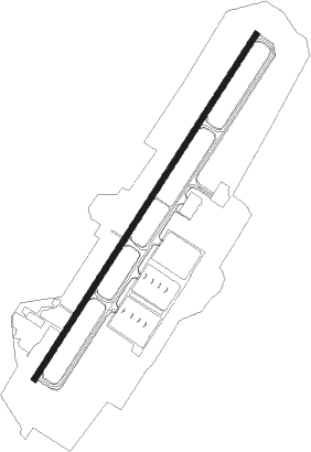
Runway info
| Runway 04 / 22 | ||
| length | 3361m (11027ft) | |
| bearing | 37° / 217° | |
| width | 47m (154ft) | |
| surface | asphalt | |
| blast zone | 121m (397ft) / 119m (390ft) | |
Nearby beacons
| code | identifier | dist | bearing | frequency |
|---|---|---|---|---|
| KAT | KATUNAYAKE VOR/DME | 1.5 | 222° | 114.10 |
| RM | RATMALANA NDB | 21 | 180° | 350 |
| RML | DME | 21 | 180° | 112.70 |
Departure and arrival routes
| Transition altitude | 11000ft |
| Transition level | 13000ft |
| SID end points | distance | outbound heading | |
|---|---|---|---|
| RW04 | |||
| DORT2D | 100mi | 71° | |
| OLSA2D | 100mi | 88° | |
| DUDA2D | 100mi | 105° | |
| RUPO2D | 46mi | 126° | |
| LALU2D | 100mi | 232° | |
| BASU2D | 112mi | 293° | |
| DEMO2D | 100mi | 326° | |
| ATET2D | 129mi | 354° | |
| RW22 | |||
| DORT1D | 100mi | 71° | |
| OLSA1D | 100mi | 88° | |
| DUDA1D | 100mi | 105° | |
| ANUT1D | 46mi | 135° | |
| LALU1D | 100mi | 232° | |
| BASU1D | 112mi | 293° | |
| DEMO1D | 100mi | 326° | |
| ATET1D | 129mi | 354° | |
| STAR starting points | distance | inbound heading | |
|---|---|---|---|
| RW04 | |||
| LALU2A | 100.1 | 52° | |
| BIKO2A | 101.3 | 131° | |
| IDIB2A | 98.5 | 162° | |
| SAGO2A | 169.7 | 184° | |
| DORT2A | 100.0 | 251° | |
| OLSA2A | 100.0 | 268° | |
| DUDA2A | 100.0 | 285° | |
| ANUT2A | 45.9 | 315° | |
| RW22 | |||
| LALU1A | 100.1 | 52° | |
| BIKO1A | 101.3 | 131° | |
| IDIB1A | 98.5 | 162° | |
| SAGO1A | 169.7 | 184° | |
| DORT1A | 100.0 | 251° | |
| OLSA1A | 100.0 | 268° | |
| DUDA1A | 100.0 | 285° | |
| RUPO1A | 45.6 | 306° | |
Instrument approach procedures
| runway | airway (heading) | route (dist, bearing) |
|---|---|---|
| RW04 | BUSLI (59°) | BUSLI 2500ft LAROD (3mi, 128°) 1700ft |
| RW04 | DUBIM (18°) | DUBIM 2500ft LAROD (3mi, 307°) 1700ft |
| RW04 | PASKU (38°) | PASKU 2500ft LAROD (3mi, 38°) 1700ft |
| RNAV | LAROD 1700ft LIKRA (4mi, 38°) 1500ft VCBI (5mi, 39°) 75ft IKONA (14mi, 37°) 2000ft IKONA (turn) 2000ft | |
| RW22 | GUPOG (245°) | GUPOG 2500ft KADIR (5mi, 308°) 1600ft |
| RW22 | IKONA (217°) | IKONA 2500ft KADIR (5mi, 218°) 1600ft |
| RW22 | SUMOX (189°) | SUMOX 2500ft KADIR (5mi, 128°) 1600ft |
| RNAV | KADIR 1600ft IGNIL (4mi, 218°) 1500ft VCBI (5mi, 216°) 77ft PASKU (13mi, 218°) 2000ft PASKU (turn) 2000ft |
Holding patterns
| STAR name | hold at | type | turn | heading* | altitude | leg | speed limit |
|---|---|---|---|---|---|---|---|
| BIKO1A | MABAL | VHF | left | 308 (128)° | 4000ft - 14000ft | 1.0min timed | 240 |
| BIKO2A | OLMID | VHF | left | 317 (137)° | 3000ft - 14000ft | 1.0min timed | 240 |
| DORT1A | IKONA | VHF | left | 40 (220)° | 2000ft - 14000ft | 1.0min timed | 230 |
| DUDA1A | NUKMA | VHF | right | 130 (310)° | 3000ft - 14000ft | 1.0min timed | 240 |
| IDIB1A | IKONA | VHF | left | 40 (220)° | 2000ft - 14000ft | 1.0min timed | 230 |
| LALU1A | MABAL | VHF | left | 308 (128)° | 4000ft - 14000ft | 1.0min timed | 240 |
| LALU2A | PASKU | VHF | left | 220 (40)° | 2000ft - 14000ft | 1.0min timed | 230 |
| OLSA1A | NUKMA | VHF | right | 130 (310)° | 3000ft - 14000ft | 1.0min timed | 240 |
| RUPO1A | NUKMA | VHF | right | 130 (310)° | 3000ft - 14000ft | 1.0min timed | 240 |
| SAGO1A | IKONA | VHF | left | 40 (220)° | 2000ft - 14000ft | 1.0min timed | 230 |
| *) magnetic outbound (inbound) holding course | |||||||
Disclaimer
The information on this website is not for real aviation. Use this data with the X-Plane flight simulator only! Data taken with kind consent from X-Plane 12 source code and data files. Content is subject to change without notice.