Kalutara - Katukurunda
Airport details
| Country | Sri Lanka |
| State | Western Province |
| Region | VC |
| Airspace | Colombo Ctr |
| Municipality | Kalutara |
| Elevation | 9ft (3m) |
| Timezone | GMT +5.5 |
| Coordinates | 6.55278, 79.97389 |
| Magnetic var | |
| Type | land |
| Available since | X-Plane v10.40 |
| ICAO code | VCCN |
| IATA code | KTY |
| FAA code | n/a |
Communication
| Katukurunda Tower | 118.400 |
Nearby Points of Interest:
Kalutara fort
-Sinharaja Forest Reserve
-Peak Wilderness Sanctuary
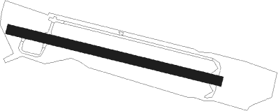
Runway info
| Runway 11 / 29 | ||
| length | 990m (3248ft) | |
| bearing | 108° / 288° | |
| width | 44m (145ft) | |
| surface | asphalt | |
Nearby beacons
| code | identifier | dist | bearing | frequency |
|---|---|---|---|---|
| RM | RATMALANA NDB | 17.5 | 342° | 350 |
| RML | DME | 17.5 | 342° | 112.70 |
| KAT | KATUNAYAKE VOR/DME | 37 | 350° | 114.10 |
Disclaimer
The information on this website is not for real aviation. Use this data with the X-Plane flight simulator only! Data taken with kind consent from X-Plane 12 source code and data files. Content is subject to change without notice.